Louisa Creek Junction day-use area
Discover the perfect place to enjoy a relaxing family picnic in a peaceful setting on the banks of tranquil Louisa Creek.
Accessible by
- High clearance 4WD
Attraction facilities
- Picnic tables (some sheltered)
-
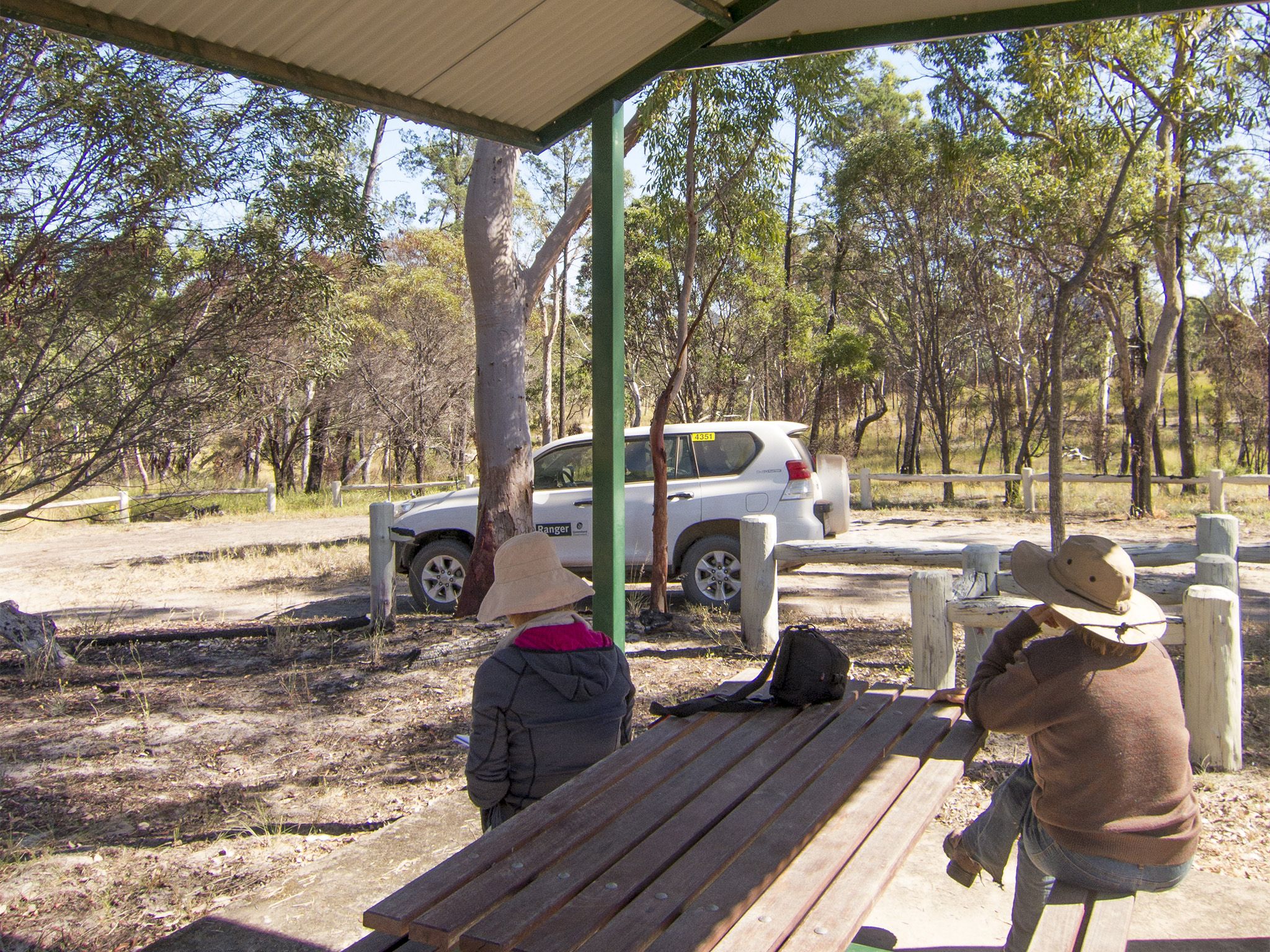
![The small Louisa Creek Junction day-use area has a sheltered picnic table.]() The small Louisa Creek Junction day-use area has a sheltered picnic table.
Photo credit: Robert Ashdown © Queensland Government
The small Louisa Creek Junction day-use area has a sheltered picnic table.
Photo credit: Robert Ashdown © Queensland Government
-
![Take a picnic lunch and watch the birds flit in and around the creek at Louisa Creek Junction day-use area.]() Take a picnic lunch and watch the birds flit in and around the creek at Louisa Creek Junction day-use area.
Photo credit: Robert Ashdown © Queensland Government
Take a picnic lunch and watch the birds flit in and around the creek at Louisa Creek Junction day-use area.
Photo credit: Robert Ashdown © Queensland Government
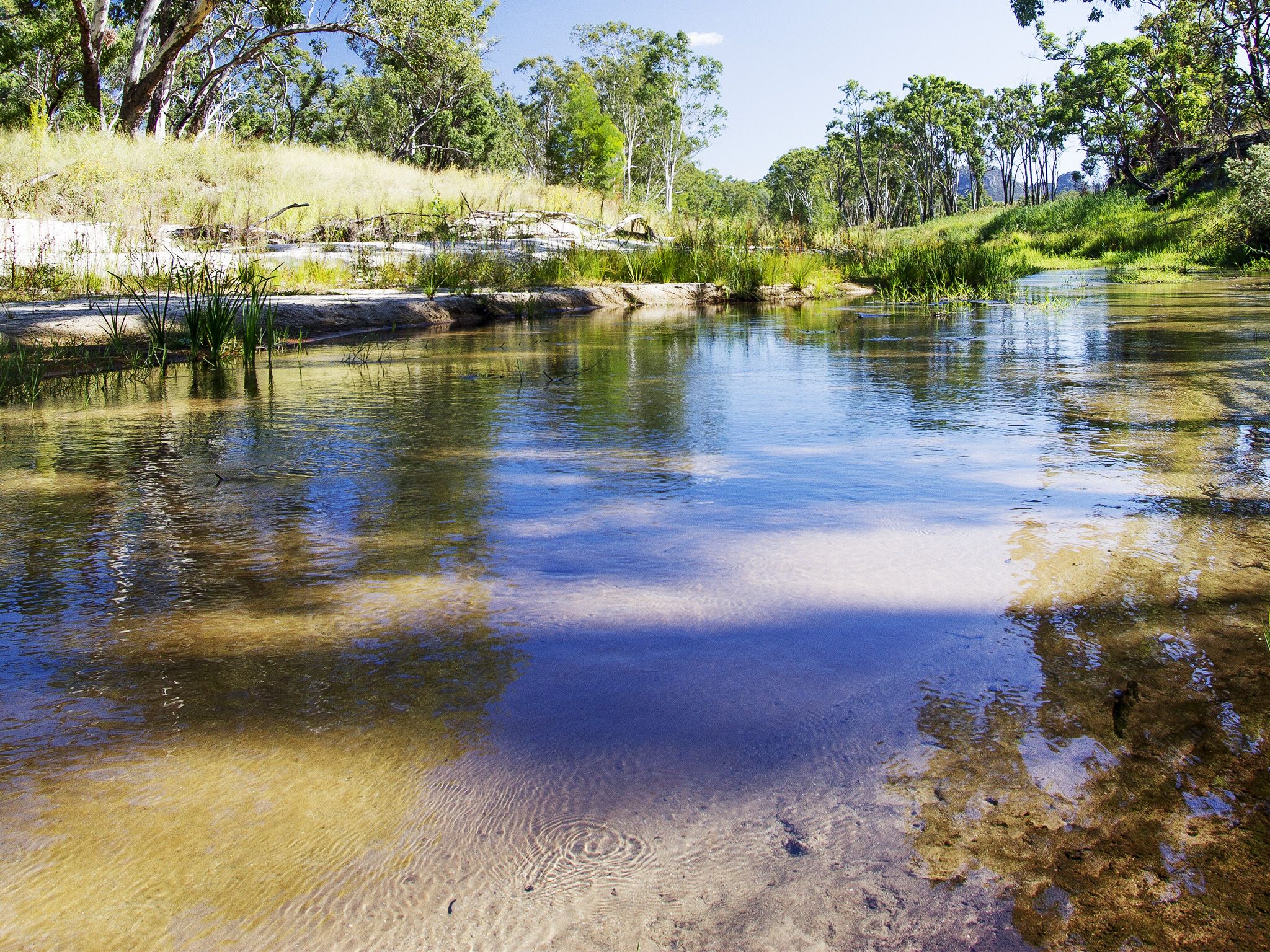
Spread out your picnic on the undercover table and enjoy the peaceful and shaded surrounds near the junction of Louisa Creek and the Nogoa River. Although Louisa Creek looks sedate here, at certain times of the year it contributes ten million litres of water to the Nogoa River every day!
Birdwatchers will love the diverse mix of birdlife that comes to the creek to drink, so make sure your binoculars, camera and field guide are handy. If you feel like stretching your legs, Spyglass Peak, Homoranthus Hill and Belinda Springs are not far away and are well worth the effort.
Getting there and getting around
Louisa Creek day-use area is in the Salvator Rosa section of Carnarvon National Park in central Queensland's Sandstone Wilderness, between Tambo and Springsure and is accessible by 4WD only.
- Louisa Creek Junction day-use area is 5.5km from the park entrance.
To reach Salvator Rosa from Springsure, drive 168km west along the Dawson Developmental Road to the Salvator Rosa turn-off and drive south 50km via Cungelella to the park entrance.
From Tambo, there are two routes into the park:
- Head north on the Dawson Developmental Road for 42km. Turn right to head east and stay on the Dawson Developmental Road for a further 89km. Turn right onto Cungelella Road for 24km then veer left to continue on Cungelella Road for a further 14km. Turn right at Salvator Rosa Road and travel approximately 16km to the park entrance.
- The second route is for high-clearance 4WDs only. Head south on the Landsborough Highway for 8km, then turn left onto Mt Playfair Road (Wilderness Way) and drive 33km.Turn left to stay on Mt Playfair Road for another 63km. Turn right onto Cungelella Road and drive 14km, then turn right at Salvator Rosa Road and travel 16km to the park entrance. Please note, the majority of the road names are not signposted at the intersections.
Warning: travel can be unexpectedly slow on these unsealed roads. Be aware of bull dust, sand and changing conditions—roads can become impassable after rain. Please respect the rights of property owners and leave all gates as you find them.
- Read 4WD with care for important information on 4WD safety and minimal impact driving.
Wheelchair access
There are no wheelchair-accessible facilities.
Before you visit
Opening hours
Louisa Creek Junction day-use area is open 24 hours a day
Check park alerts for the latest information on access, closures and conditions.
Visiting safely
For more safety information see Visiting Salvator Rosa safely.
- There are currently no park alerts for this park.