- Issued
- 5 August 2024
- Region
We have now acquired and dedicated land as national park tenure that enables the connection of Ella Bay, Eubenangee Swamp and Russell River national parks. But the journey to this gazettal has been a long one, fraught with many challenges to overcome.
Cast your mind back over half a century ago – what were you doing? Were you even born yet?
In 1967, visionaries Len Webb and Geoff Tracy charted a course for environmental conservation in Far North Queensland that would not see fulfilment for over 5 decades. Their proposal to protect some of the Wet Tropics bioregion’s most pristine coastal lowlands as national park remained an elusive dream until just this year, when our Northern Region Estate Management team were able to transform their aspiration into reality.
An incredible achievement worth celebrating
Both past and present staff were recognised at a recent gathering, celebrating their tireless dedication to this success story, 57 years in the making.
Representatives from the Department of Resources, Wet Tropics Management Authority, as well as staff from Queensland Parks and Wildlife Service’s Tenure Services, Strategic Acquisitions, Northern Region Estate Management and Northern Parks and Forests teams, including the local Ranger team, all joined together in celebrating this momentous achievement.


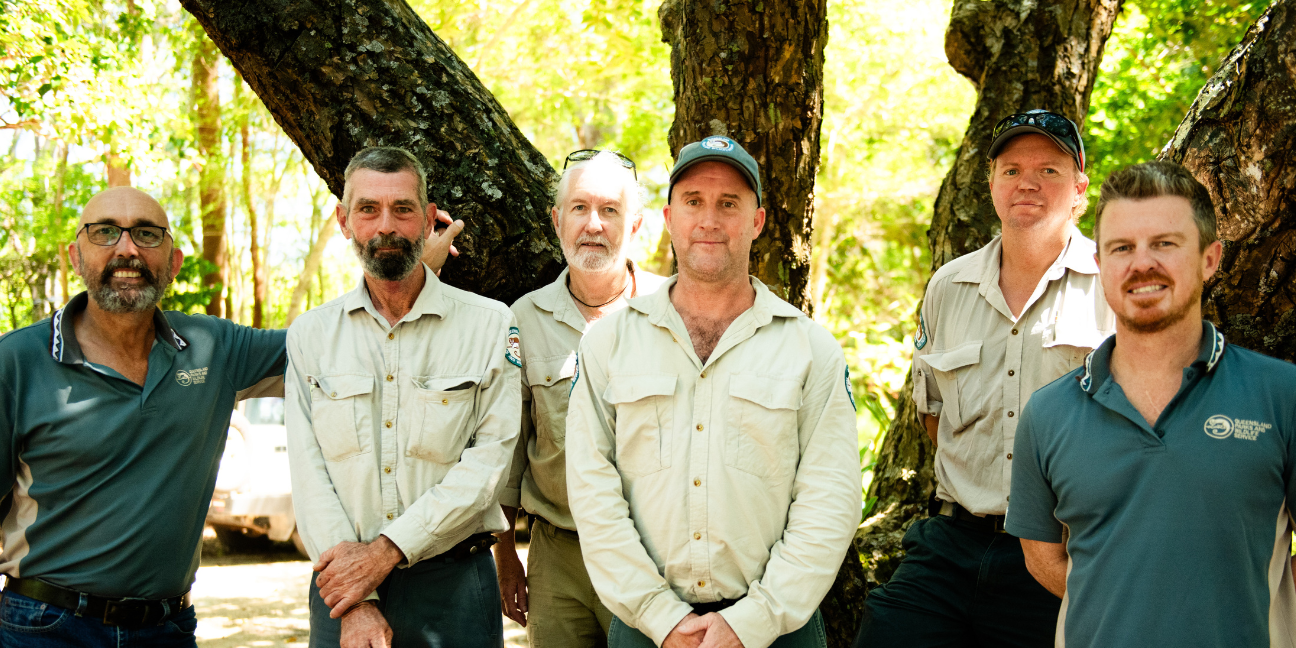

Former Northern Region Regional Director, Peter Stanton, attended the celebrations and was thrilled to see this integral gazettal occur in his lifetime.
‘I have been waiting a long time for this moment!’ Peter said.
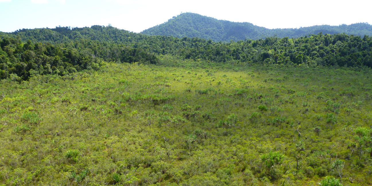
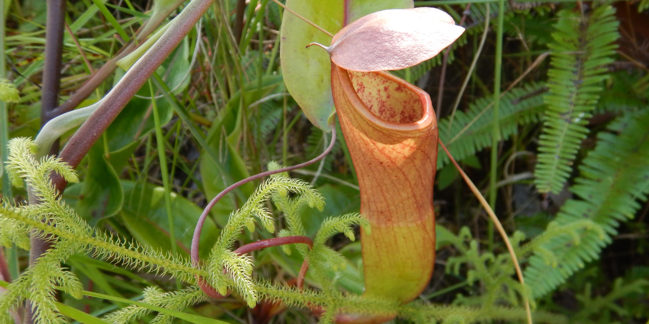
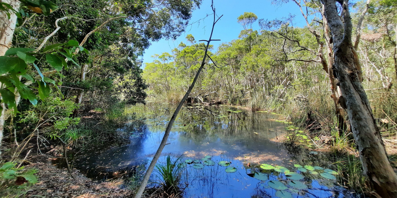
These new acquisitions now connect three parks - Ella Bay, Eubenangee Swamp and Russell River national parks - protecting an array of unique coastal and mountain wetlands, estuaries, lowland peat swamps, feather palm forests and more.
It also includes the valuable Casey Creek area and provides continuity in tenure across the nationally listed wetland – Wyyuri swamp.


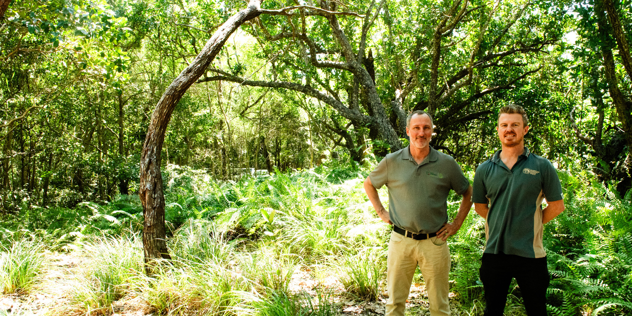
‘Having continuity in tenure, and expanding the boundary of our patch, will enable us to get an established fire regime back into the landscape, which is essential for ecological balance and health of this amazing protected area,’ Ranger in Charge Leigh said.
Providing permanent protection to this estate is something we are all proud of, we recognise the significance of this gazettal and thank all those involved. These things don’t just happen, it takes the right people, in the right positions, at the right time, to see it through to full completion,’ Principal Ranger Carol said.
But this didn’t happen overnight and there were many hurdles those involved, overcame.
A historic backdrop of barriers
While mapping the Wet Tropics bioregion in the late 60s, Webb and Tracy identified an area near Innisfail as having some of the best representation of coastal lowlands. At the time, the national parks we have today in this area were not even gazetted yet! Over the years several parcels of land from this initial park proposal were acquired and dedicated as national park, however 16 unallocated state land (USL) parcels remained the missing pieces of the puzzle in Webb and Tracy’s original proposal.
Many attempts to turn the USL parcels, held by the Department of Resources, into national park tenure were met with barrier after barrier. Roads that veered off alignment, an historic hesitance to relinquish land that bore the potential for agricultural bounty and an enigmatic Unexploded Ordnance (UXO) noting from 1943, were just some of the many obstacles to overcome.
The gazettal of this land only came to fruition thanks to the commitment of key individual staff that shared the vision and drive to see past the seemingly insurmountable barriers and years of resistance to progress this dedication.
The determined spirit of our Northern Region Estate Management team propelled this ambitious plan towards a triumphant ending. Developing strong collaborative relationships with the Department of Resources and the Commonwealth Defence Force, they navigated to solutions where none seemed to exist, working within tight Governor in Council deadlines.
Principal Land Officer Deanna from the Department of Resources said she was proud to be part of this work that will have a lasting legacy in our community.
‘We know that to go far, you have to go together, with each other, our stakeholders and other departments. This is a great example of teams from different departments and stakeholder groups coming together to co-design and deliver a key government priority to support the growth and management of protected areas,’ Principal Land Officer Deanna said.
‘This work will have a lasting impact for generations to come, ensuring the environmental sustainability of this important land.’
A legacy of patience and perseverance
Turning unallocated state land (USL) into a national park can take anywhere from 8-12 months, and up to 57 years, like this one. It’s a huge process with a lot of dedicated teams working tirelessly in the background.
First:
- We assess the land we’re wishing to acquire for protection and conservation, based on its natural and cultural heritage values.
- If it meets the values criteria, our estates and tenure services teams then check for any impediments, which can range from a road that’s off alignment to navigating mining authorities and making sure the land is impediment free for protecting.
- Once we’ve received internal approval to acquire the land, we write to our colleagues in the Department of Resources (DoR) seeking for the USL to be transferred for protected area purposes, DoR may then ‘offer’ the land to us and we ‘accept’ this offer. But it doesn’t end there…
The next step is to change the land Titles into our name (from DoR) to the Department of Environment, Science and Innovation (DESI).
- Once it’s in DESI’s name, our Tenure Services team prepare a proposal, working with other Queensland Government departments and agencies to check for any broader interests such as forestry, mining and fishing before we can dedicate any land as a protected area.
They then work with the Office of Queensland Parliamentary Counsel (OQPC), to draft new subordinate legislation that then needs approval from the Governor in Council to legally dedicate land as a protected area under the Nature Conservation Act 1992 (NCA).
- This process alone takes around 5 months and involves many briefing materials and maps. This part of the process is heavily administrative but the team understands it’s a necessary step towards achieving protection over important conservation areas.
- As soon as the land becomes protected area, we commence managing it as it’s gazetted tenure under the NCA.
- It’s then over to the local Ranger team to include any new land acquired into their park operations. This can include installing new boundary signs, updating webpages and maps as well as incorporating new compliance and conservation initiatives.
For this particular acquisition, the collaboration between departments, the strategic maneuvering by our estates team, as well as a lot of patience and perseverance, finally culminated in the acquisition and gazettal of over 1,600 hectares of land as national park, protecting endangered regional ecosystems and areas of national significance for perpetuity.
This final, resounding victory in the face of adversity and ticking clocks reflects the unyielding commitment of everyone involved to fulfil visions of the past and preserve the environment for the future.
What’s the next step in this remarkable story?
There are a few road parcels (non-constructed) that the team will continue to work with DoR and councils to close and tidy up the tenure boundaries in the area.
Related articles
-
Image credit A. Bates © Queensland Government![Photo of a dusty red and orange sunrise with eucalyptus trees in the foreground and fog covering the grass]() The critters that call the Cape home
The critters that call the Cape home
Issued 27 June 2024
We’re highlighting some of the unsung heroes of fascinating flora and fauna who call these Cape York Peninsula national parks home.
-
Issued 25 June 2024
Ranger Gene is one of nine Rangers on Rinyirru (Lakefield) National Park (CYPAL), and we asked him what tips he had for visitors to this…
-
Image credit Adam Creed © Queensland Government![Orange sunset sky reflected in water surrounded by grey rocks]() Have more to remember on your trip to ‘The Tip’
Have more to remember on your trip to ‘The Tip’
Issued 25 June 2024
We're giving you a sneak-peek at some of national park beauty and wilderness that awaits. Find out where to get the best info to start…


