Queensland National Parks Booking System Update
The new Queensland National Parks Booking Service is live for bookings.
Customer account login
If you are making your first booking since 1 July 2024, a new customer account will be created automatically as part of your next booking. Please note your previous login credentials will no longer be valid.
Customers who have made a booking after 1 July 2024, please use your email address to reset your password to access your account.
Crater lakes, huge strangler figs, rainforest walks, lakeside camping areas and places of important local history are some of the interesting features along the 28km Danbulla Road.
Location
On the Atherton Tableland about 1.5hr drive from Cairns.
Welcome
The Tableland Yidinji Aboriginal people welcome you to Danbulla and ask that you respect their special place.
Park facilities
- Campfires allowed (conditions apply)
- Generators allowed (conditions apply)
- Lookout
- Picnic tables (some sheltered)
- Toilets
- Tent camping
- Camper trailer camping
- Campervan camping
- Cycling
- Fishing
- Scenic drive
- Walking
-
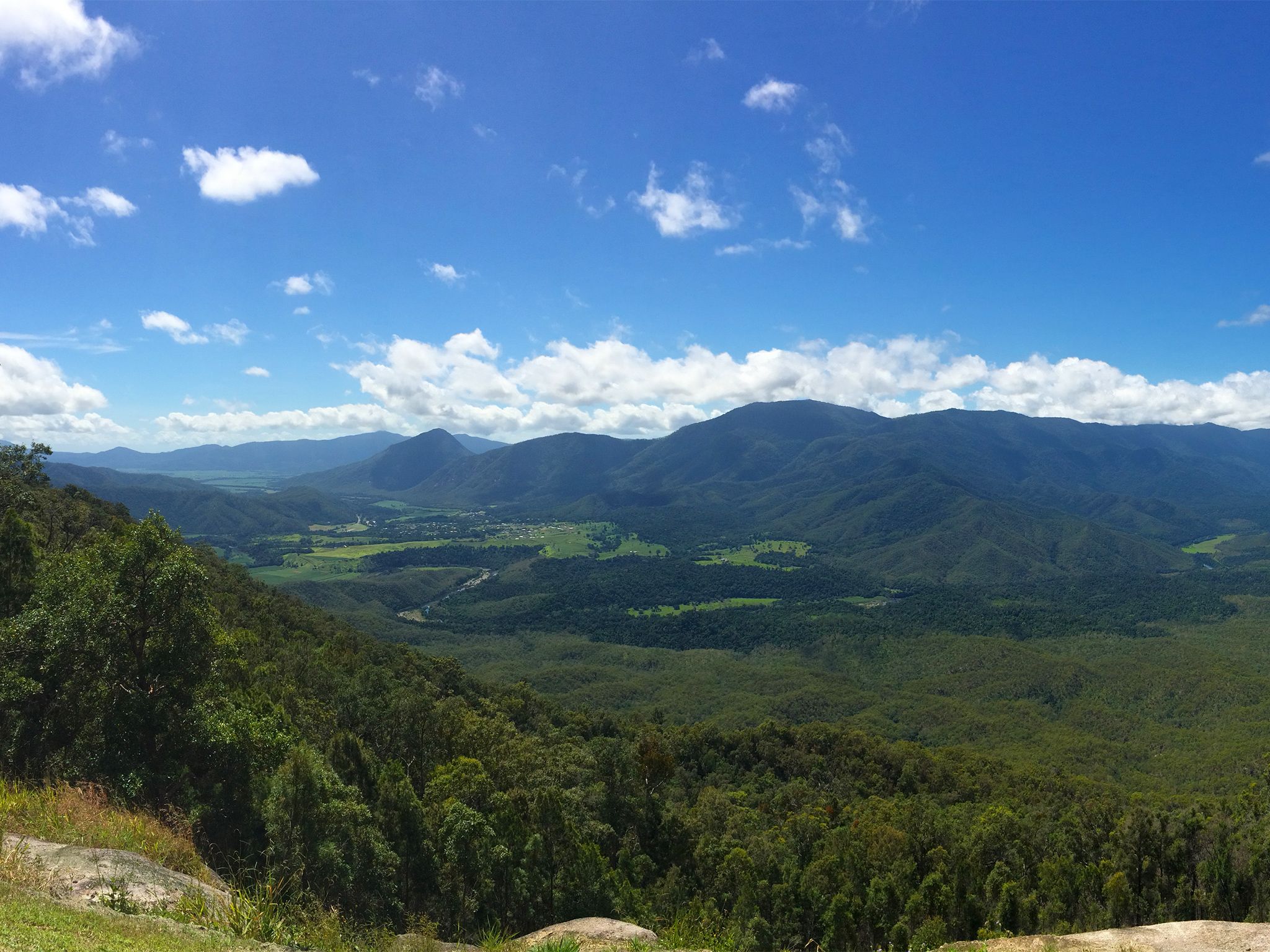
![Take in scenic views over the Mulgrave River valley at the Gillies lookout.]() Take in scenic views over the Mulgrave River valley at the Gillies lookout.
Photo credit: © Queensland Government
Take in scenic views over the Mulgrave River valley at the Gillies lookout.
Photo credit: © Queensland Government
-
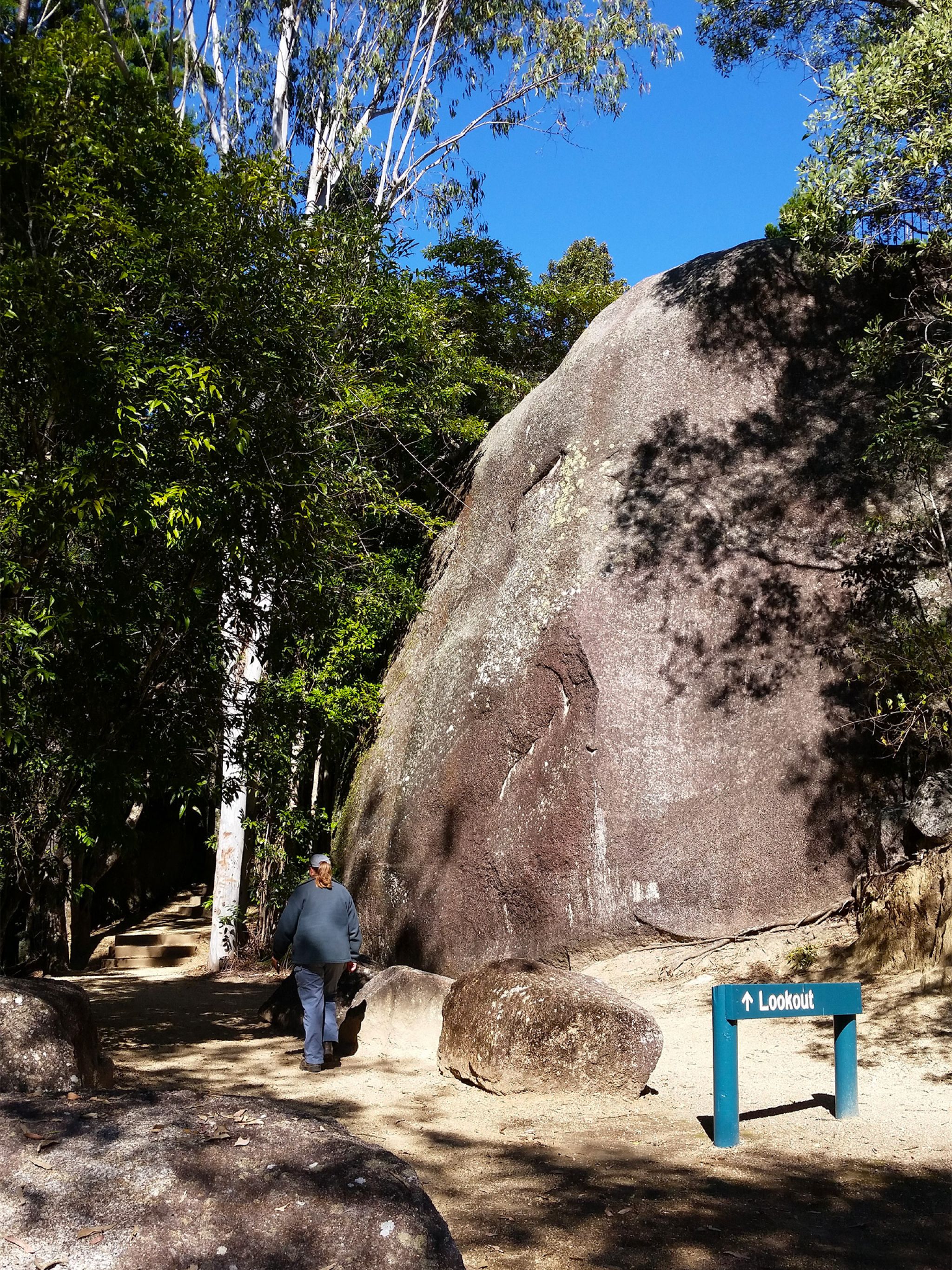
![Climb Platypus Rock and view the surrounding forest canopy from the lookout.]() Climb Platypus Rock and view the surrounding forest canopy from the lookout.
Photo credit: © Queensland Government
Climb Platypus Rock and view the surrounding forest canopy from the lookout.
Photo credit: © Queensland Government
-
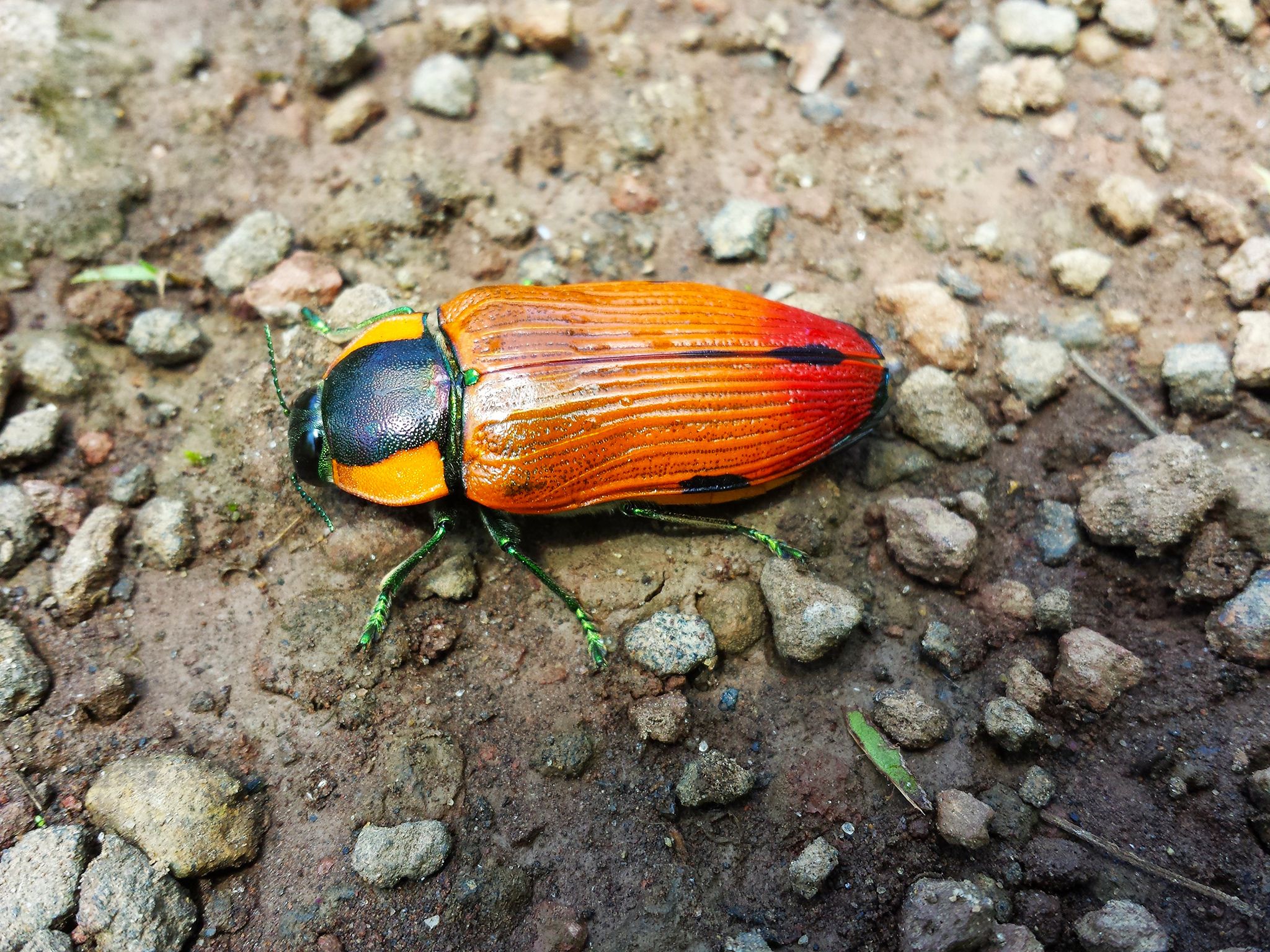
![Keep an eye out for insect life!]() Keep an eye out for insect life!
Photo credit: © Queensland Government
Keep an eye out for insect life!
Photo credit: © Queensland Government
-
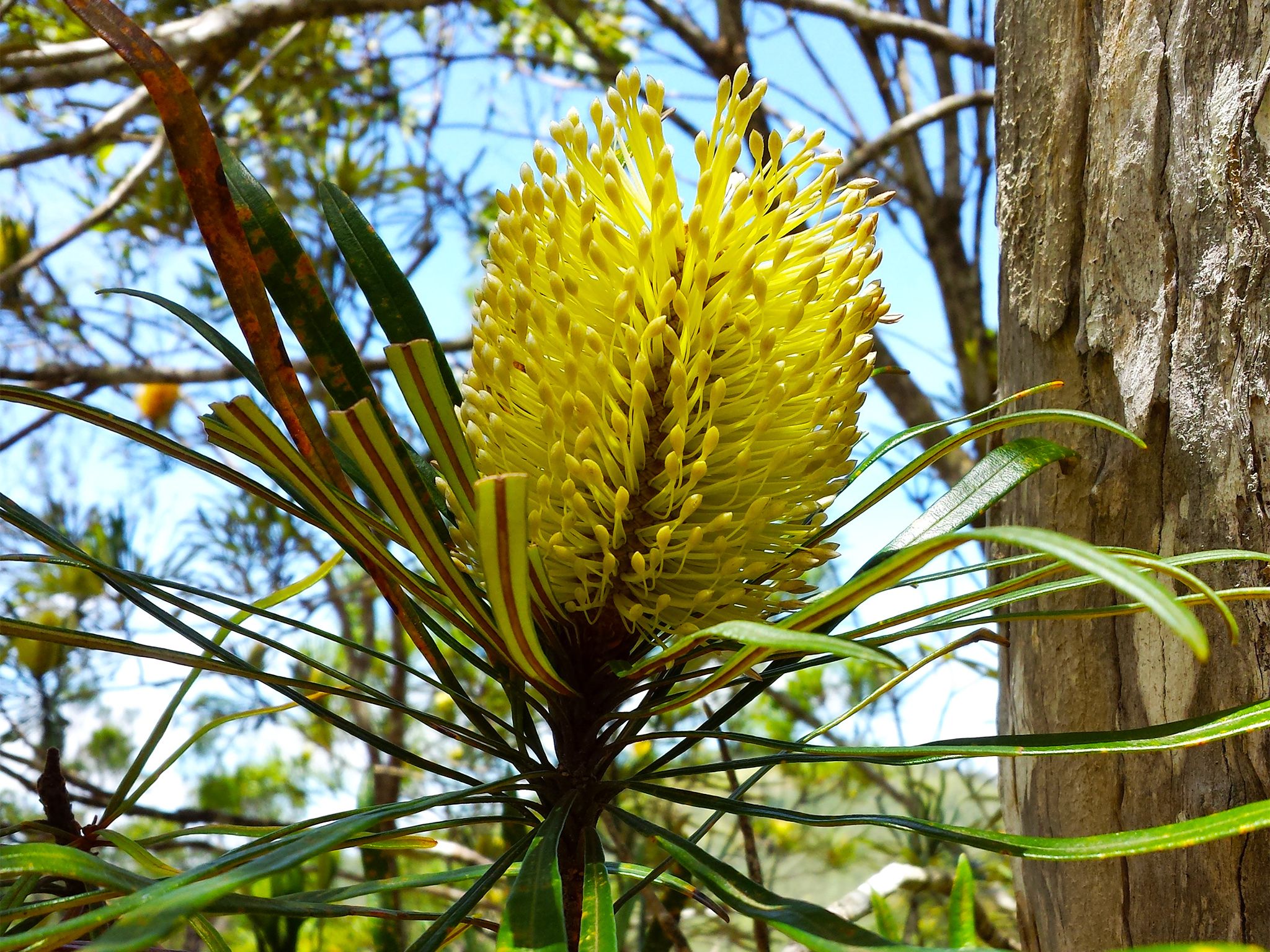
![Flowers provide splashes of colour throughout Danbulla.]() Flowers provide splashes of colour throughout Danbulla.
Photo credit: © Queensland Government
Flowers provide splashes of colour throughout Danbulla.
Photo credit: © Queensland Government
-
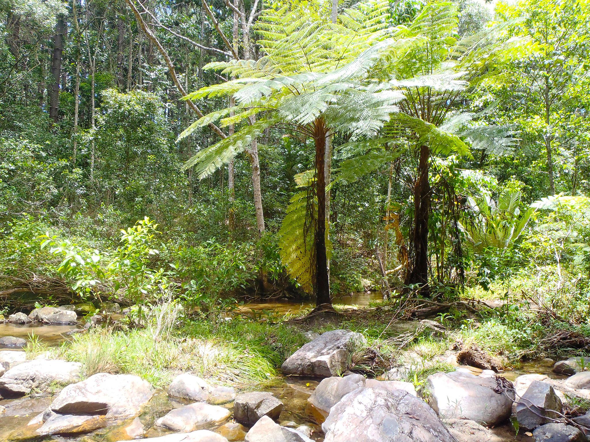
![Explore rainforest along Kauri Creek on the Jungaljungal walk.]() Explore rainforest along Kauri Creek on the Jungaljungal walk.
Photo credit: © Queensland Government
Explore rainforest along Kauri Creek on the Jungaljungal walk.
Photo credit: © Queensland Government
-
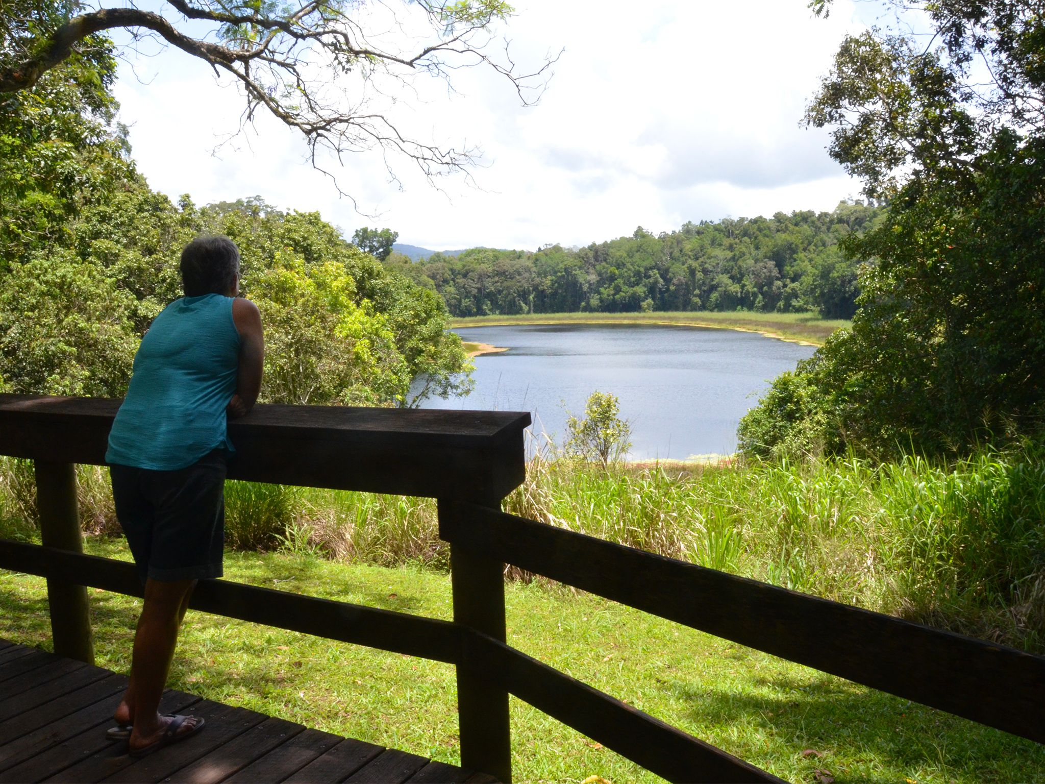
![Enjoy views of Lake Euramoo from the viewing platform.]() Enjoy views of Lake Euramoo from the viewing platform.
Photo credit: © Tim Wood
Enjoy views of Lake Euramoo from the viewing platform.
Photo credit: © Tim Wood
-
![Have a picnic or barbecue under the hoop pines at Platypus day-use area.]() Have a picnic or barbecue under the hoop pines at Platypus day-use area.
Photo credit: © Queensland Government
Have a picnic or barbecue under the hoop pines at Platypus day-use area.
Photo credit: © Queensland Government
-
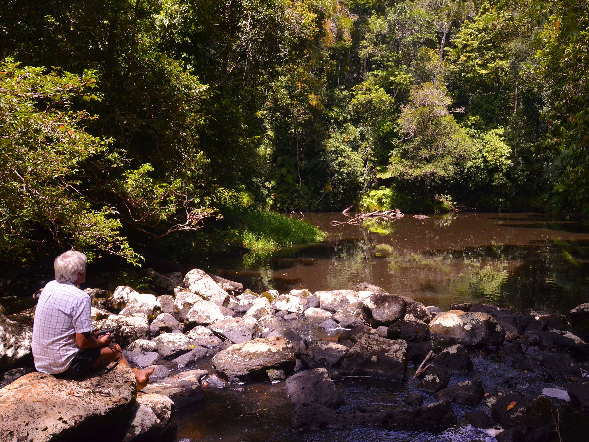
![Sit and contemplate the formation of Mobo Creek Crater.]() Sit and contemplate the formation of Mobo Creek Crater.
Photo credit: © Tim Wood
Sit and contemplate the formation of Mobo Creek Crater.
Photo credit: © Tim Wood
-
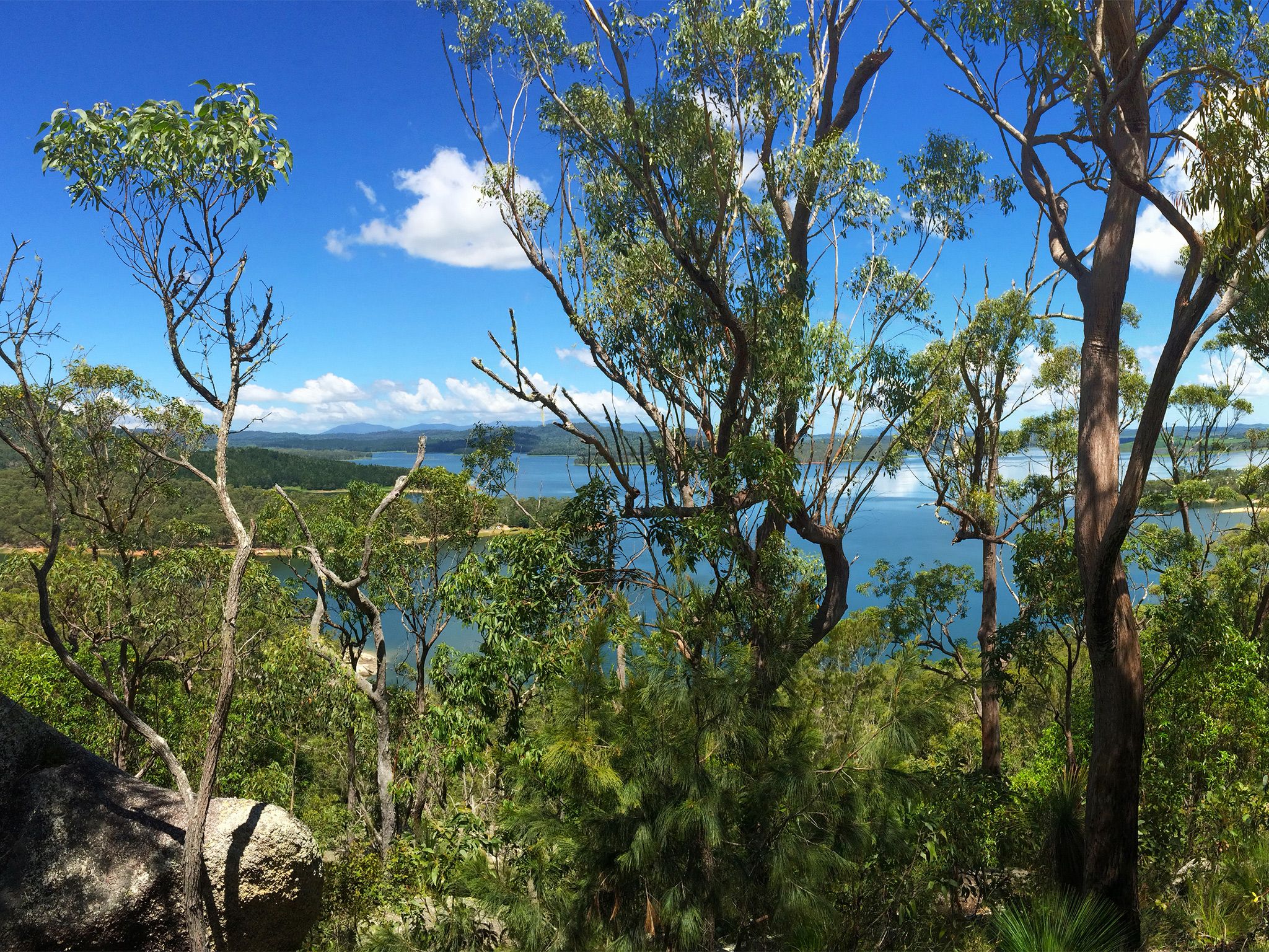
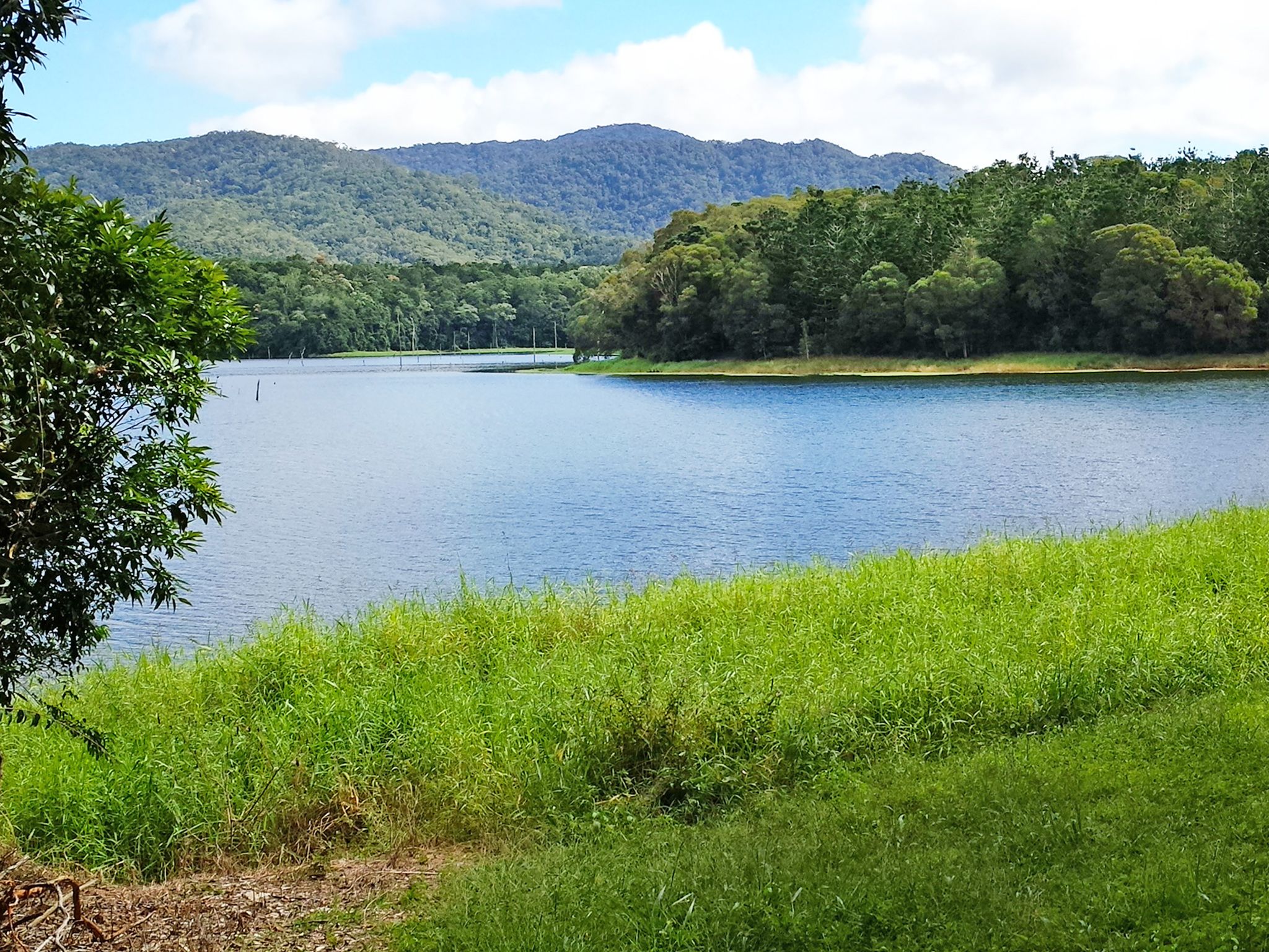
![Peek through the trees for views of Lake Tinaroo.]() Peek through the trees for views of Lake Tinaroo.
Photo credit: © Queensland Government
Peek through the trees for views of Lake Tinaroo.
Photo credit: © Queensland Government
-
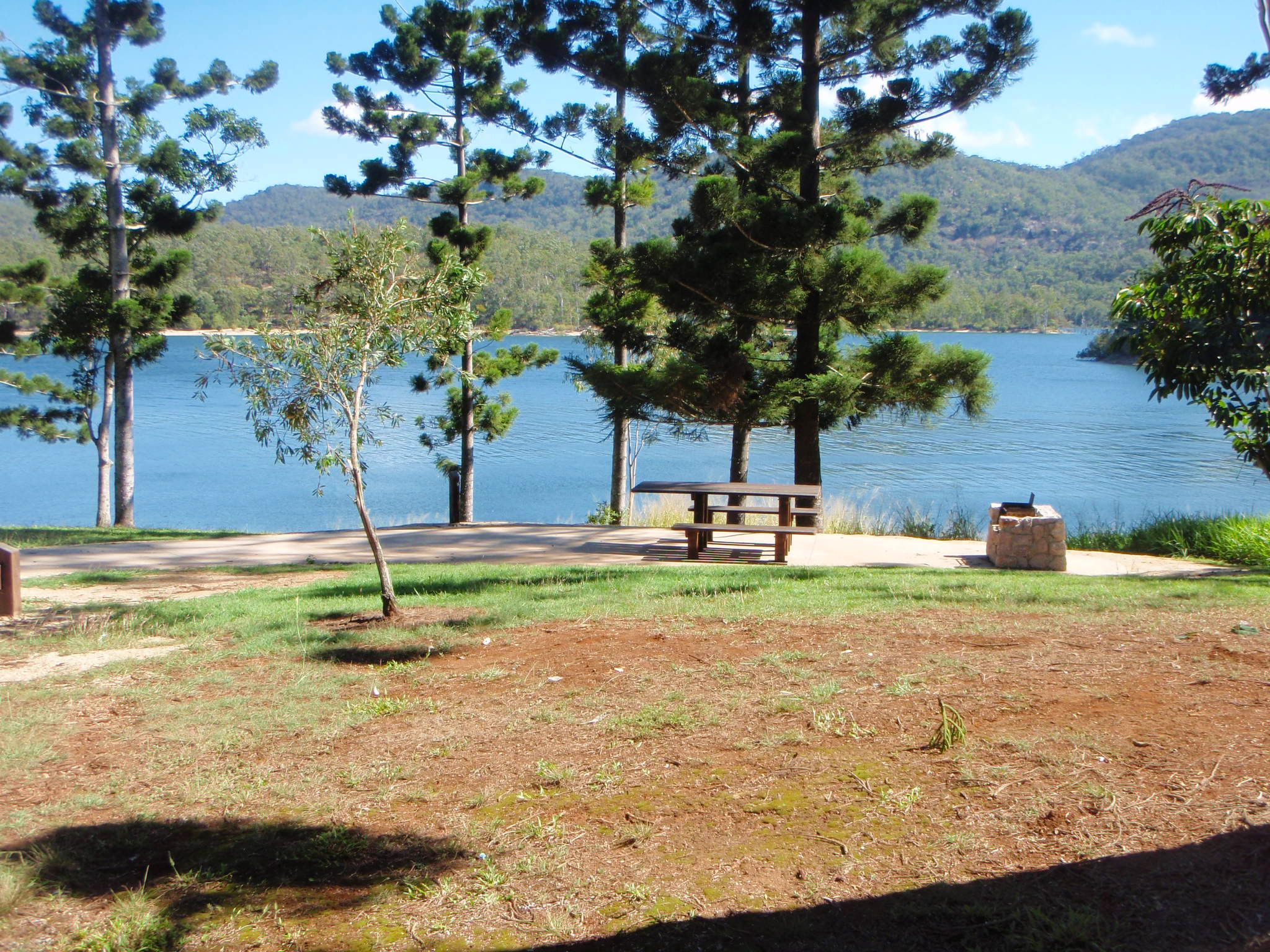
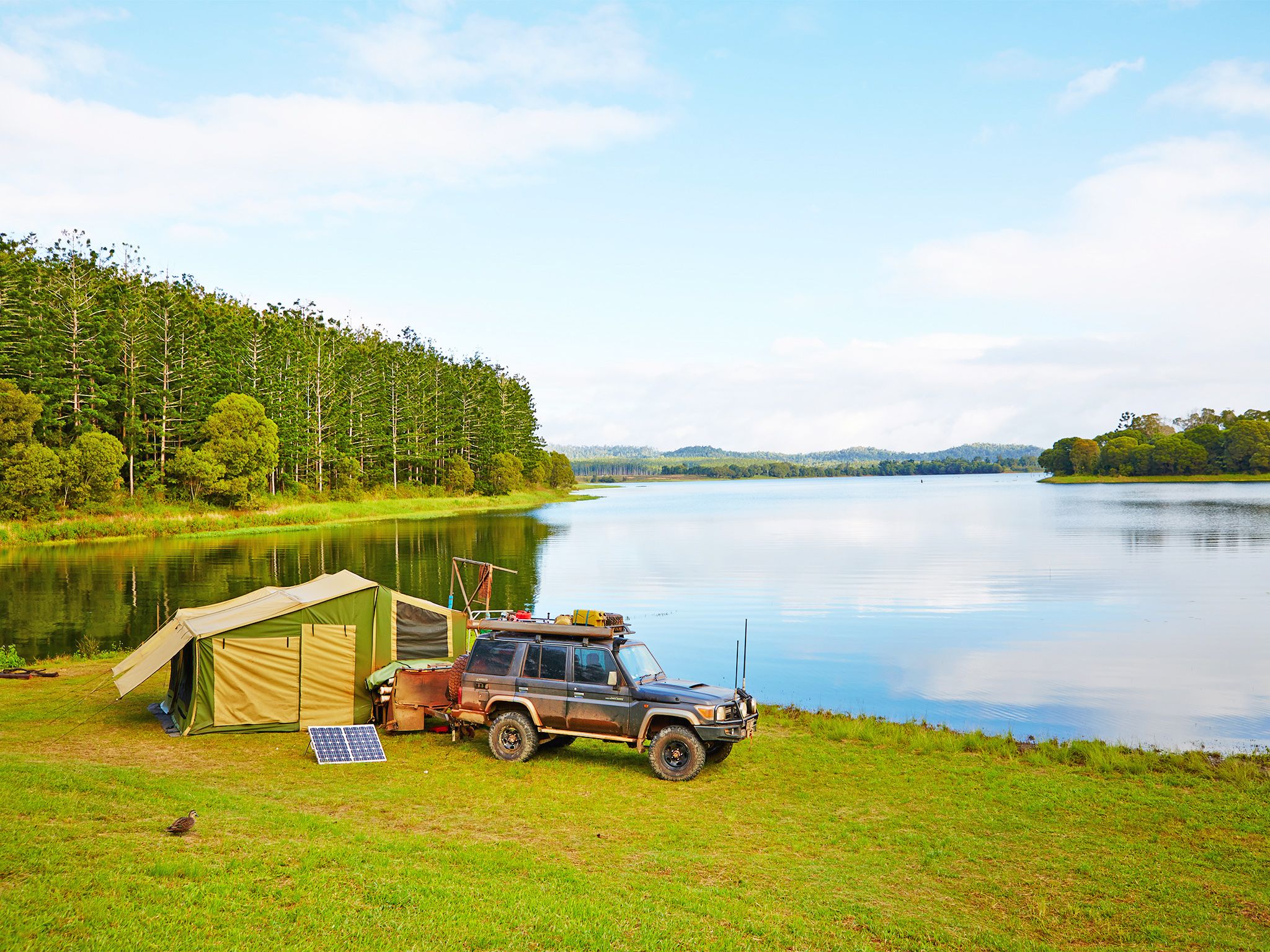
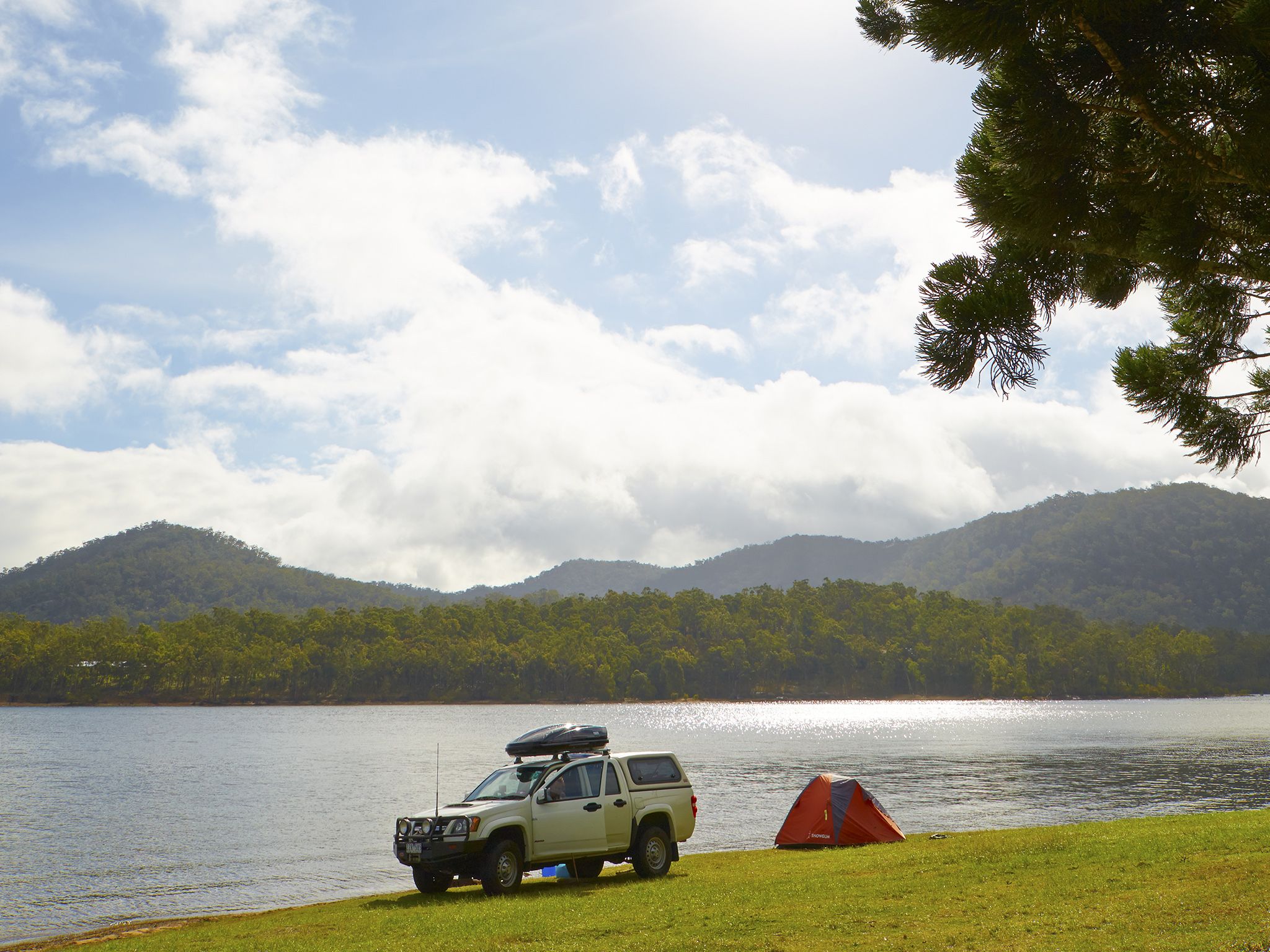
![Remember your boat when you camp at any of the Danbulla camping areas, like Downfall Creek.]() Remember your boat when you camp at any of the Danbulla camping areas, like Downfall Creek.
Photo credit: © Queensland Government
Remember your boat when you camp at any of the Danbulla camping areas, like Downfall Creek.
Photo credit: © Queensland Government
-
![Drive through the varied vegetation of the Lamb Range on the Mount Edith and Kauri Creek roads.]() Drive through the varied vegetation of the Lamb Range on the Mount Edith and Kauri Creek roads.
Photo credit: Mike Prociv © Queensland Government
Drive through the varied vegetation of the Lamb Range on the Mount Edith and Kauri Creek roads.
Photo credit: Mike Prociv © Queensland Government
-
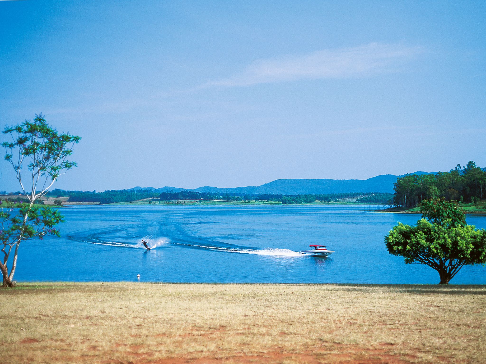
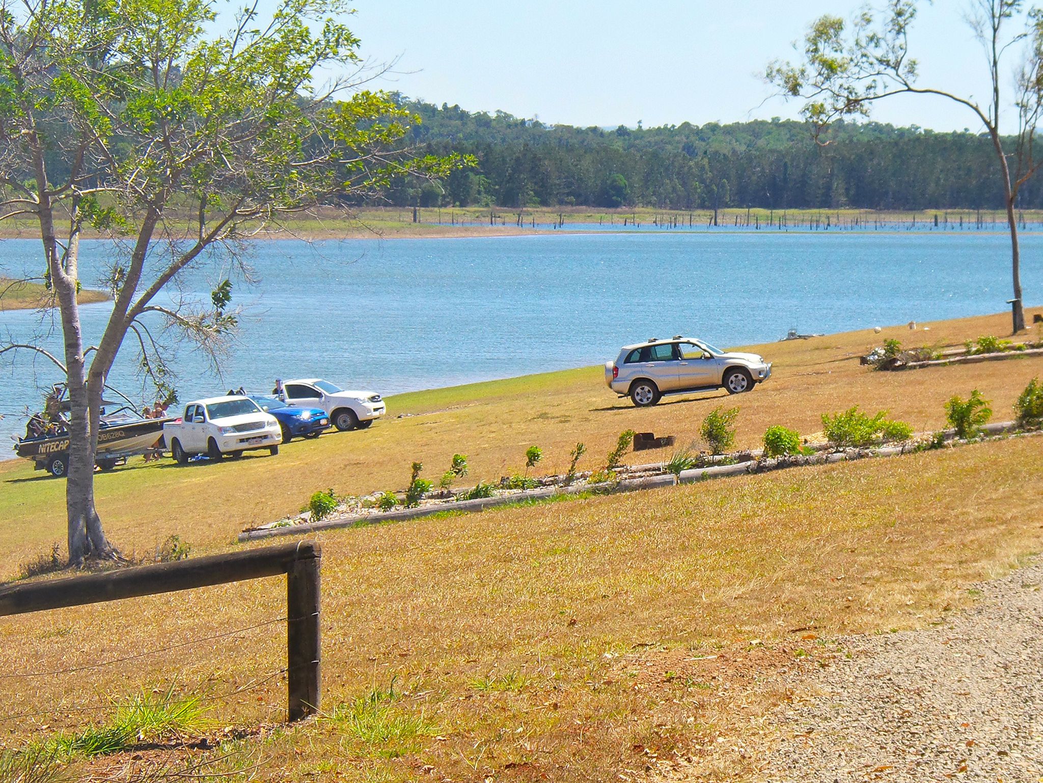
![Waterskiing is a popular activity on Lake Tinaroo.]() Waterskiing is a popular activity on Lake Tinaroo.
Photo credit: © Tourism and Events Queensland
Waterskiing is a popular activity on Lake Tinaroo.
Photo credit: © Tourism and Events Queensland
-
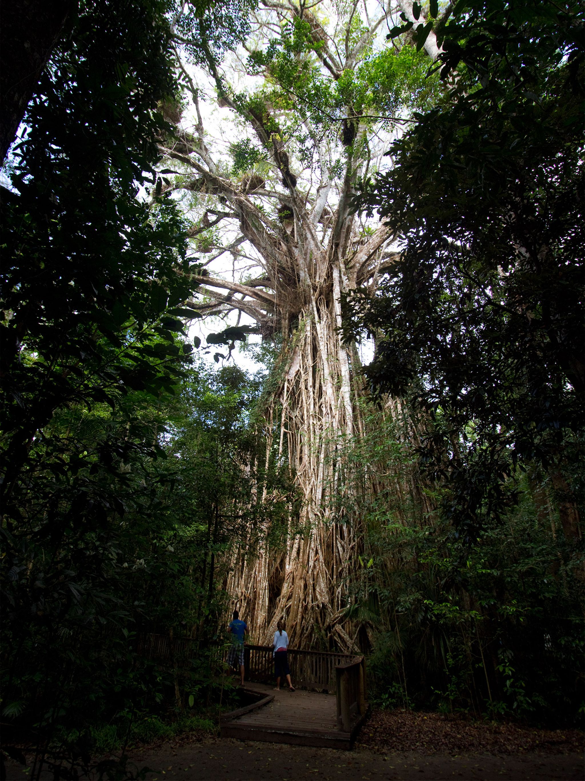
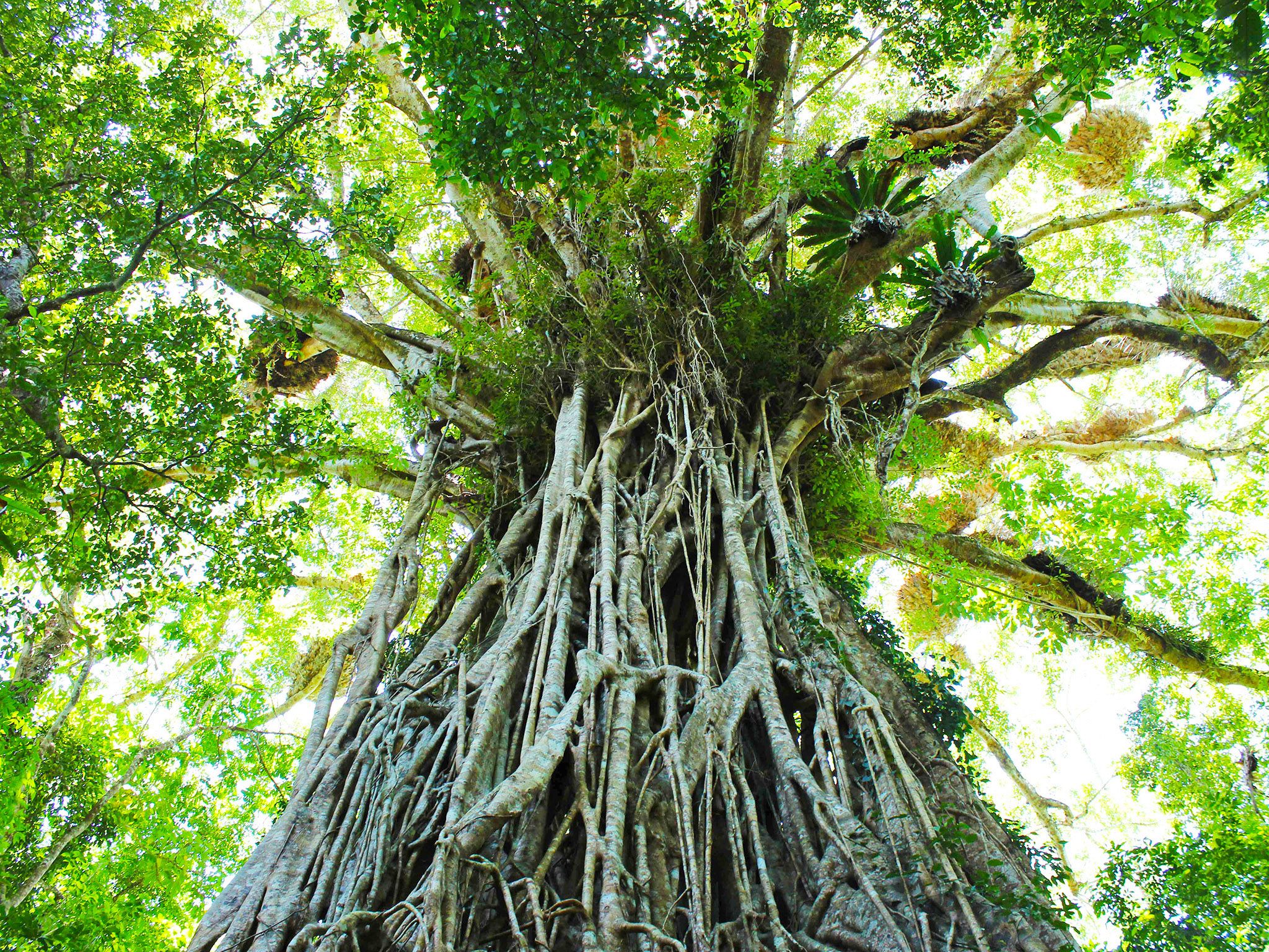
![Don’t miss out on visiting the majestic cathedral fig tree.]() Don’t miss out on visiting the majestic cathedral fig tree.
Photo credit: Robert Ashdown © Queensland Government
Don’t miss out on visiting the majestic cathedral fig tree.
Photo credit: Robert Ashdown © Queensland Government
-
![Groups of all sizes can enjoy camping at Downfall Creek camping area.]() Groups of all sizes can enjoy camping at Downfall Creek camping area.
Photo credit: © Lovegreen Photography
Groups of all sizes can enjoy camping at Downfall Creek camping area.
Photo credit: © Lovegreen Photography
-
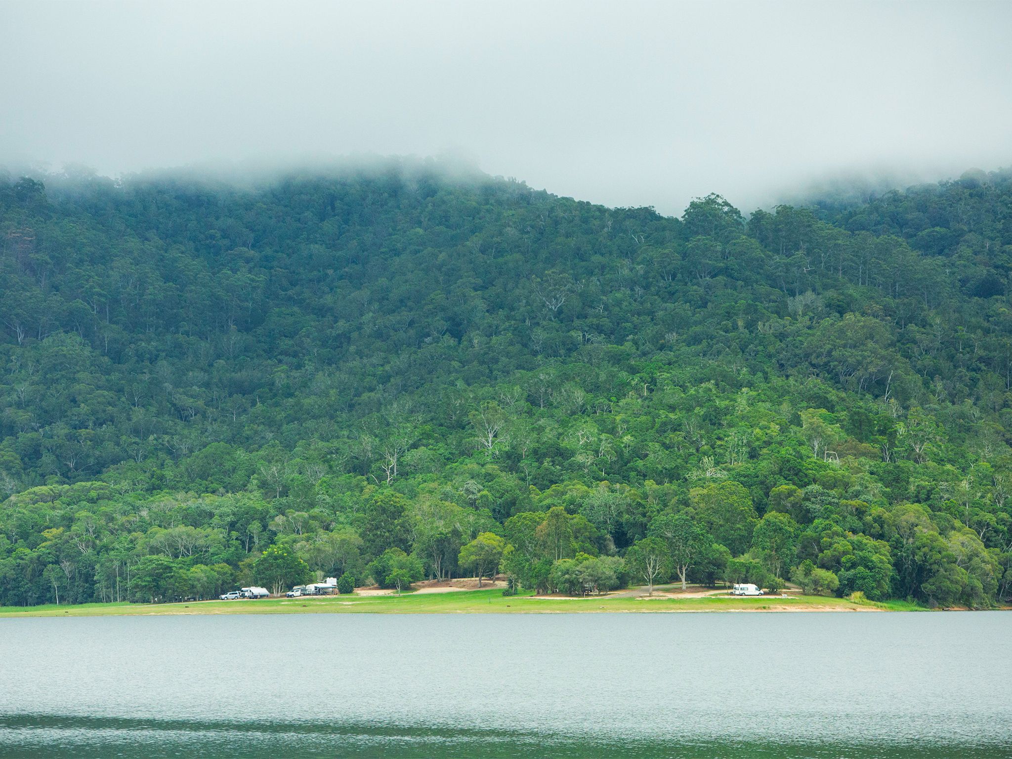
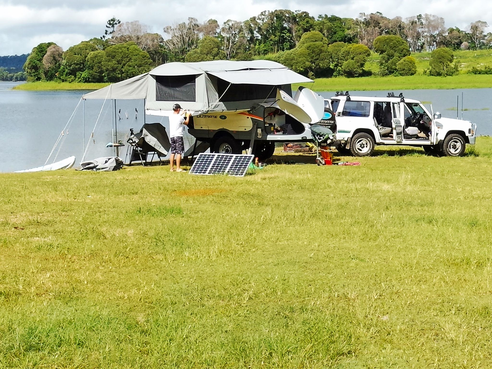
![The camping areas around Lake Tinaroo are popular family spots.]() The camping areas around Lake Tinaroo are popular family spots.
Photo credit: © Lovegreen Photography
The camping areas around Lake Tinaroo are popular family spots.
Photo credit: © Lovegreen Photography
-
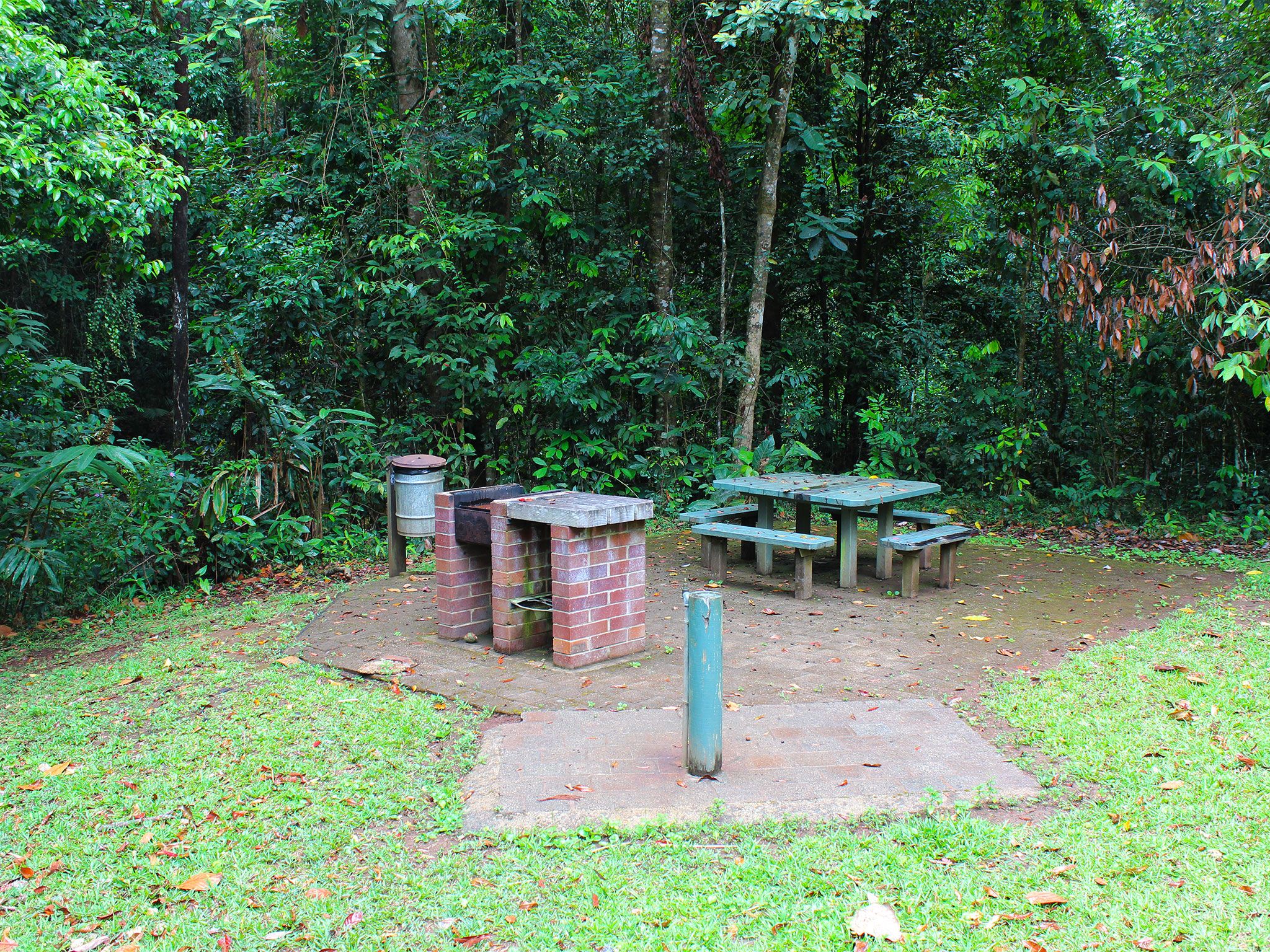
![Enjoy a shady picnic beside the creek at Kauri Creek day-use area.]() Enjoy a shady picnic beside the creek at Kauri Creek day-use area.
Photo credit: Mike Prociv © Queensland Government
Enjoy a shady picnic beside the creek at Kauri Creek day-use area.
Photo credit: Mike Prociv © Queensland Government
-
![Relax on the banks of Lake Tinaroo at Kauri Creek camping area.]() Relax on the banks of Lake Tinaroo at Kauri Creek camping area.
Photo credit: Maxime Coquard © Queensland Government
Relax on the banks of Lake Tinaroo at Kauri Creek camping area.
Photo credit: Maxime Coquard © Queensland Government
-
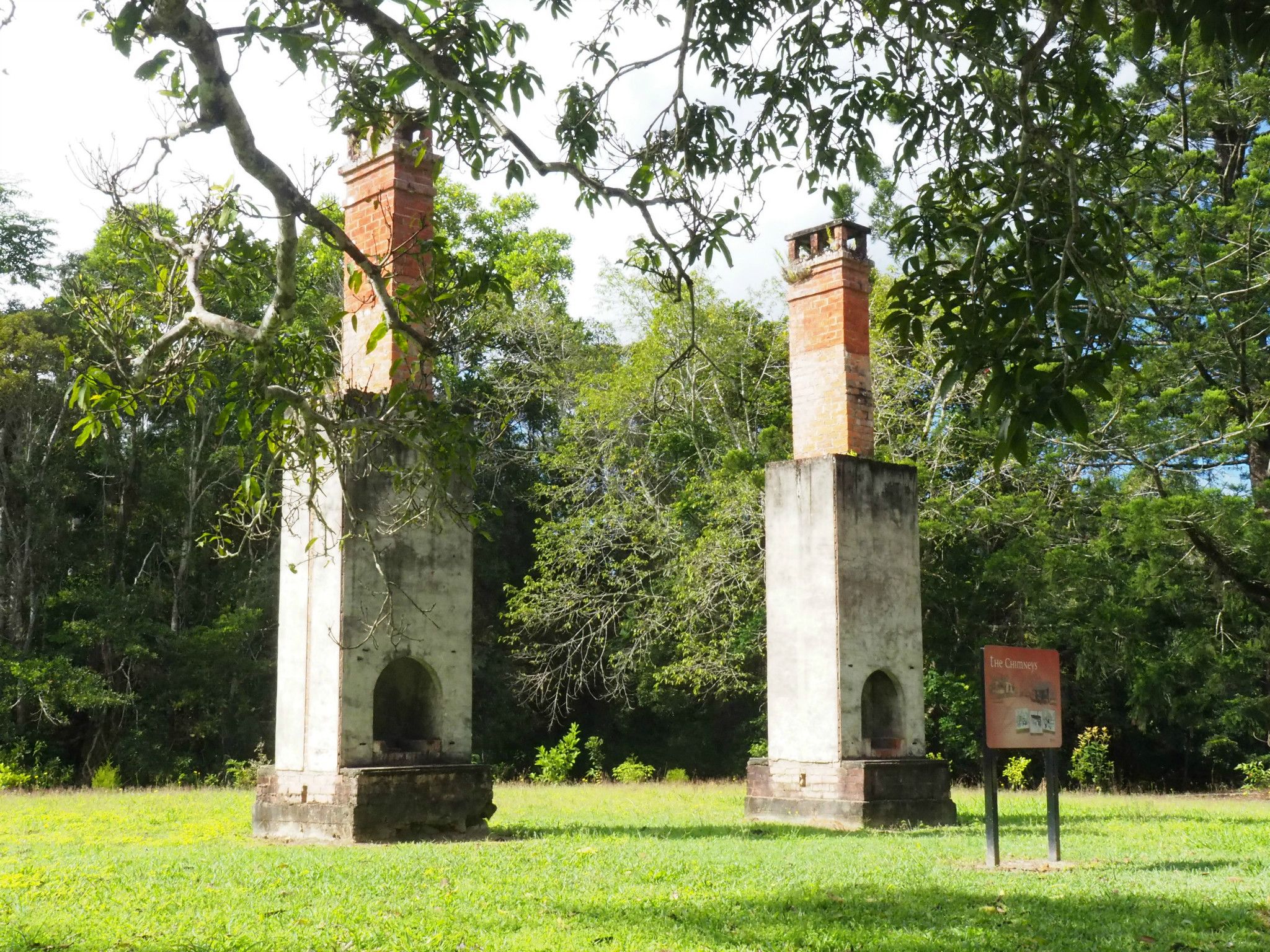
![Have a picnic beside the remnants of an historic soldier-settler house at The Chimneys day-use area.]() Have a picnic beside the remnants of an historic soldier-settler house at The Chimneys day-use area.
Photo credit: Julie Swartz © Queensland Government
Have a picnic beside the remnants of an historic soldier-settler house at The Chimneys day-use area.
Photo credit: Julie Swartz © Queensland Government
-
![Camp at Platypus camping area and throw a fishing line into Lake Tinaroo.]() Camp at Platypus camping area and throw a fishing line into Lake Tinaroo.
Photo credit: Maxime Coquard © Queensland Government
Camp at Platypus camping area and throw a fishing line into Lake Tinaroo.
Photo credit: Maxime Coquard © Queensland Government
-
![Platypus camping area has expansive views of Lake Tinaroo.]() Platypus camping area has expansive views of Lake Tinaroo.
Photo credit: Julie Swartz © Queensland Government
Platypus camping area has expansive views of Lake Tinaroo.
Photo credit: Julie Swartz © Queensland Government
-
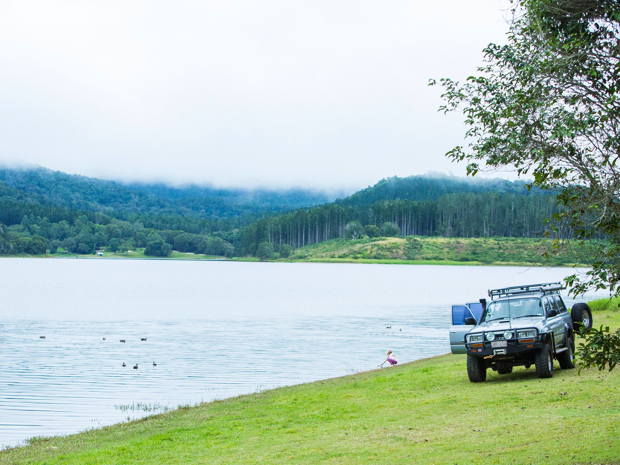
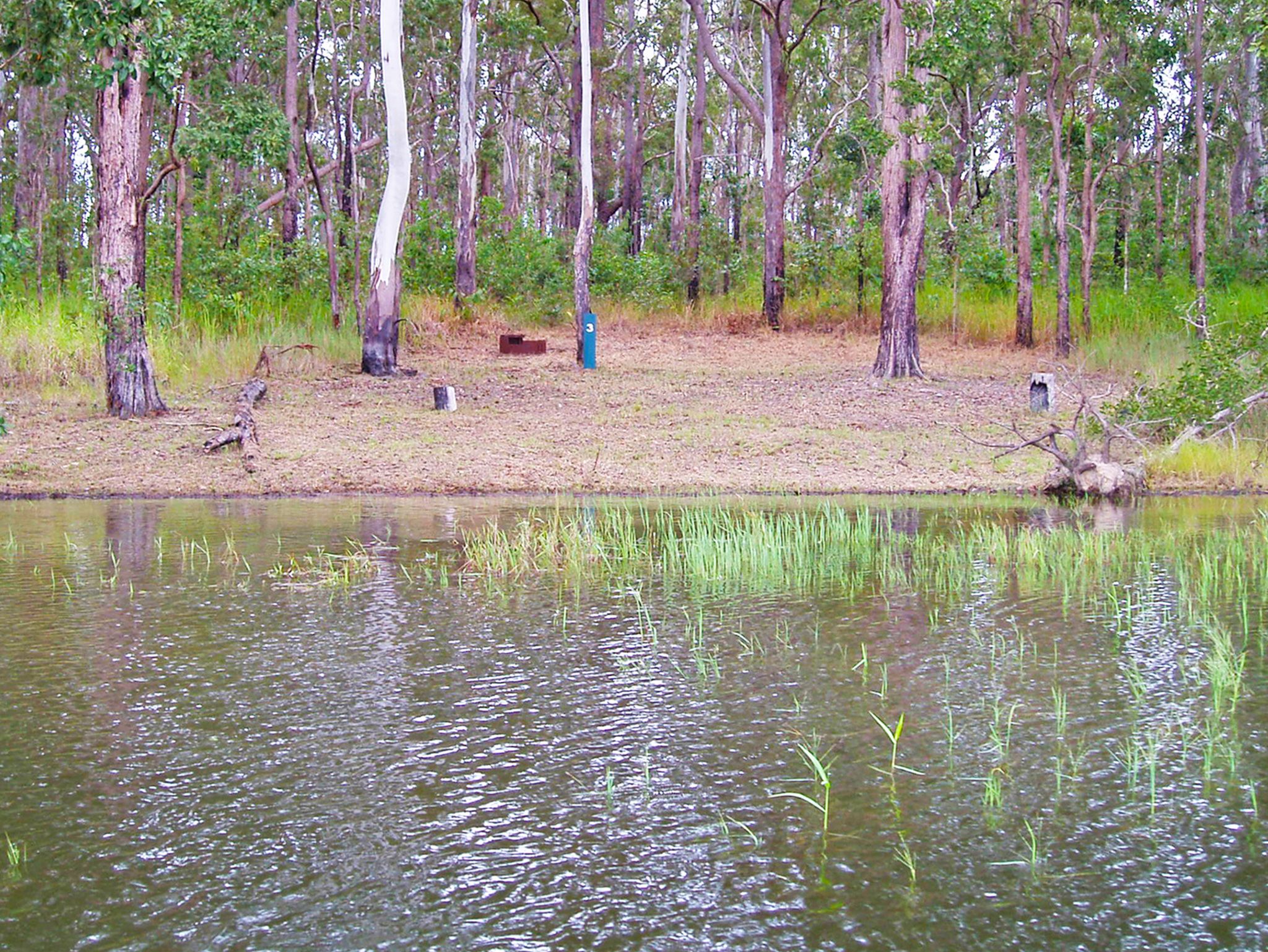
![Kauri Creek camping area is on the edge of an inlet, which is great for a swim or exploration by canoe.]() Kauri Creek camping area is on the edge of an inlet, which is great for a swim or exploration by canoe.
Photo credit: © Queensland Government
Kauri Creek camping area is on the edge of an inlet, which is great for a swim or exploration by canoe.
Photo credit: © Queensland Government
-
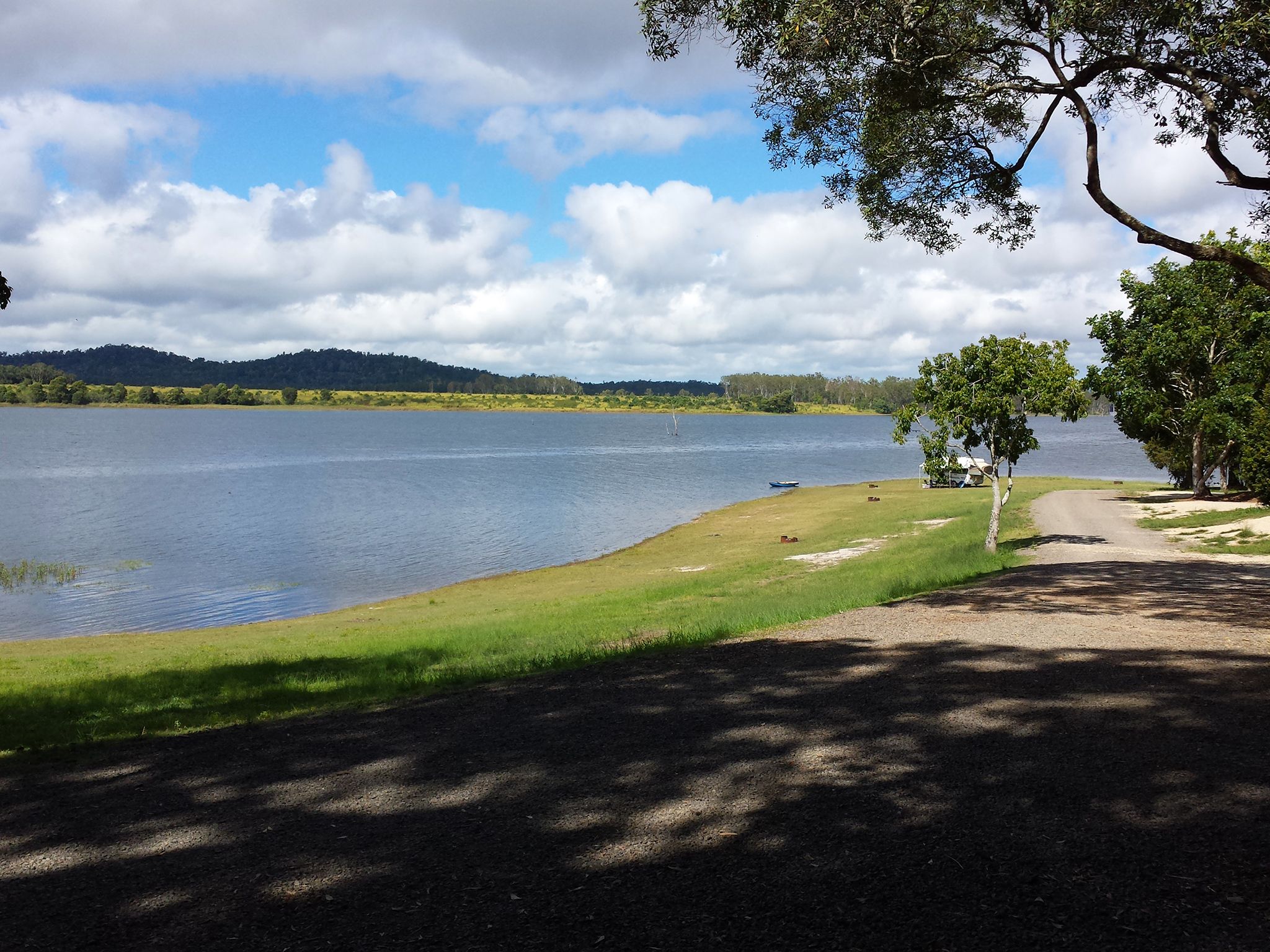
![School Point camping area offers attractive camp sites with wonderful views of the dam.]() School Point camping area offers attractive camp sites with wonderful views of the dam.
Photo credit: © Queensland Government
School Point camping area offers attractive camp sites with wonderful views of the dam.
Photo credit: © Queensland Government
-
![Fong-On Bay camping area is popular with waterskiers and boaties.]() Fong-On Bay camping area is popular with waterskiers and boaties.
Photo credit: Julie Swartz © Queensland Government
Fong-On Bay camping area is popular with waterskiers and boaties.
Photo credit: Julie Swartz © Queensland Government
-
![Curri Curri bush camping area.]() Pull up your boat, pitch your tent and have a campfire at Curri Curri bush camping area.
Photo credit: © Queensland Government
Pull up your boat, pitch your tent and have a campfire at Curri Curri bush camping area.
Photo credit: © Queensland Government
-
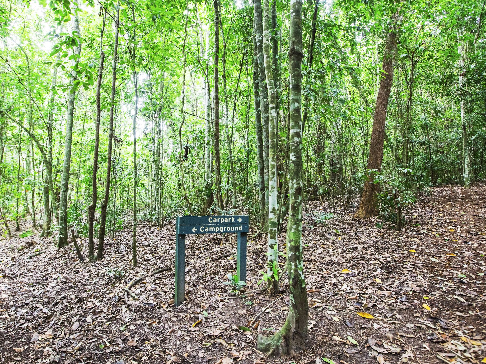
![The Regeneration walk passes through forest that is the result of natural revegetation processes.]() The Regeneration walk passes through forest that is the result of natural revegetation processes.
Photo credit: © Lovegreen Photography
The Regeneration walk passes through forest that is the result of natural revegetation processes.
Photo credit: © Lovegreen Photography
-
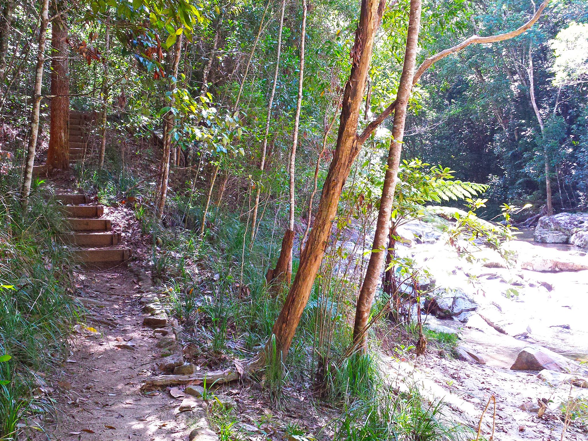
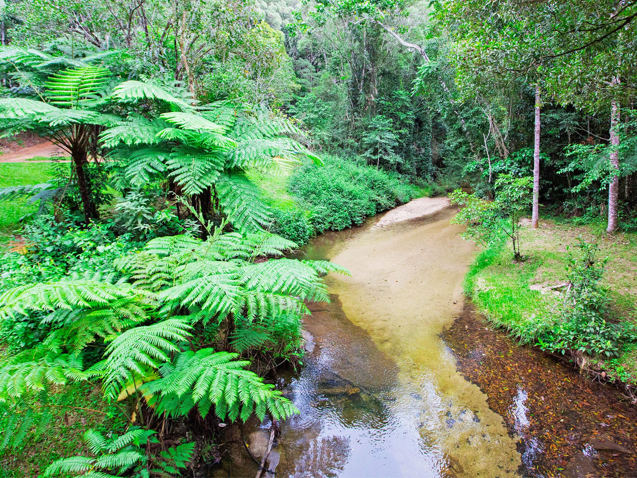
![The Jungaljungal walk winds through rainforest along the bank of Kauri Creek.]() The Jungaljungal walk winds through rainforest along the bank of Kauri Creek.
Photo credit: © Queensland Government
The Jungaljungal walk winds through rainforest along the bank of Kauri Creek.
Photo credit: © Queensland Government
-
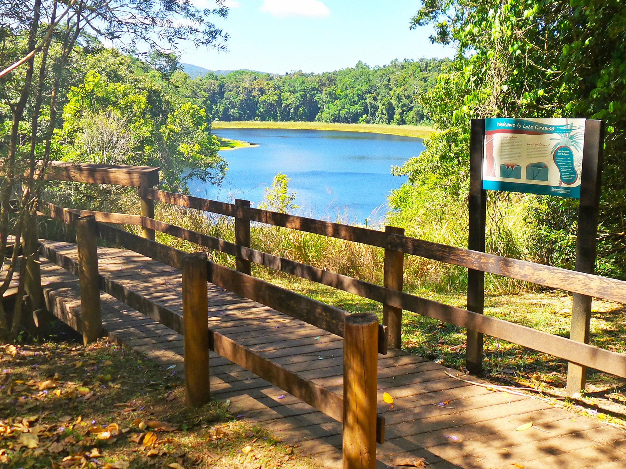
![The Lake Euramoo lookout affords excellent views of this volcanic maar.]() The Lake Euramoo lookout affords excellent views of this volcanic maar.
Photo credit: Julie Swartz © Queensland Government
The Lake Euramoo lookout affords excellent views of this volcanic maar.
Photo credit: Julie Swartz © Queensland Government
-
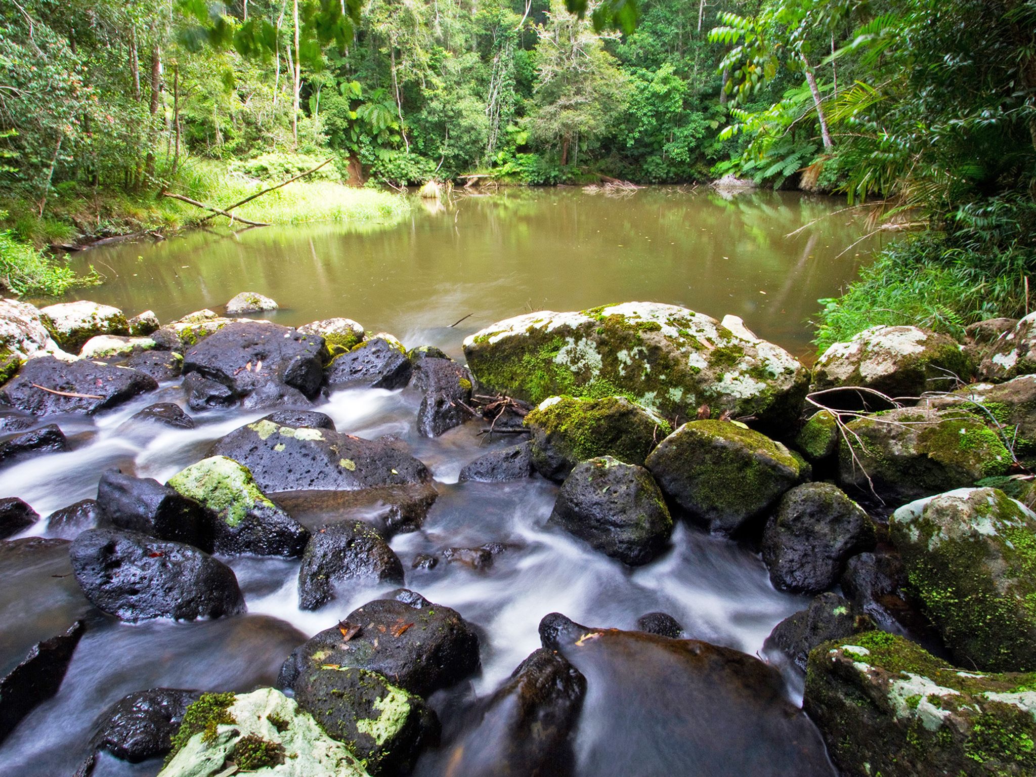
![Descend to the beautiful Mobo Creek Crater along the Mobo Creek Crater walk.]() Descend to the beautiful Mobo Creek Crater along the Mobo Creek Crater walk.
Photo credit: Robert Ashdown © Queensland Government
Descend to the beautiful Mobo Creek Crater along the Mobo Creek Crater walk.
Photo credit: Robert Ashdown © Queensland Government
-
![Look up into the spreading canopy of the majestic cathedral fig tree.]() Look up into the spreading canopy of the majestic cathedral fig tree.
Photo credit: Mike Prociv © Queensland Government
Look up into the spreading canopy of the majestic cathedral fig tree.
Photo credit: Mike Prociv © Queensland Government
-
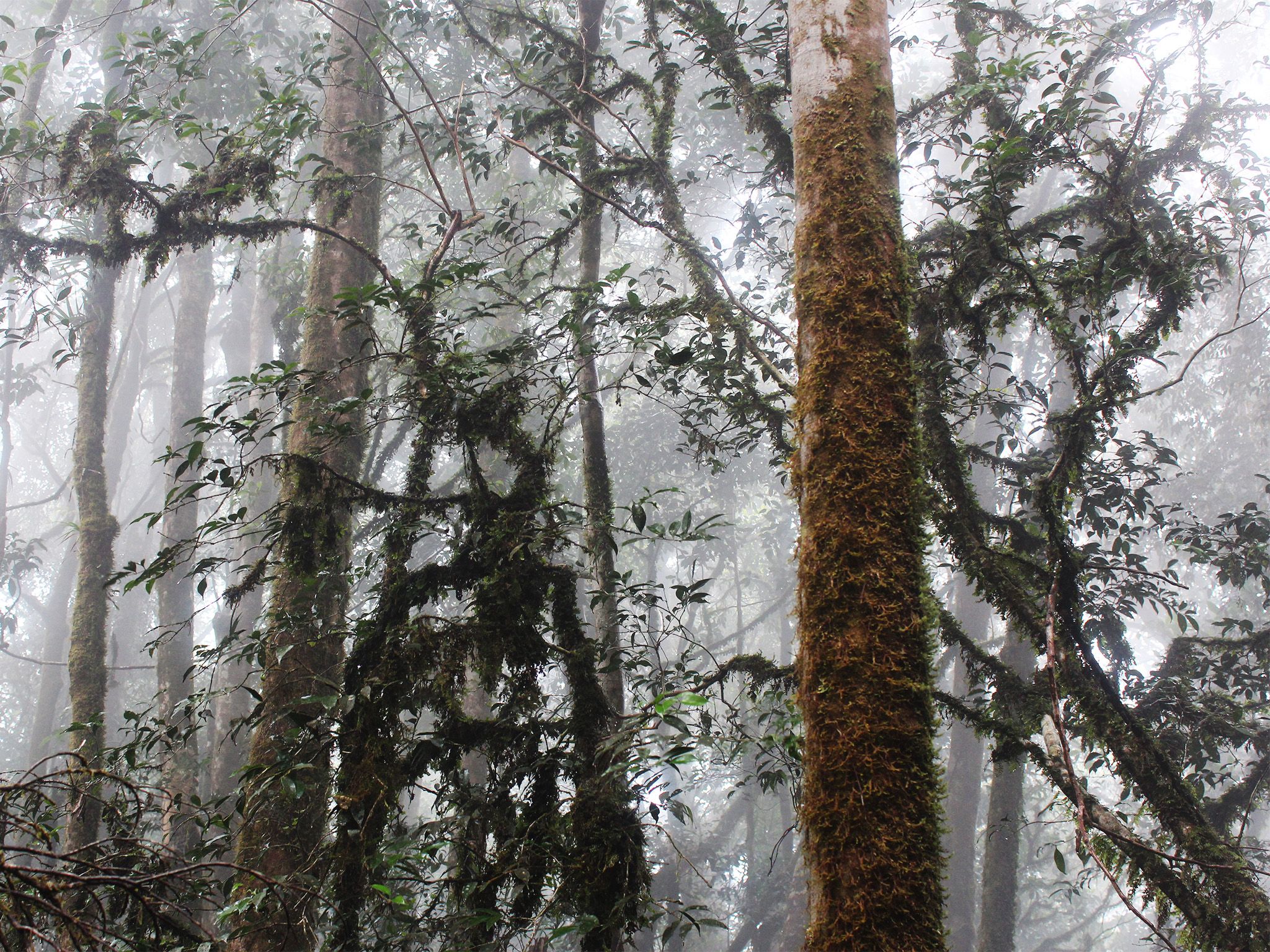
![Drive up into the often misty forests of the Lamb Range on the Mount Edith and Kauri Creek roads.]() Drive up into the often misty forests of the Lamb Range on the Mount Edith and Kauri Creek roads.
Photo credit: Mike Prociv © Queensland Government
Drive up into the often misty forests of the Lamb Range on the Mount Edith and Kauri Creek roads.
Photo credit: Mike Prociv © Queensland Government
-
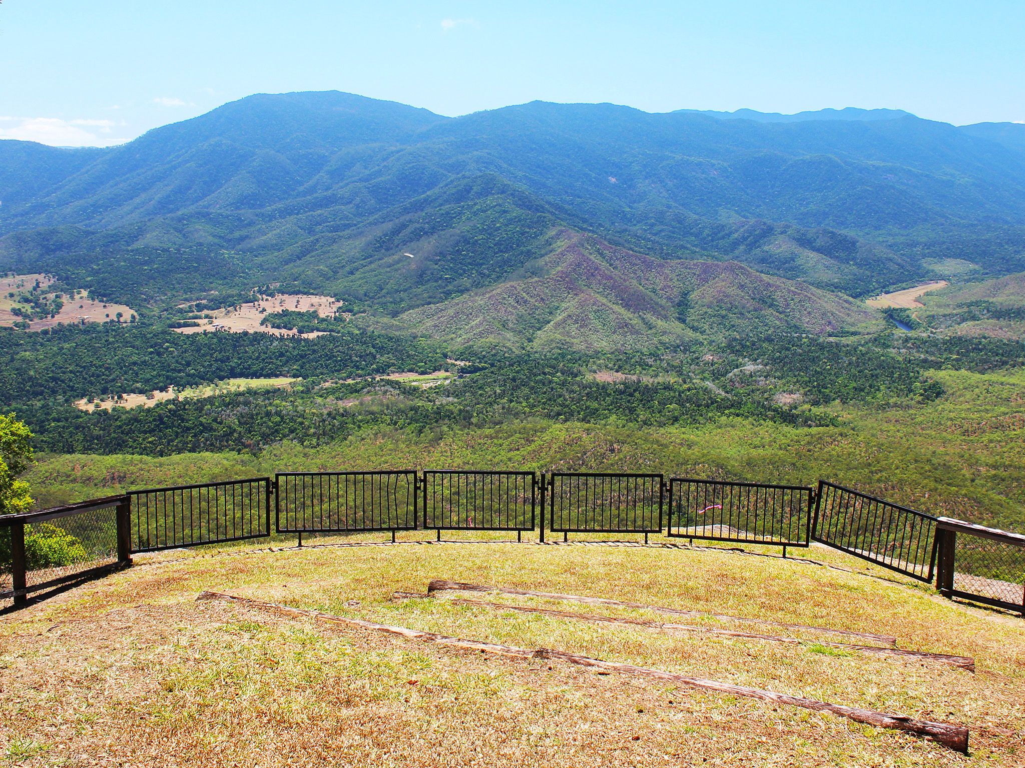
![Gillies lookout offers views over the Mulgrave River valley to the coastal mountains ranges beyond.]() Gillies lookout offers views over the Mulgrave River valley to the coastal mountains ranges beyond.
Photo credit: Mike Prociv © Queensland Government
Gillies lookout offers views over the Mulgrave River valley to the coastal mountains ranges beyond.
Photo credit: Mike Prociv © Queensland Government
-
![Enjoy a picnic beside the scenic Kauri Creek at Kauri Creek day-use area.]() Enjoy a picnic beside the scenic Kauri Creek at Kauri Creek day-use area.
Photo credit: © Lovegreen Photography
Enjoy a picnic beside the scenic Kauri Creek at Kauri Creek day-use area.
Photo credit: © Lovegreen Photography
-
![Climb Platypus Rock and view the surrounding forest canopy from the lookout.]() Climb Platypus Rock and view the surrounding forest canopy from the lookout.
Photo credit: © Queensland Government
Climb Platypus Rock and view the surrounding forest canopy from the lookout.
Photo credit: © Queensland Government
-
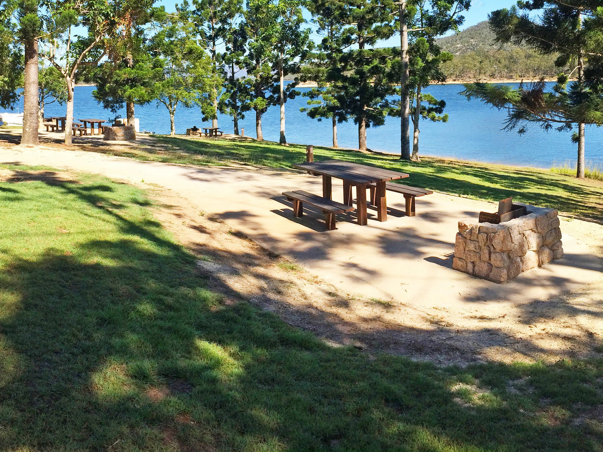
![At Platypus day-use area enjoy a picnic in the shade of hoop pines beside Lake Tinaroo.]() At Platypus day-use area enjoy a picnic in the shade of hoop pines beside Lake Tinaroo.
Photo credit: © Queensland Government
At Platypus day-use area enjoy a picnic in the shade of hoop pines beside Lake Tinaroo.
Photo credit: © Queensland Government
-
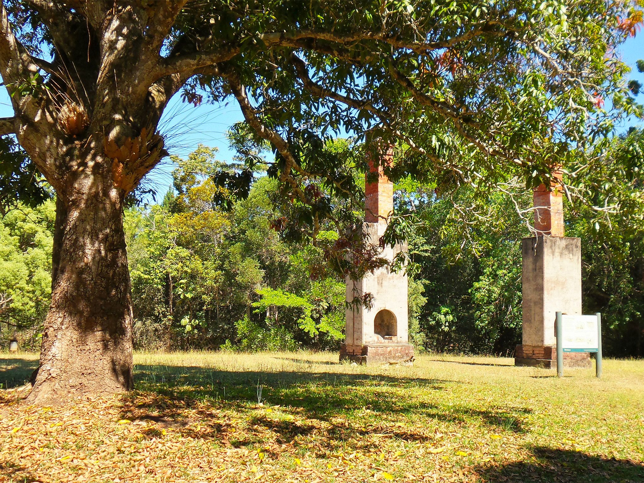
![The chimneys are all that remain of an old soldier-settler house.]() The chimneys are all that remain of an old soldier-settler house.
Photo credit: Roger James © Queensland Government
The chimneys are all that remain of an old soldier-settler house.
Photo credit: Roger James © Queensland Government


- Temporary closure: Madigan Road and Gillies lookout, Danbulla National Park 30 January 2024 to 31 August 2025
- Temporary road closures: Mount Edith Road, Kauri Creek Road and Tinaroo Creek Road, Danbulla National Park 22 December 2023 to 23 April 2026
- Planned upcoming closures: various camping areas, Danbulla National Park and State Forest 1 October to 30 November 2025
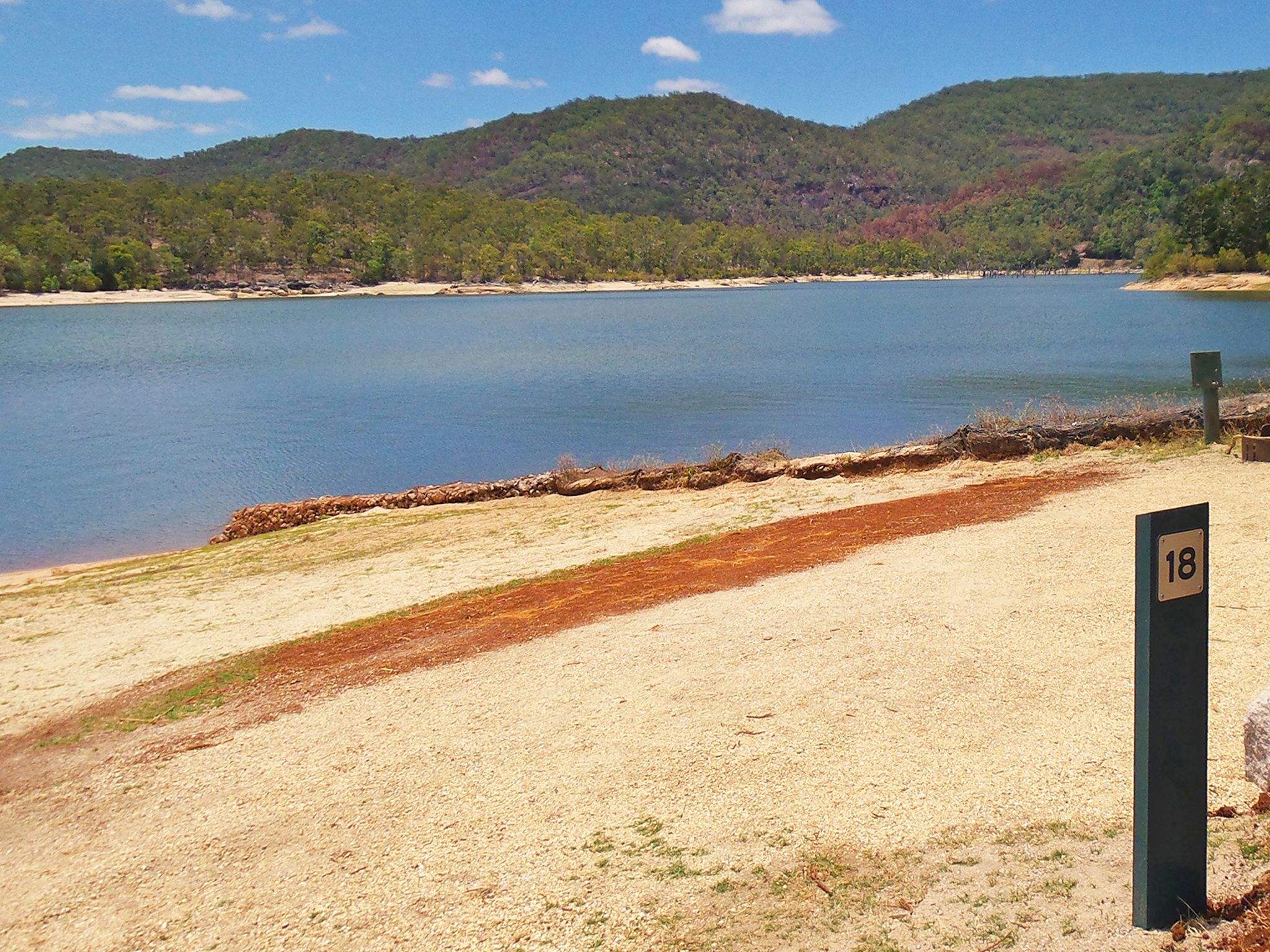
- Reduced capacity due to higher than expected water levels of Tinaroo Dam: Downfall Creek, Kauri Creek and Fong On Bay camping areas, Danbulla National Park. 17 September 2024 to 30 August 2025
- Planned burning activities: Danbulla National Park 9 June to 30 September 2025