Impressive mountain peaks, escarpments and ridges offer breathtaking views in this Gondwana Rainforests of Australia World Heritage Area, a home for rare and endangered wildlife and a popular bushwalking destination.
Location
About 110km south-west of Brisbane
Park facilities
- Campfires allowed (conditions apply)
- Lookout
- Picnic tables
- Toilets
- Wheelchair access (may require assistance)
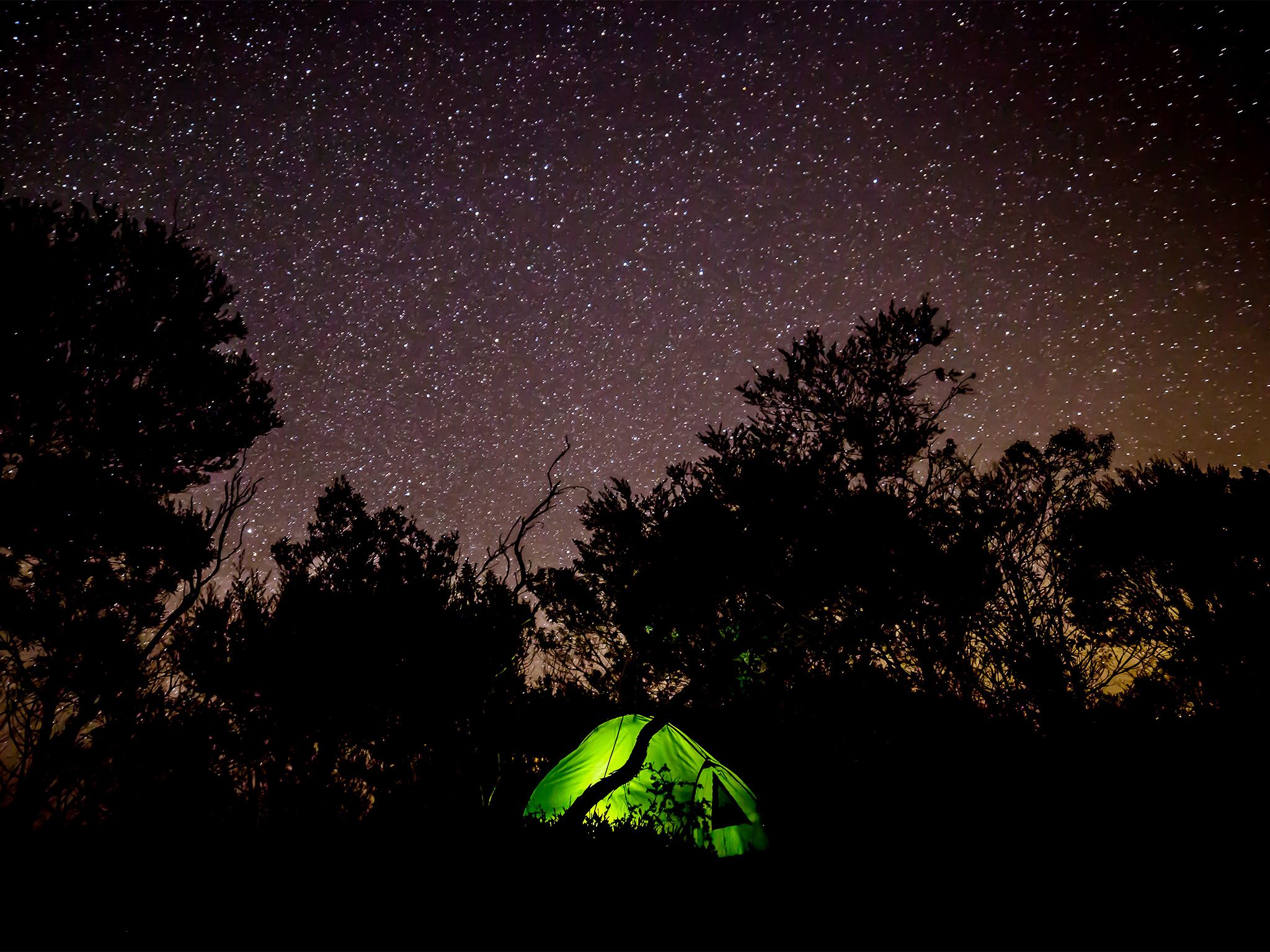
- Tent camping
- Caravan camping
- Camper trailer camping
- Campervan camping
- Motor home camping
- Hiking
- Walking
- World Heritage
-
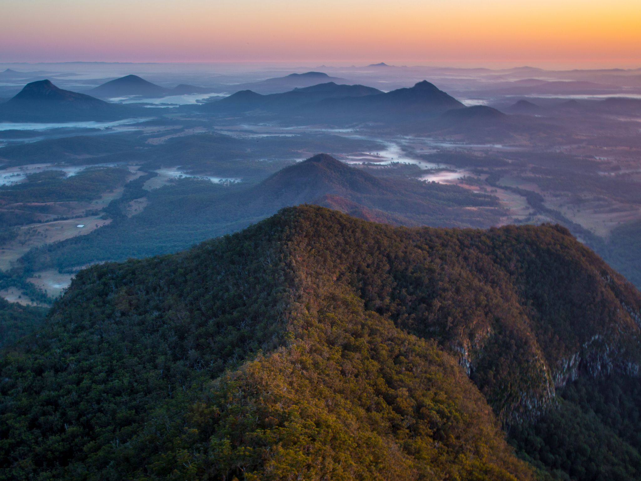
![Take the Mount Mitchell track to the summit of East Peak for endless views over the Fassifern Valley.]() Take the Mount Mitchell track to the summit of East Peak for endless views over the Fassifern Valley.
Photo credit: © Janette Asche
Take the Mount Mitchell track to the summit of East Peak for endless views over the Fassifern Valley.
Photo credit: © Janette Asche
-
![Govenor's Chair has spectacular views over Lake Moogerah and the volcanic landscape of Main Range.]() Govenor's Chair has spectacular views over Lake Moogerah and the volcanic landscape of Main Range.
Photo credit: © Chris Whitelaw
Govenor's Chair has spectacular views over Lake Moogerah and the volcanic landscape of Main Range.
Photo credit: © Chris Whitelaw
-
![Every lookout in Main Range has spectacular views!]() Every lookout in Main Range has spectacular views!
Photo credit: Maxime Coquard © Queensland Government
Every lookout in Main Range has spectacular views!
Photo credit: Maxime Coquard © Queensland Government
-
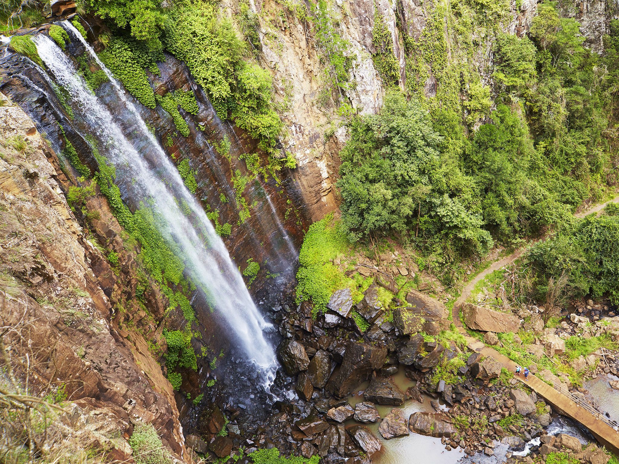
![Take in spectacular views of the falls along the Queen Mary Falls circuit.]() Take in spectacular views of the falls along the Queen Mary Falls circuit.
Photo credit: Maxime Coquard © Queensland Government
Take in spectacular views of the falls along the Queen Mary Falls circuit.
Photo credit: Maxime Coquard © Queensland Government
-
![Main Range National Park has fantastic opportunities for experienced off-trail walkers.]() Main Range National Park has fantastic opportunities for experienced off-trail walkers.
Photo credit: © Casey Eveleigh Photography
Main Range National Park has fantastic opportunities for experienced off-trail walkers.
Photo credit: © Casey Eveleigh Photography
-
![Stop along the Dalrymple circuit to soak up the serenity of Dalrymple Creek.]() Stop along the Dalrymple circuit to soak up the serenity of Dalrymple Creek.
Photo credit: Maxime Coquard © Queensland Government
Stop along the Dalrymple circuit to soak up the serenity of Dalrymple Creek.
Photo credit: Maxime Coquard © Queensland Government
-
![The Rainforest circuit is a great short walk for the whole family.]() The Rainforest circuit is a great short walk for the whole family.
Photo credit: Maxime Coquard © Queensland Government
The Rainforest circuit is a great short walk for the whole family.
Photo credit: Maxime Coquard © Queensland Government
-
![Camp under the Manna gum trees beside Dalrymple Creek at the Manna Gum camping area.]() Camp under the Manna gum trees beside Dalrymple Creek at the Manna Gum camping area.
Photo credit: Maxime Coquard © Queensland Government
Camp under the Manna gum trees beside Dalrymple Creek at the Manna Gum camping area.
Photo credit: Maxime Coquard © Queensland Government
-
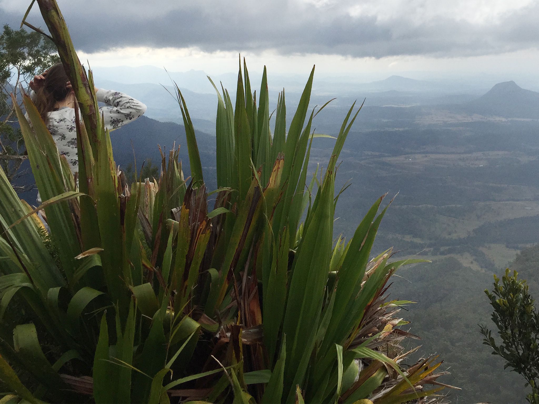
![Giant spear lillies.]() Look for giant spear lilies at nearby lookouts.
Photo credit: Robert Ashdown © Queensland Government
Look for giant spear lilies at nearby lookouts.
Photo credit: Robert Ashdown © Queensland Government
-
![Discover the panoramic views just north of the camp site.]() Discover the panoramic views just north of the camp site.
Photo credit: © Casey Eveleigh Photography
Discover the panoramic views just north of the camp site.
Photo credit: © Casey Eveleigh Photography
-
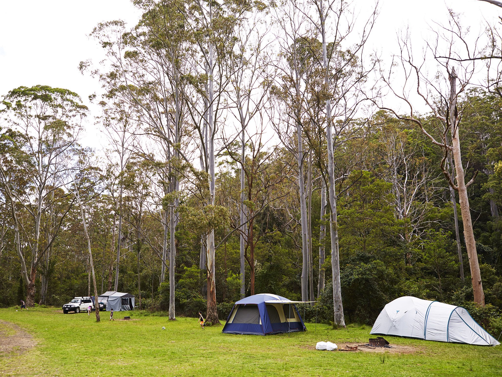
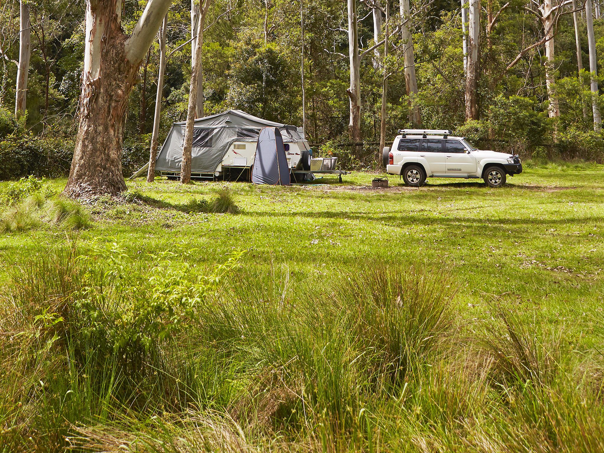
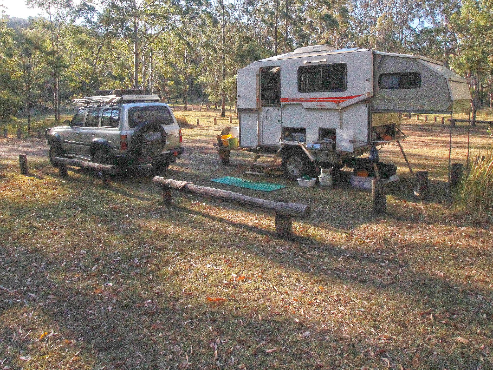
![Manna Gum camping area, a large grassy area with a white four wheel drive parked in front of a set up caravan, surrounded by tall gum trees.]() This spacious camping area has sites for tents, camper trailers, caravans and motorhomes.
Photo credit: Maxime Coquard © Queensland Government
This spacious camping area has sites for tents, camper trailers, caravans and motorhomes.
Photo credit: Maxime Coquard © Queensland Government
-
![Take in the superb views across to Lake Moogerah from the edge of the camp site.]() Take in the superb views across to Lake Moogerah from the edge of the camp site.
Photo credit: © Noah Bergel-Bartlett
Take in the superb views across to Lake Moogerah from the edge of the camp site.
Photo credit: © Noah Bergel-Bartlett
-
![The camping area is a spacious, grassy spot nestled beside Dalrymple Creek.]() The camping area is a spacious, grassy spot nestled beside Dalrymple Creek.
Photo credit: © Jennifer Bartlett
The camping area is a spacious, grassy spot nestled beside Dalrymple Creek.
Photo credit: © Jennifer Bartlett
-
![Pitch your tent under the rainforest canopy.]() Pitch your tent under the rainforest canopy.
Photo credit: © Jennifer Bartlett
Pitch your tent under the rainforest canopy.
Photo credit: © Jennifer Bartlett
-
![Photo of fragile mountain heath bursting into colour during spring]() Fragile mountain heath bursts into colour during spring
Photo credit: © Queensland Government
Fragile mountain heath bursts into colour during spring
Photo credit: © Queensland Government
-
![Settle back into the peace and quiet .]() Settle back into the peace and quiet .
Photo credit: © Chris Whitelaw
Settle back into the peace and quiet .
Photo credit: © Chris Whitelaw
-
![The Steamers are a nearby feature of this camp site.]() The Steamers are a nearby feature of this camp site.
Photo credit: © Tony Kevin Photography
The Steamers are a nearby feature of this camp site.
Photo credit: © Tony Kevin Photography
-
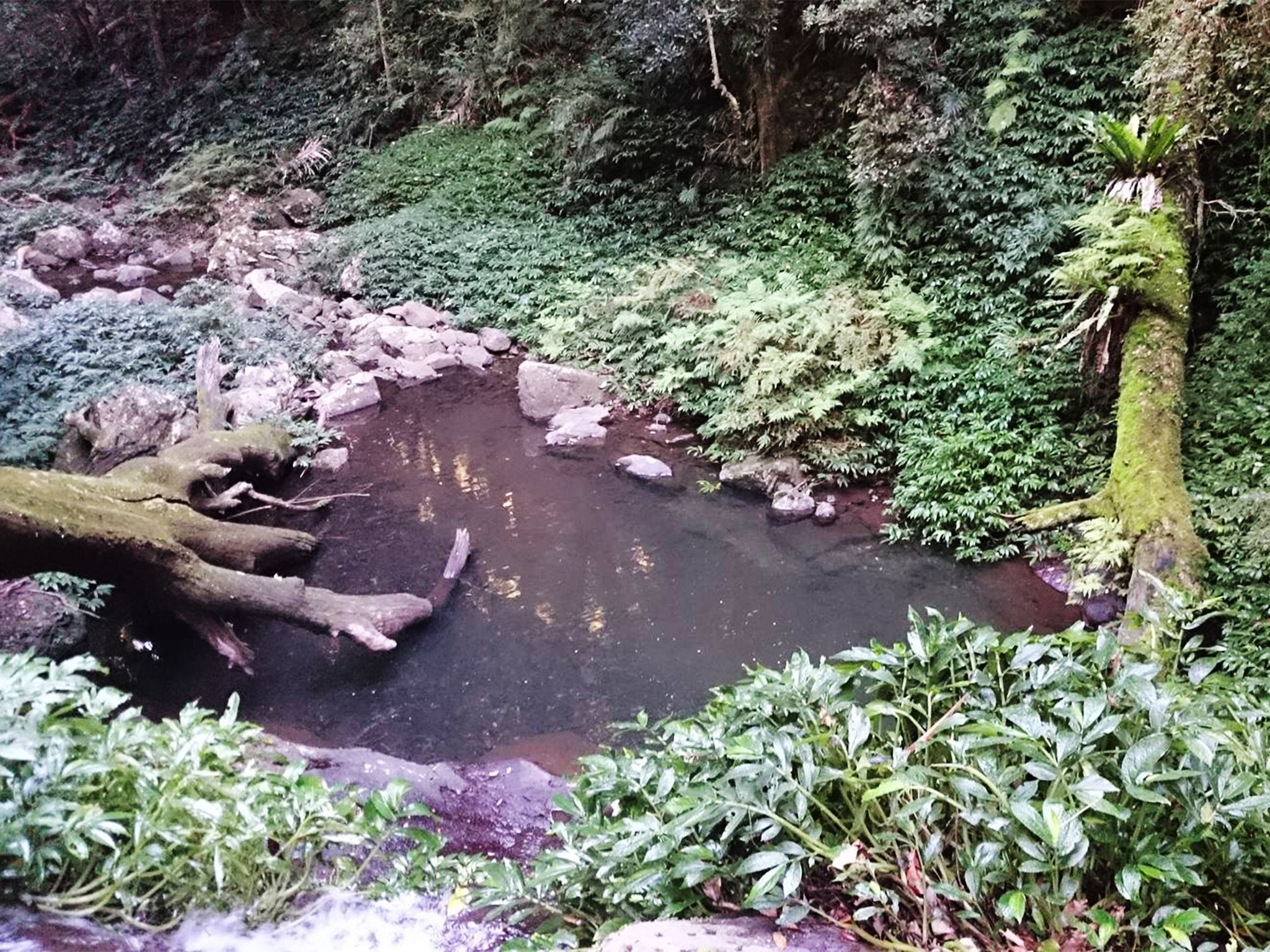
![The track leads to a pool at the base of the Araucaria Falls.]() The track leads to a pool at the base of the Araucaria Falls.
Photo credit: Joel Kotze © Queensland Government
The track leads to a pool at the base of the Araucaria Falls.
Photo credit: Joel Kotze © Queensland Government
-
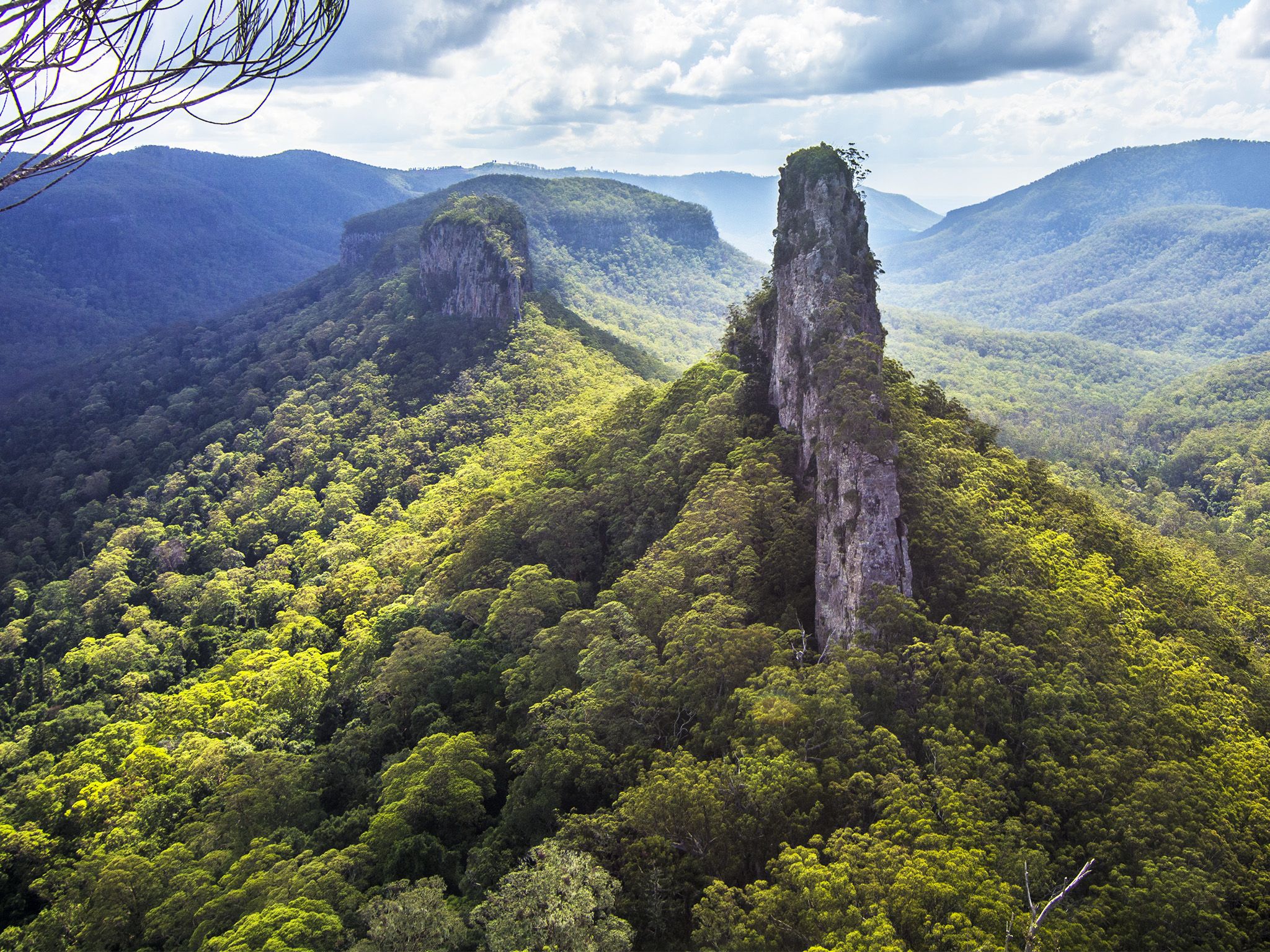
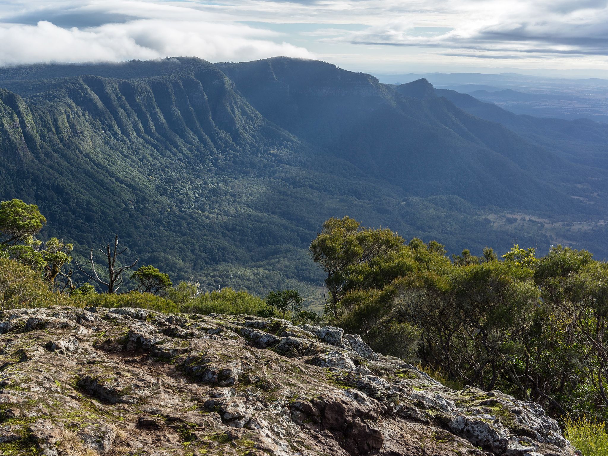
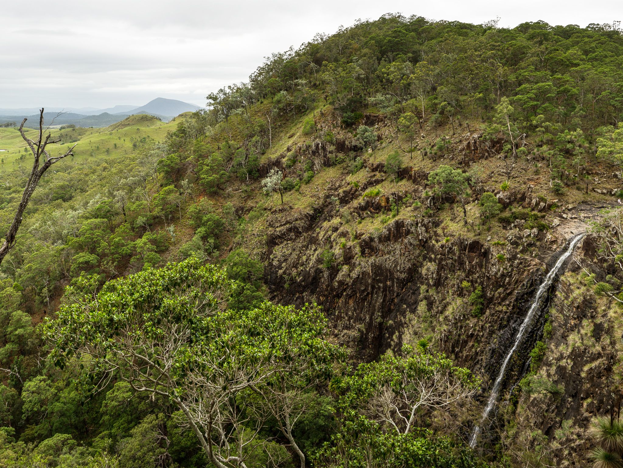
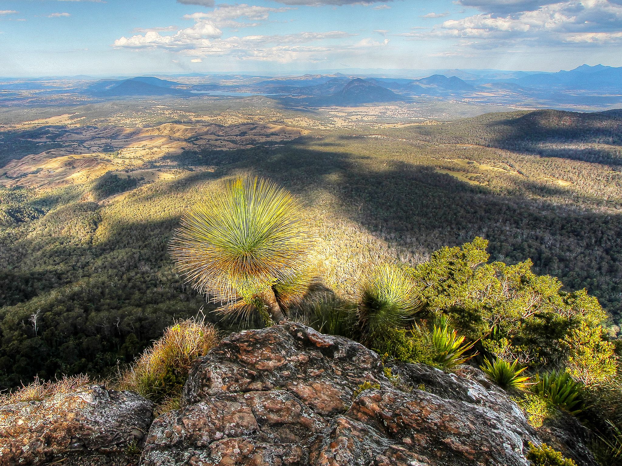
![Drink in spectacular views over the northern Ramparts and west to the Darling Downs.]() Drink in spectacular views over the northern Ramparts and west to the Darling Downs.
Photo credit: © Janette Asche
Drink in spectacular views over the northern Ramparts and west to the Darling Downs.
Photo credit: © Janette Asche
-
![Wander alongside scenic West Gap Creek.]() Wander alongside scenic West Gap Creek.
Photo credit: Maxime Coquard © Queensland Government
Wander alongside scenic West Gap Creek.
Photo credit: Maxime Coquard © Queensland Government
-
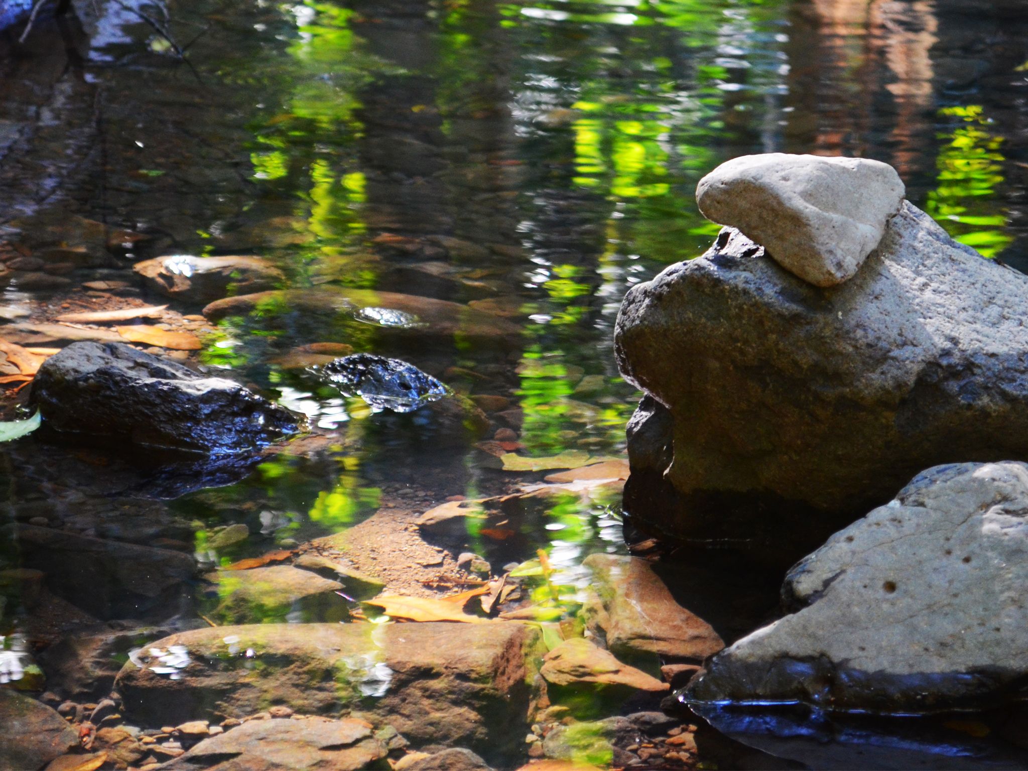
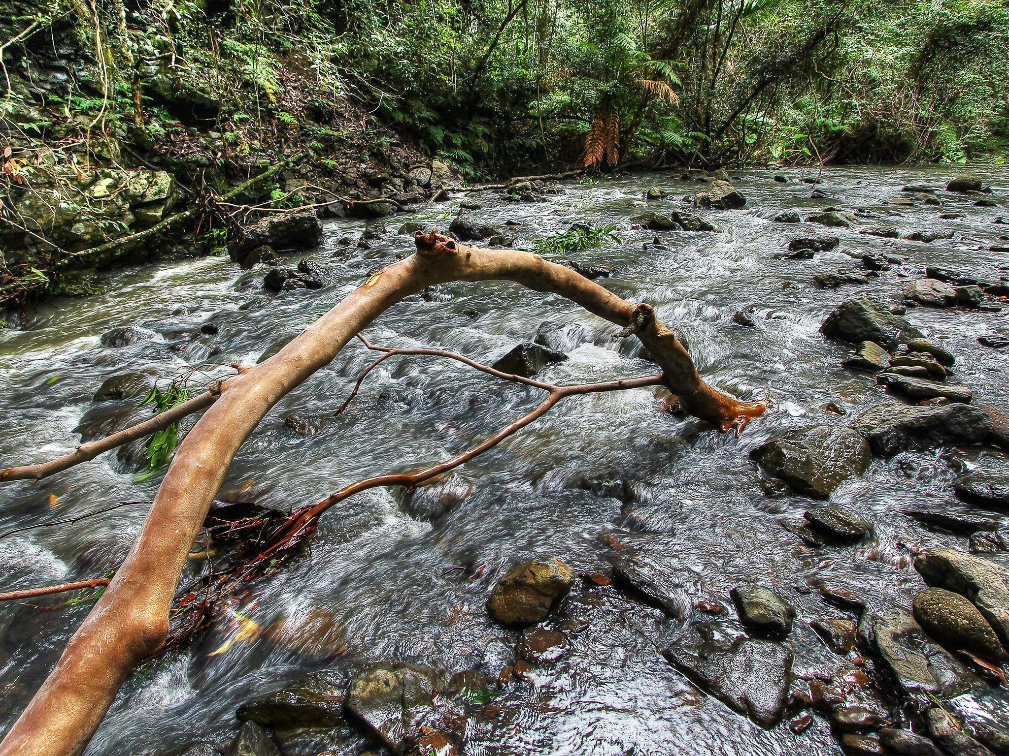
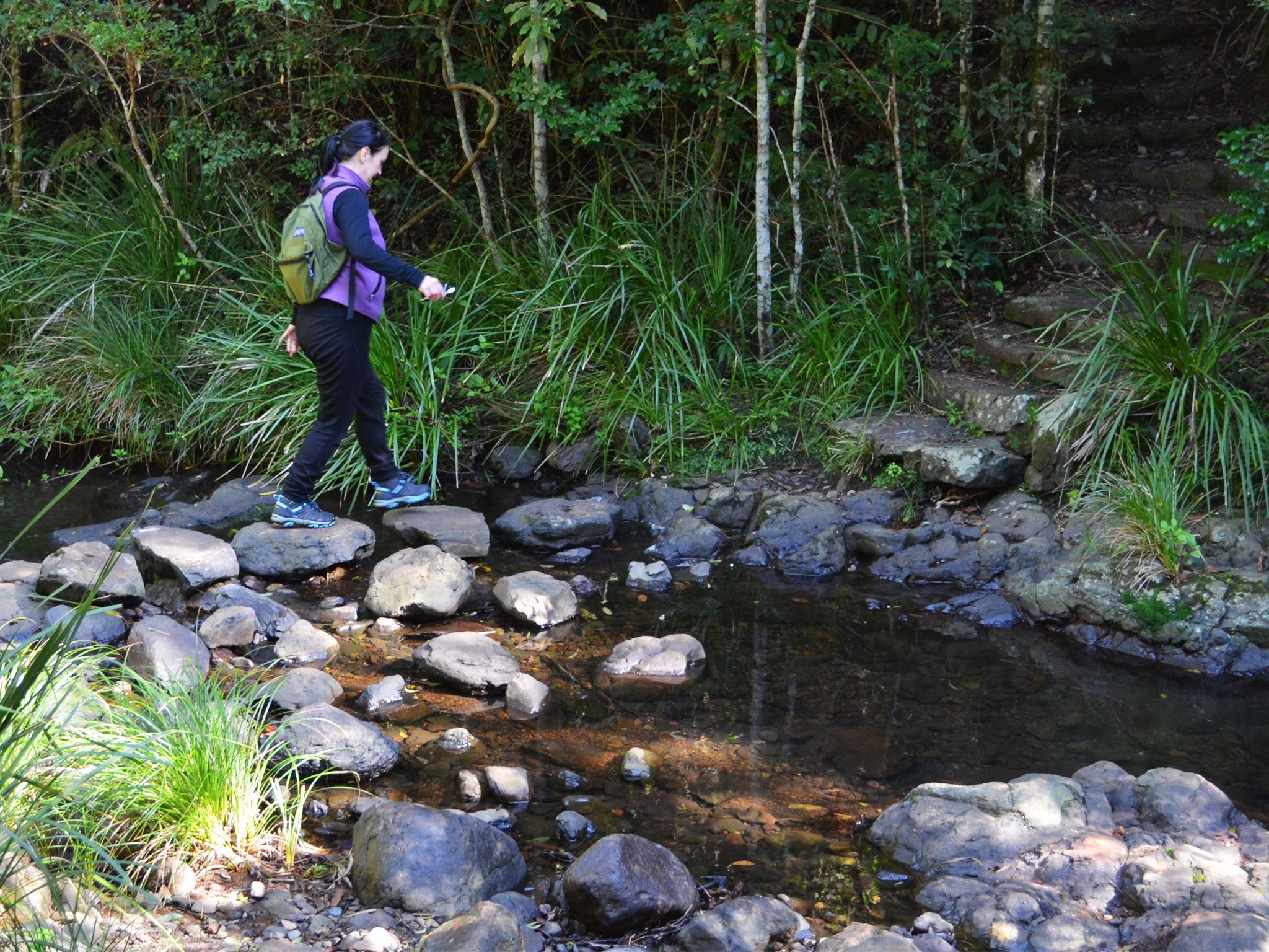
![Rock hop over the upper reaches of Dalrymple Creek.]() Rock hop over the upper reaches of Dalrymple Creek.
Photo credit: © Sarah Haskmann
Rock hop over the upper reaches of Dalrymple Creek.
Photo credit: © Sarah Haskmann
-
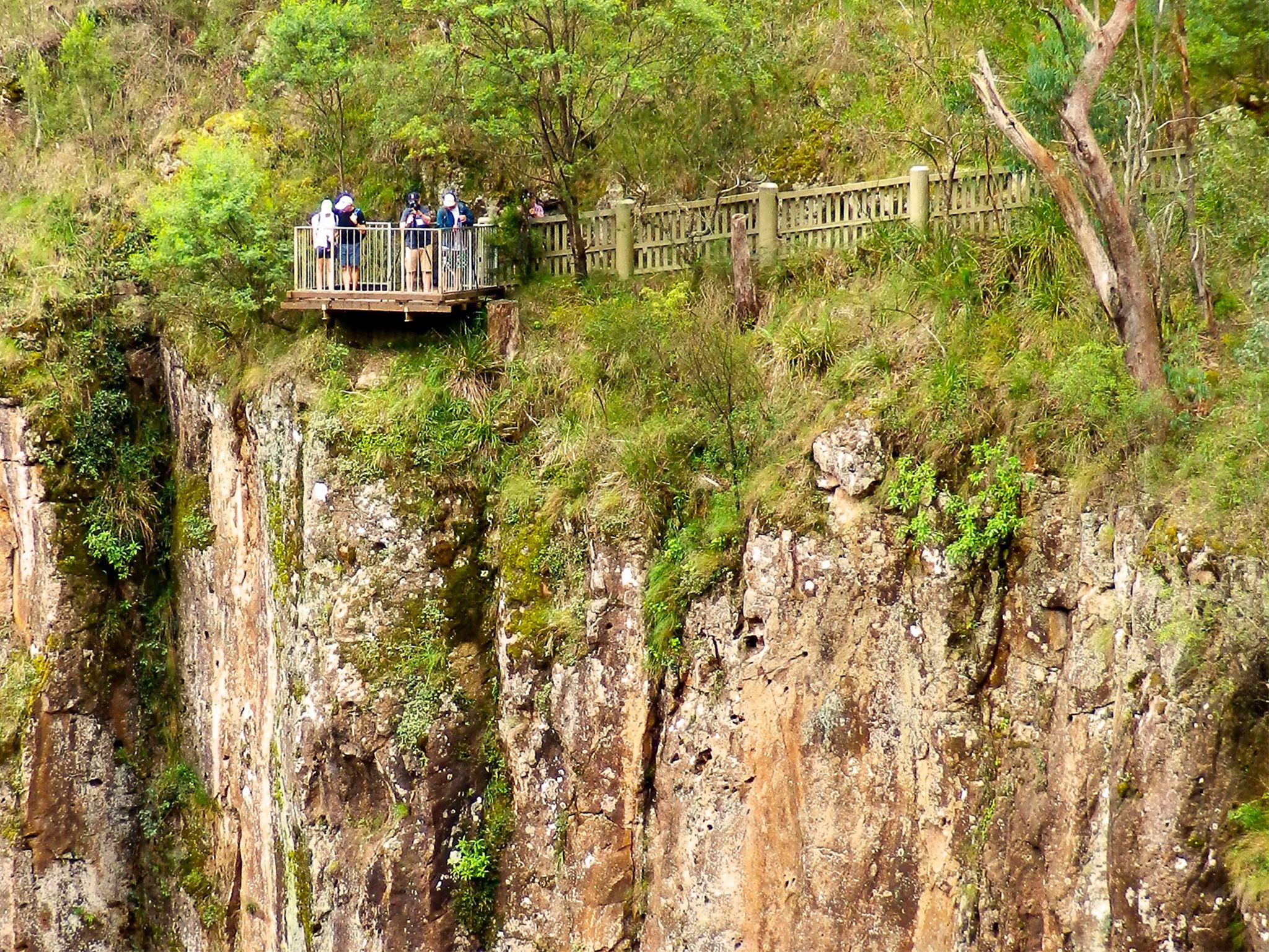
![Take in views across the gorge.]() Take in views across the gorge.
Photo credit: Jodie Bray © Queensland Government
Take in views across the gorge.
Photo credit: Jodie Bray © Queensland Government
-
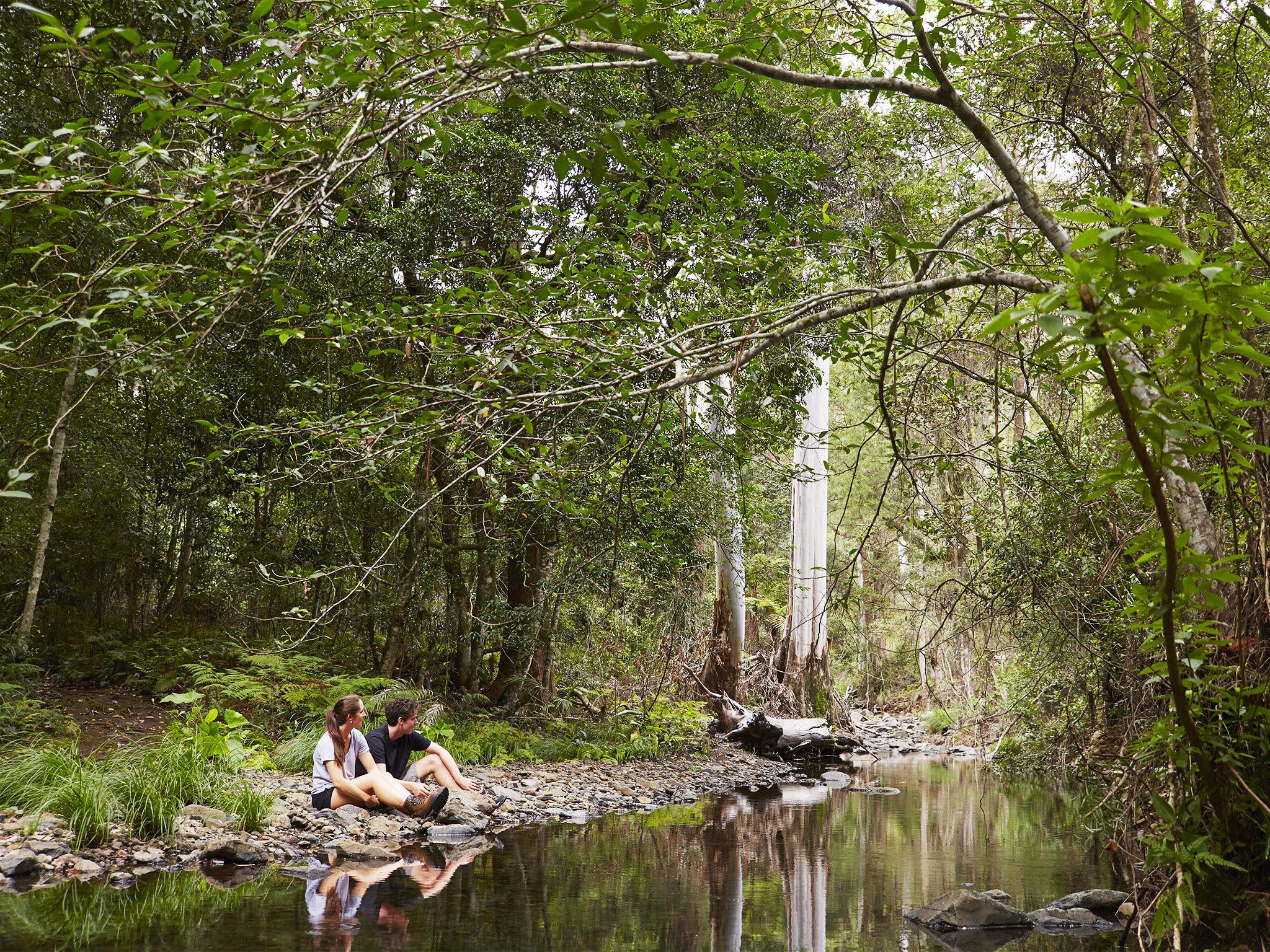
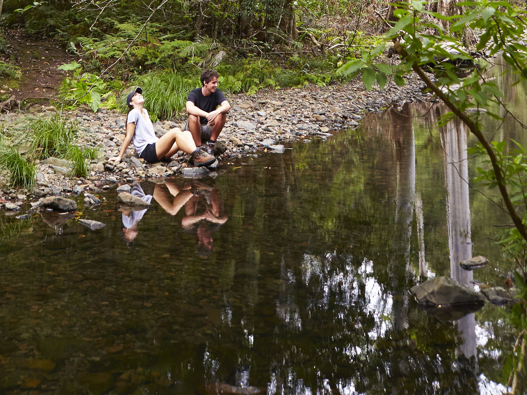
![Stop and take in the serenity of Dalrymple Creek.]() Stop and take in the serenity of Dalrymple Creek.
Photo credit: Maxime Coquard © Queensland Government
Stop and take in the serenity of Dalrymple Creek.
Photo credit: Maxime Coquard © Queensland Government
-
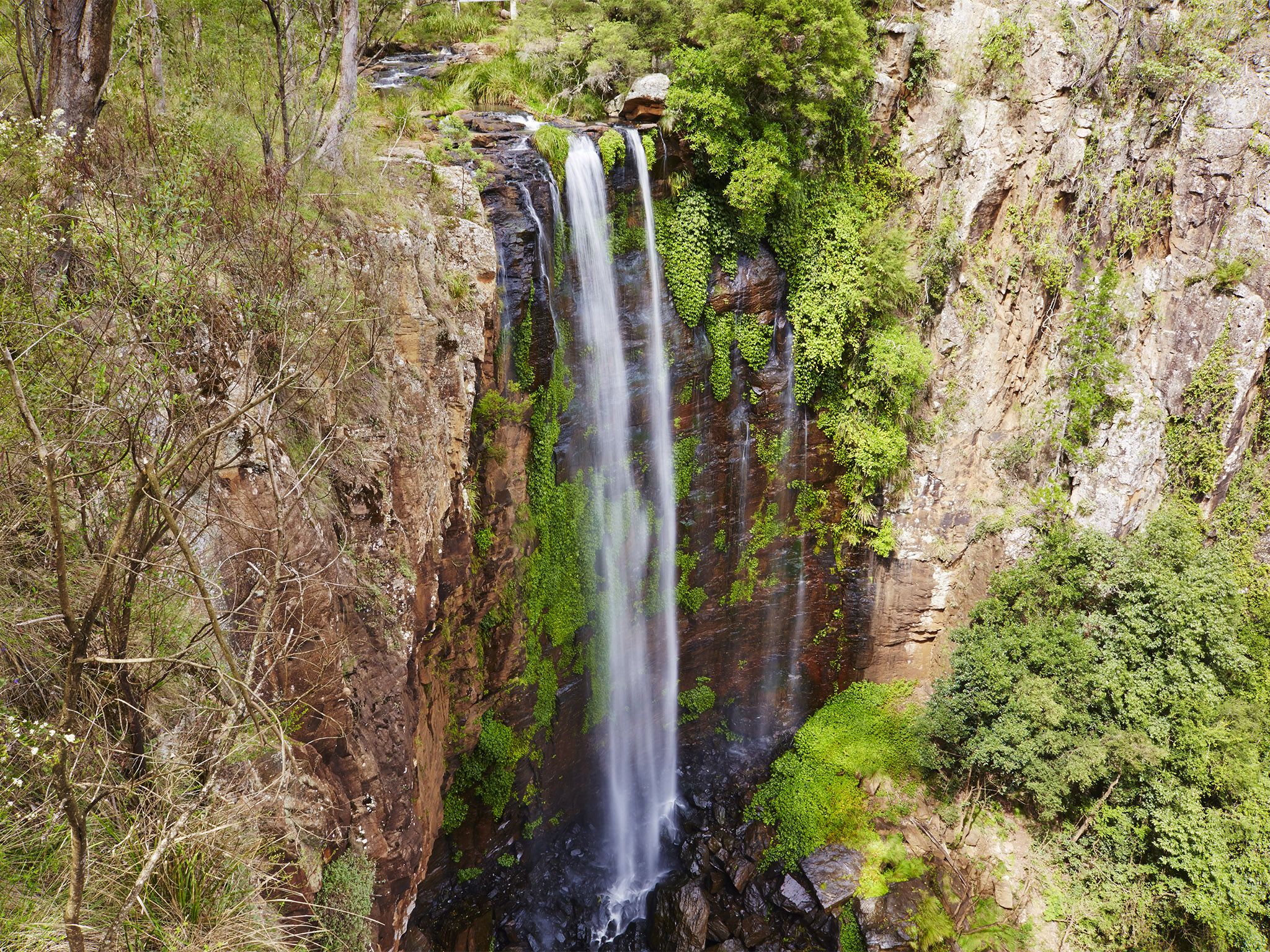
![After rain, water cascades over the 100m drop.]() After rain, water cascades over the 100m drop.
Photo credit: Cameron Semple © High and Wide
After rain, water cascades over the 100m drop.
Photo credit: Cameron Semple © High and Wide
-
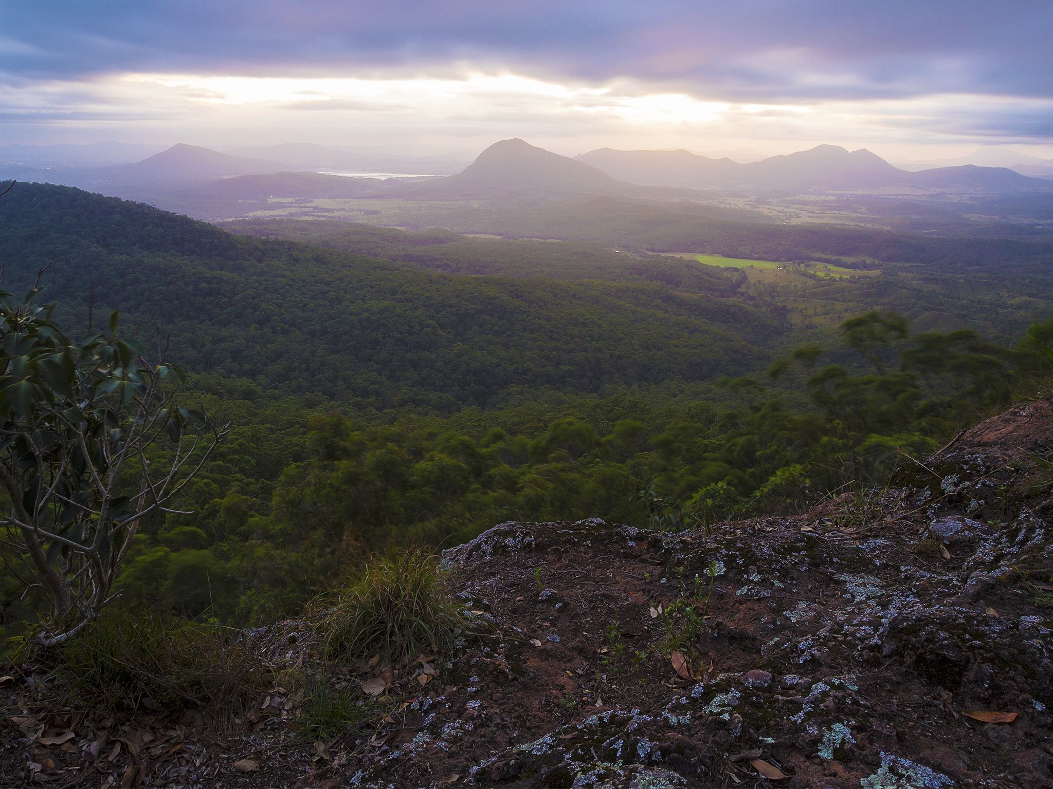
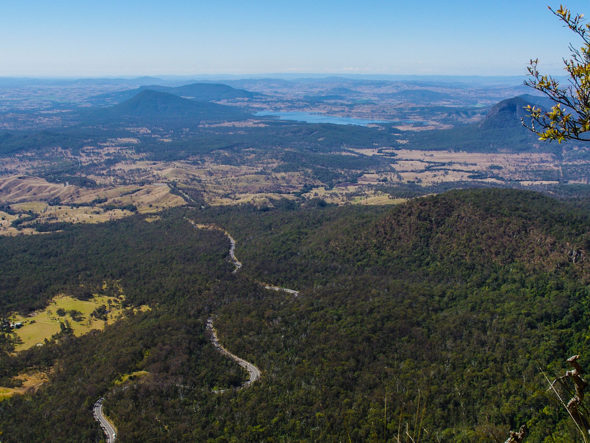
![It's only a short walk to spectacular views over Lake Moogerah and the volcanic landscape of Main Range.]() It's only a short walk to spectacular views over Lake Moogerah and the volcanic landscape of Main Range.
Photo credit: © Gareth McGuigan
It's only a short walk to spectacular views over Lake Moogerah and the volcanic landscape of Main Range.
Photo credit: © Gareth McGuigan
-
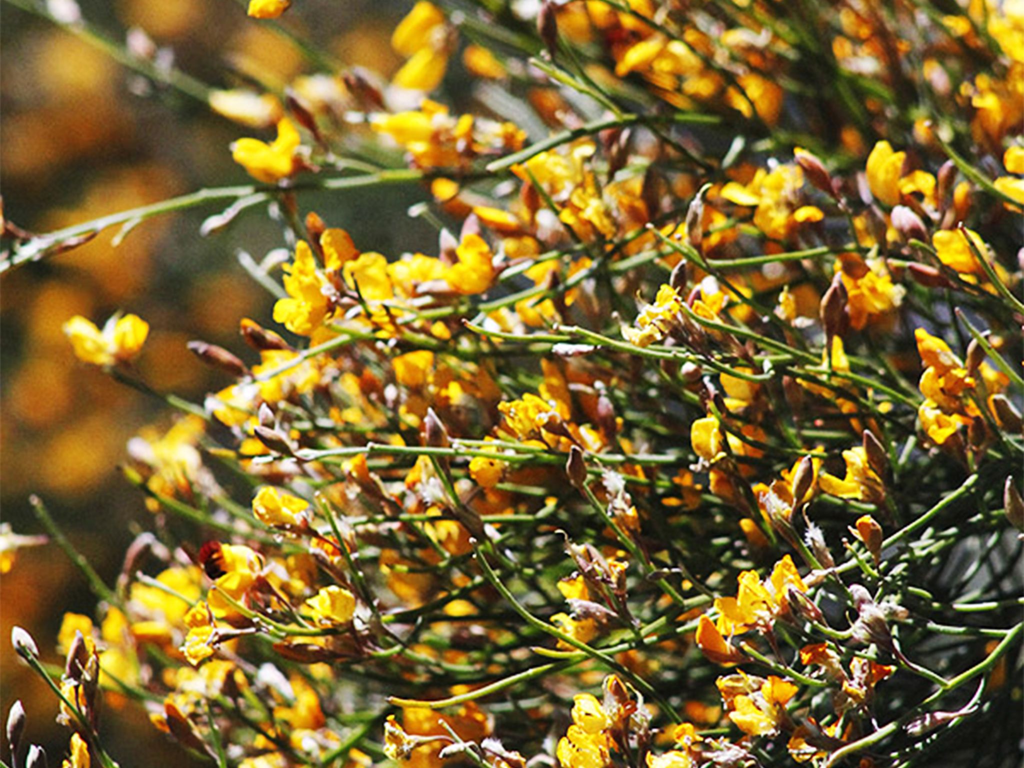
![Look for splashes of colour from wildflowers along the trail.]() Look for splashes of colour from wildflowers along the trail.
Photo credit: © Chris Whitelaw
Look for splashes of colour from wildflowers along the trail.
Photo credit: © Chris Whitelaw
-
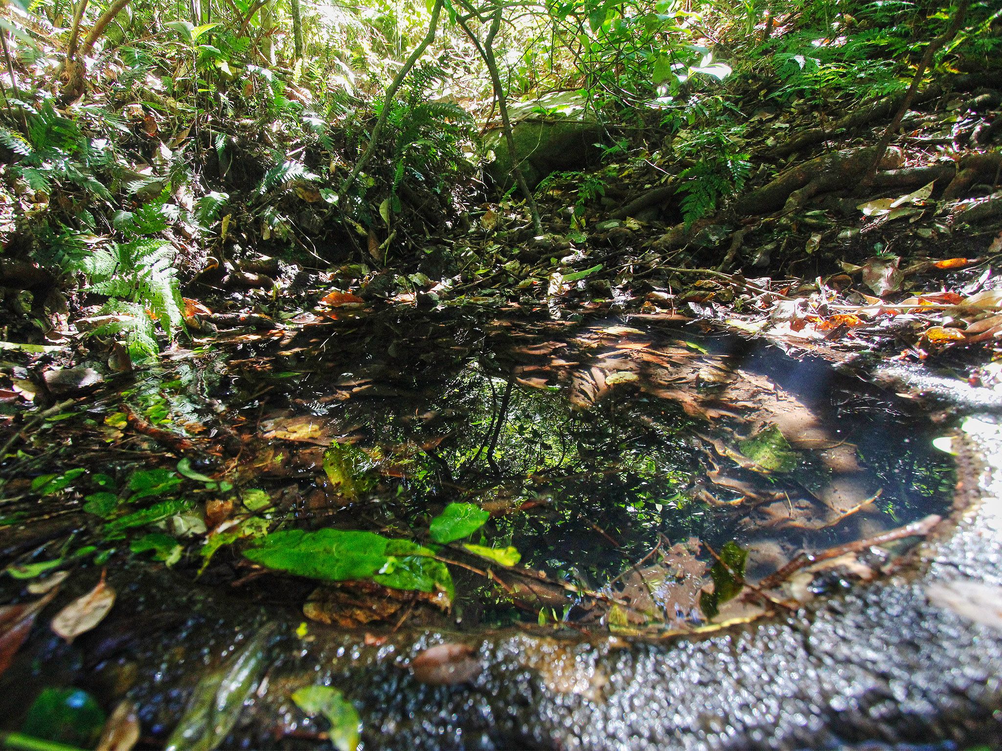
![A natural spring is the main feature of the Moss's Well track.]() A natural spring is the main feature of the Moss's Well track.
Photo credit: © Chris Whitelaw
A natural spring is the main feature of the Moss's Well track.
Photo credit: © Chris Whitelaw
-
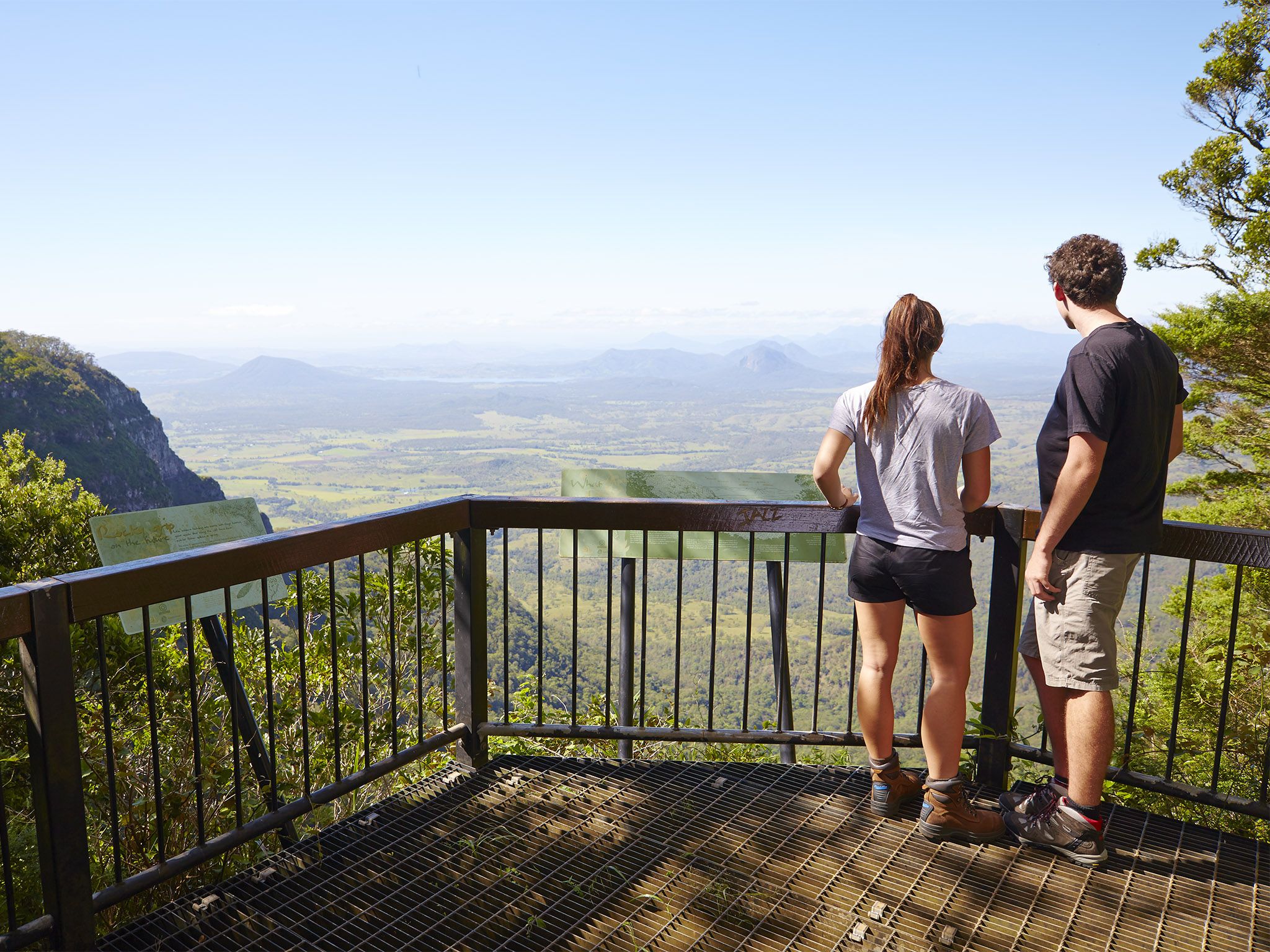
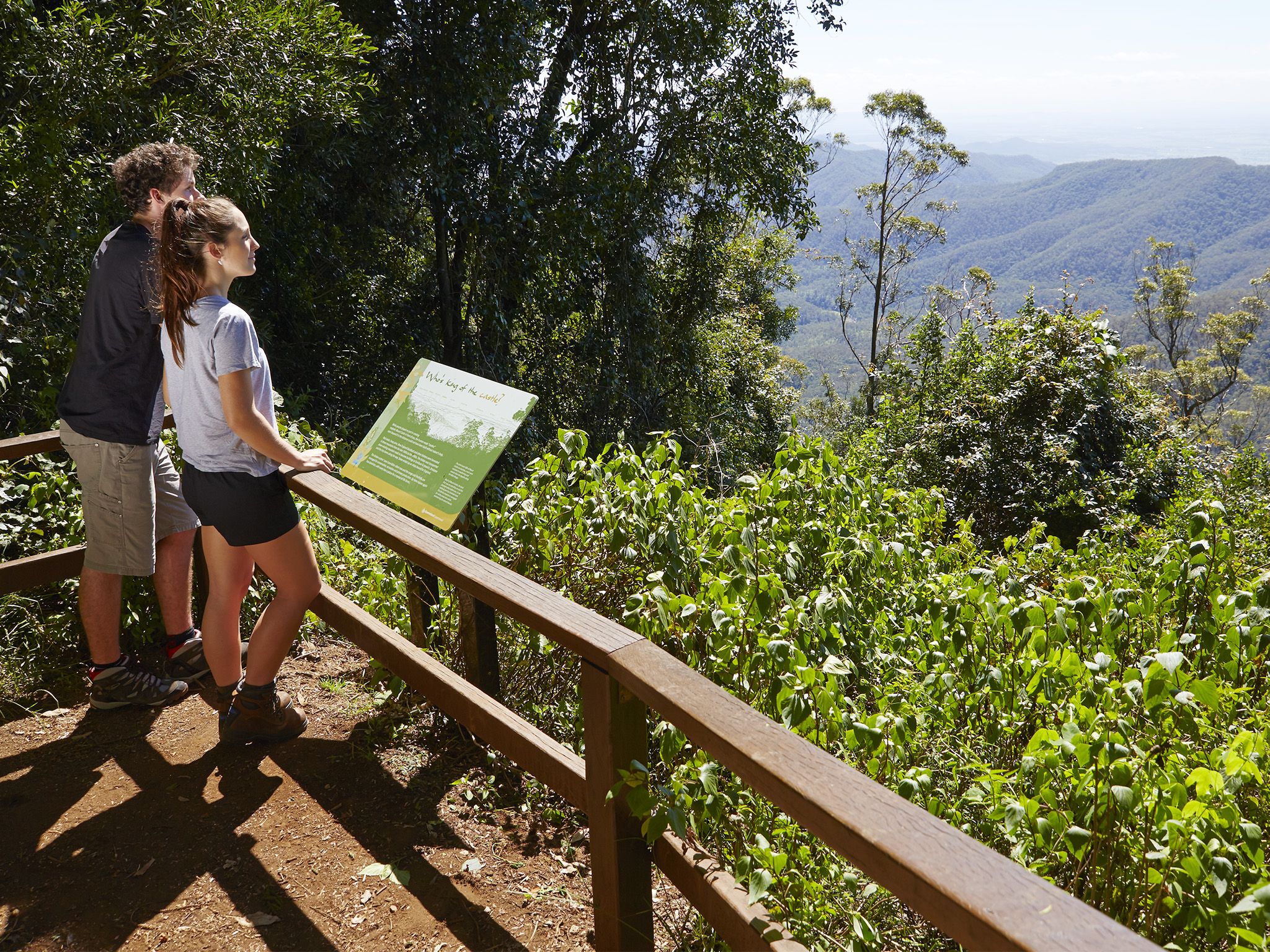
![Take in inspiring views of Laidley Valley and the the Little Liverpool Range from the lookout.]() Take in inspiring views of Laidley Valley and the the Little Liverpool Range from the lookout.
Photo credit: Maxime Coquard © Queensland Government
Take in inspiring views of Laidley Valley and the the Little Liverpool Range from the lookout.
Photo credit: Maxime Coquard © Queensland Government
-
![Take in sweeping southern views of Mount Mitchell at the end of the track.]() Take in sweeping southern views of Mount Mitchell at the end of the track.
Photo credit: © Sarah Haskmann
Take in sweeping southern views of Mount Mitchell at the end of the track.
Photo credit: © Sarah Haskmann
-
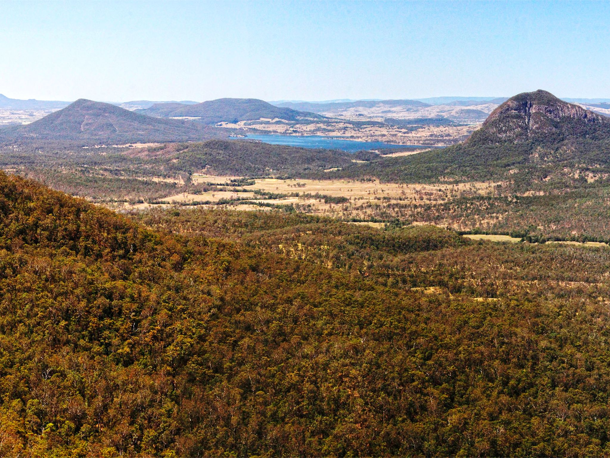
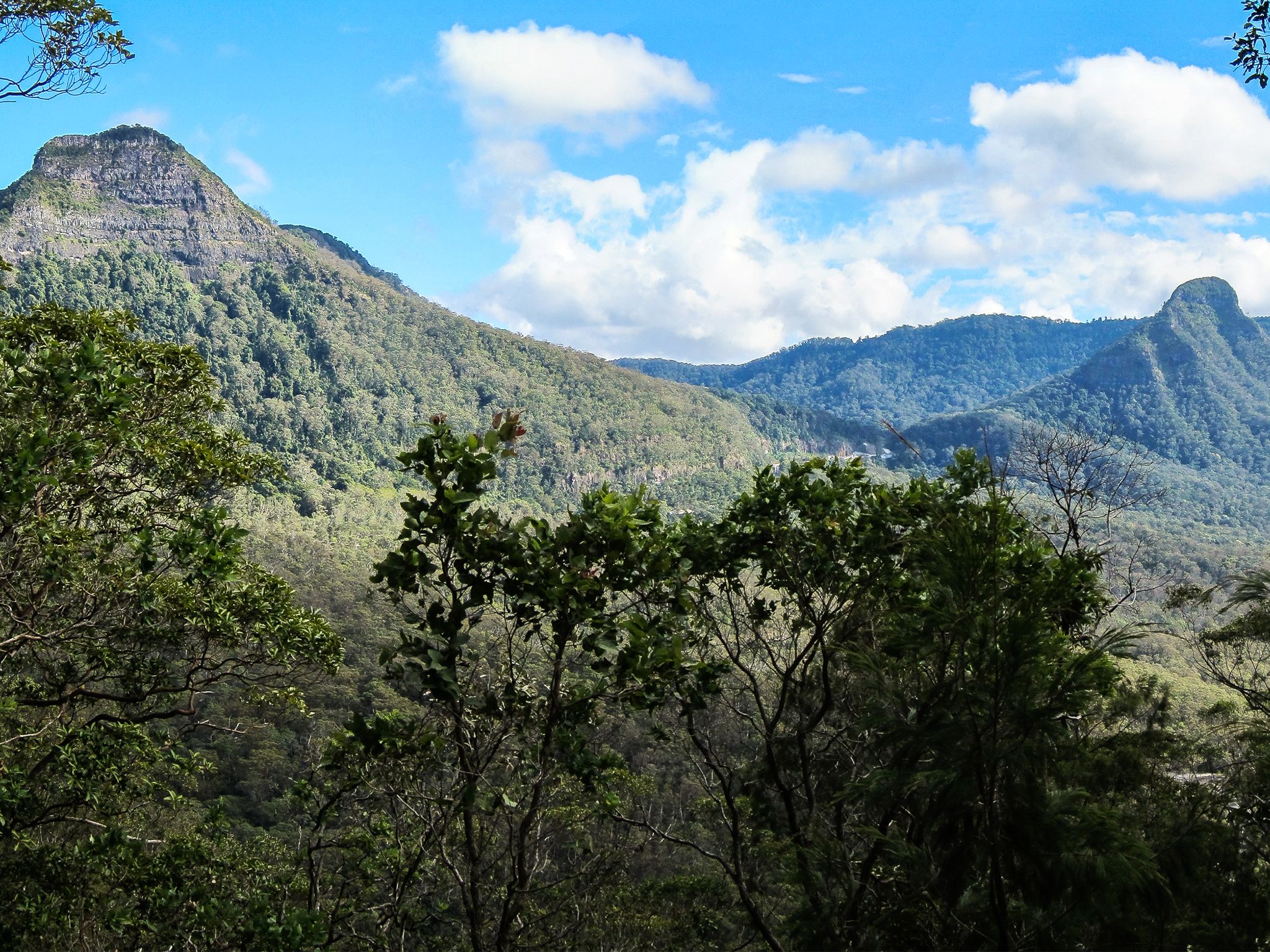
![Take in views of Mount Mitchell and Mount Cordeaux.]() Take in views of Mount Mitchell and Mount Cordeaux.
Photo credit: Cameron Semple © High and Wide
Take in views of Mount Mitchell and Mount Cordeaux.
Photo credit: Cameron Semple © High and Wide
-
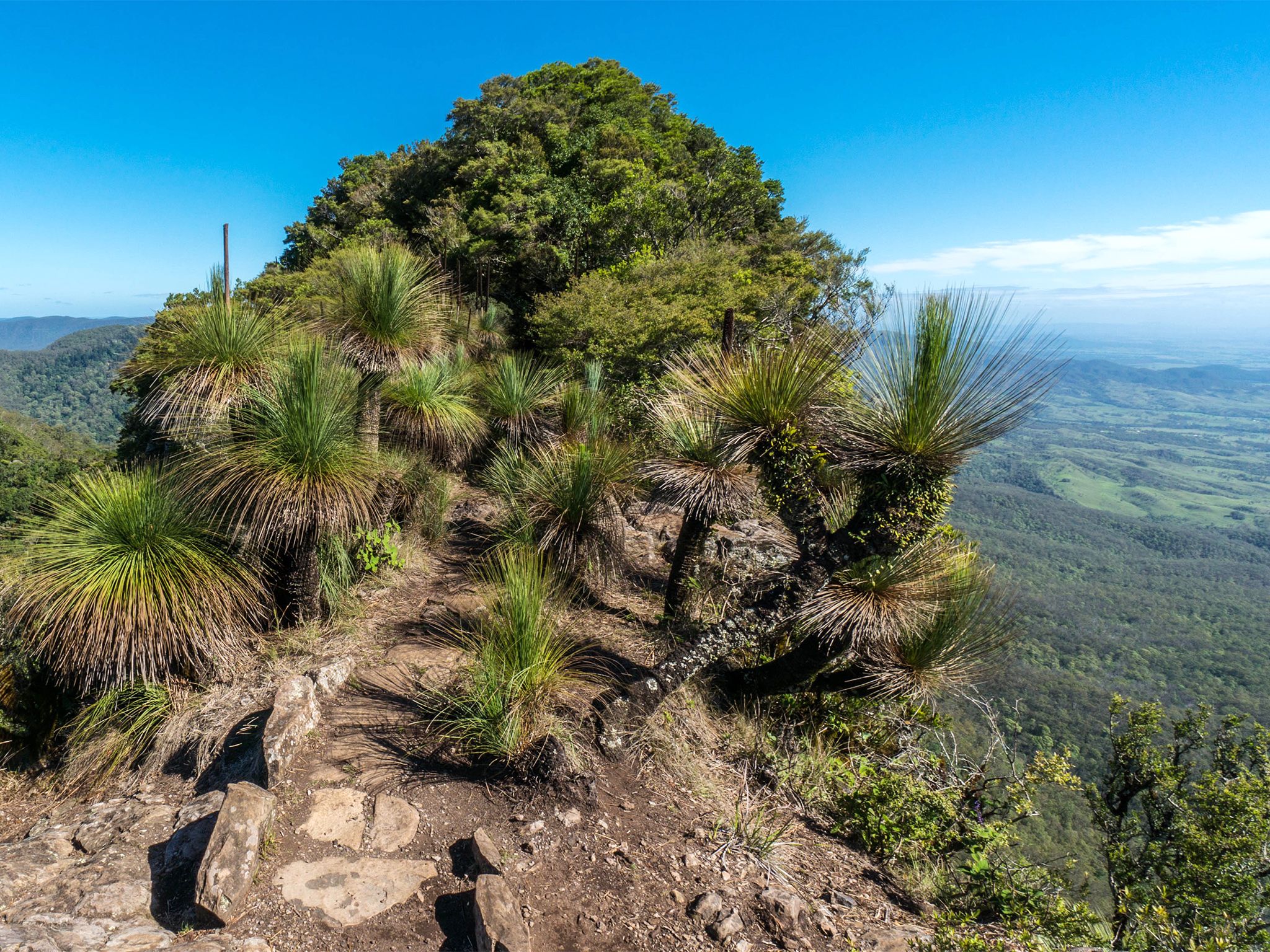
![Head to the summit of East Peak for endless views over the Fassifern Valley.]() Head to the summit of East Peak for endless views over the Fassifern Valley.
Photo credit: Cameron Semple © High and Wide
Head to the summit of East Peak for endless views over the Fassifern Valley.
Photo credit: Cameron Semple © High and Wide
-
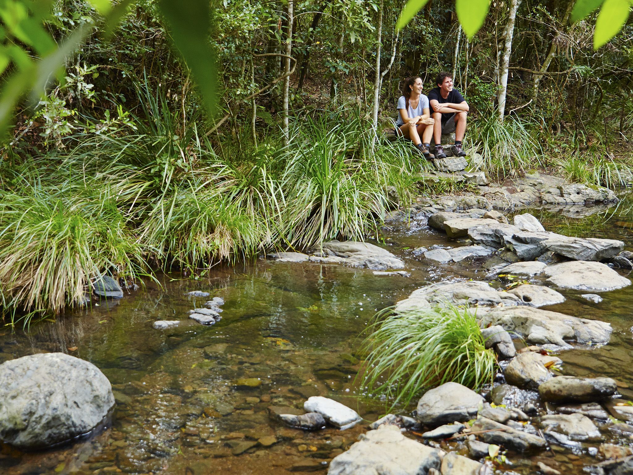
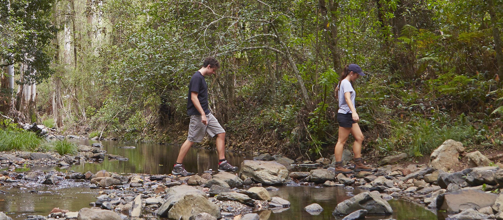
![The track follows the pristine Dalrymple Creek, crossing it several times.]() The track follows the pristine Dalrymple Creek, crossing it several times.
Photo credit: Maxime Coquard © Queensland Government
The track follows the pristine Dalrymple Creek, crossing it several times.
Photo credit: Maxime Coquard © Queensland Government
-
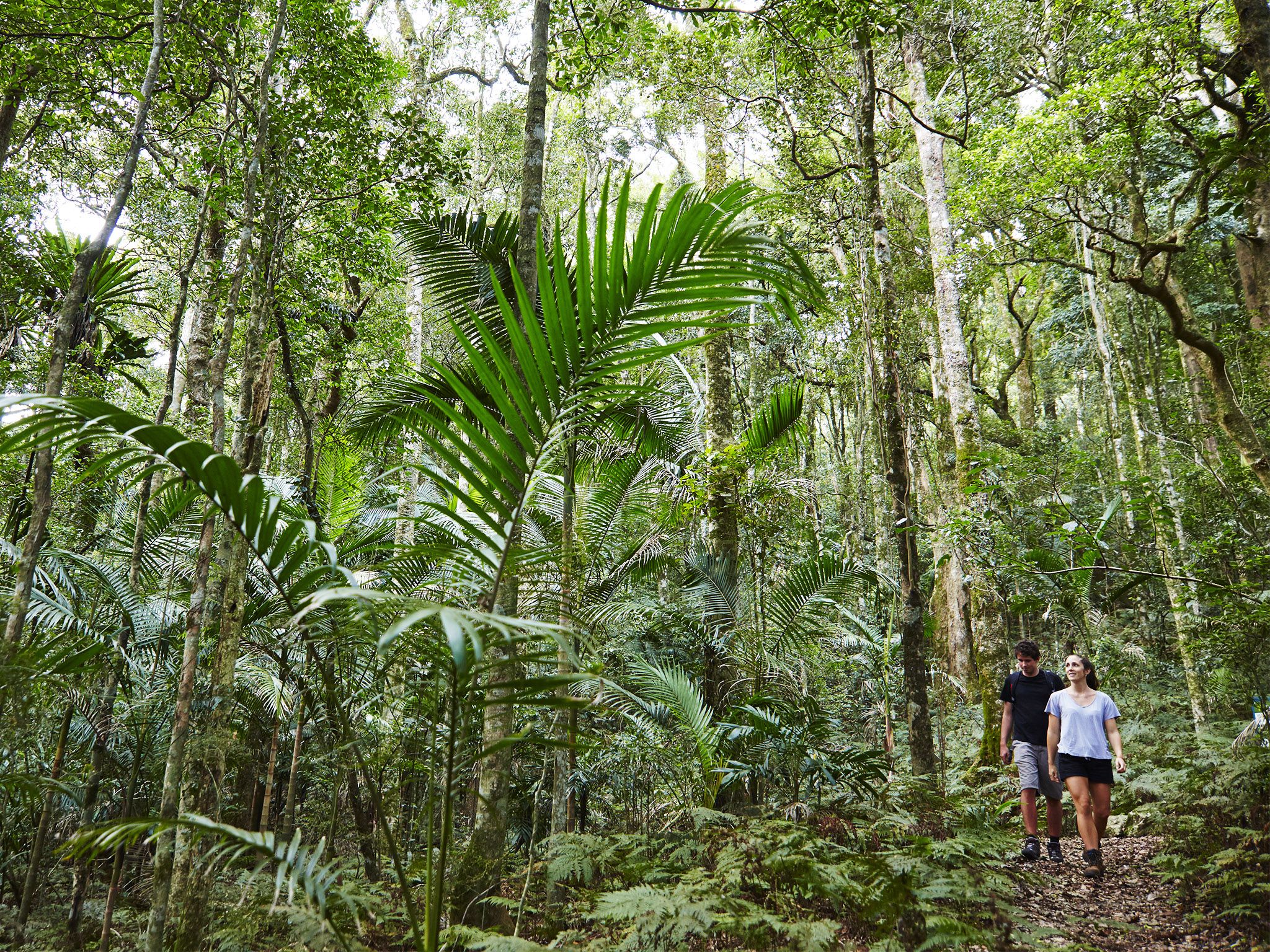
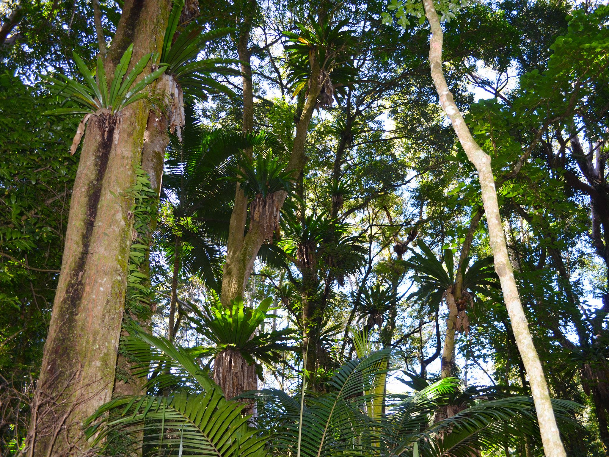
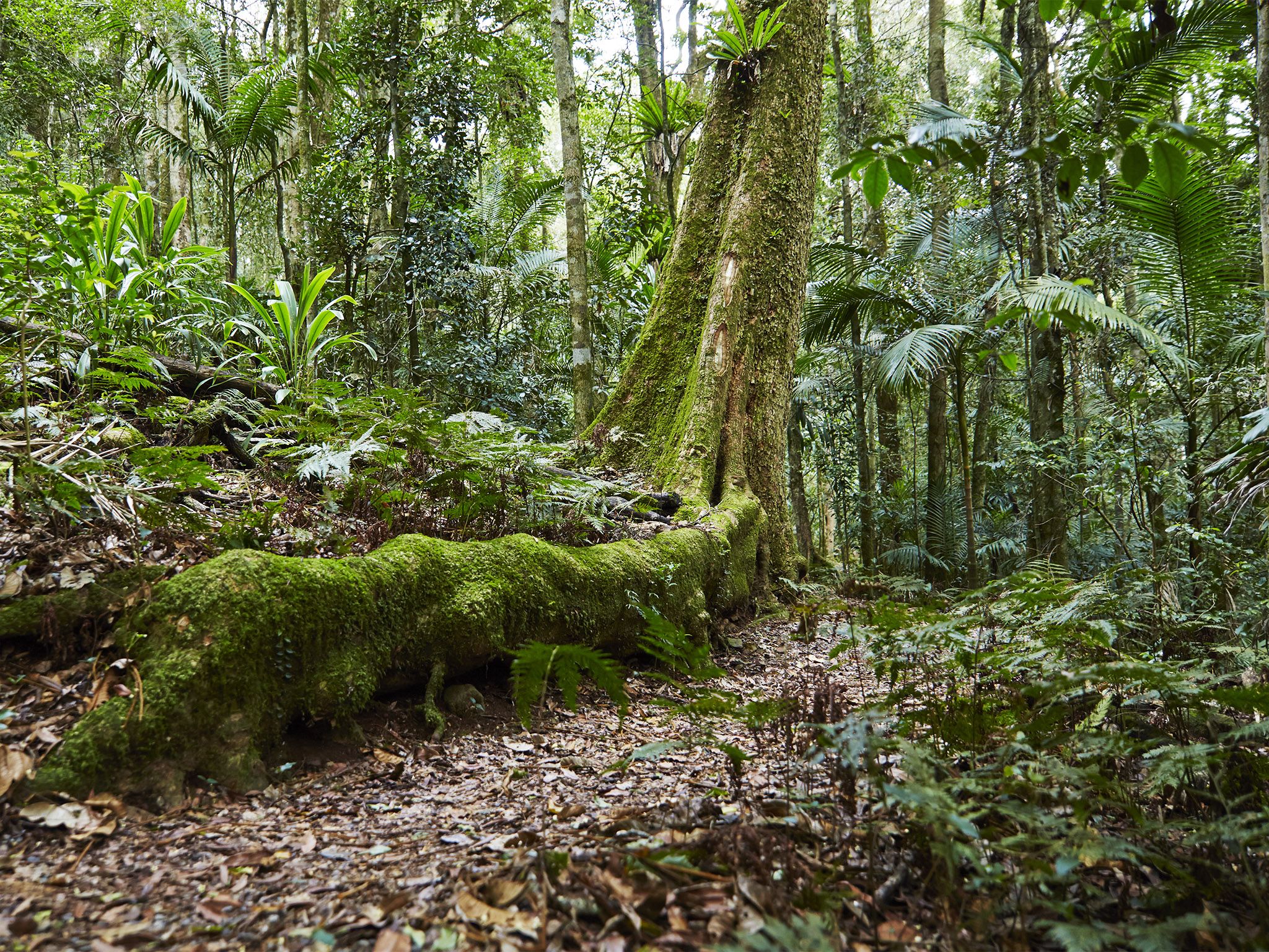
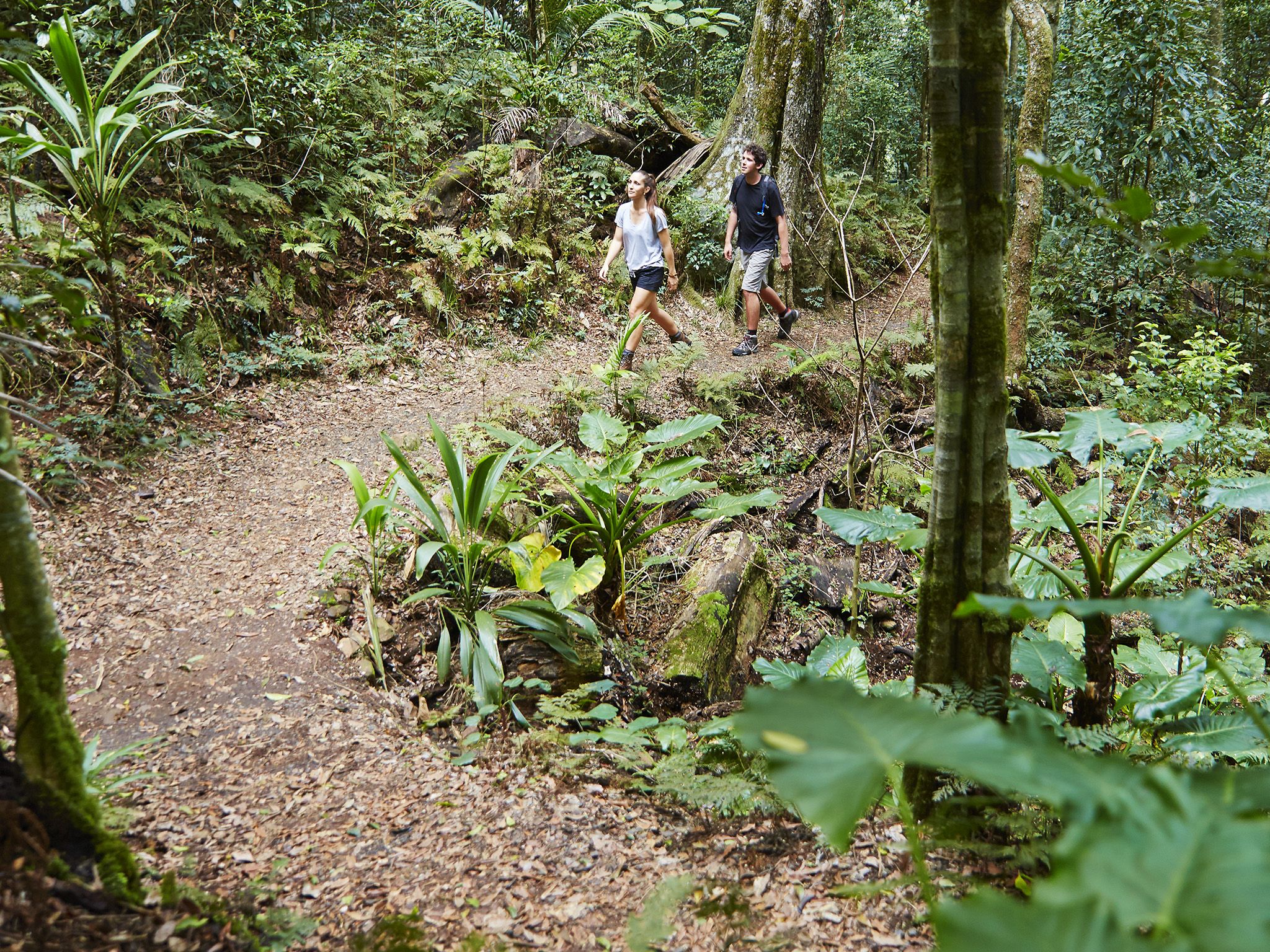
![Wander through lush sub-tropical rainforest.]() Wander through lush sub-tropical rainforest.
Photo credit: Maxime Coquard © Queensland Government
Wander through lush sub-tropical rainforest.
Photo credit: Maxime Coquard © Queensland Government
-
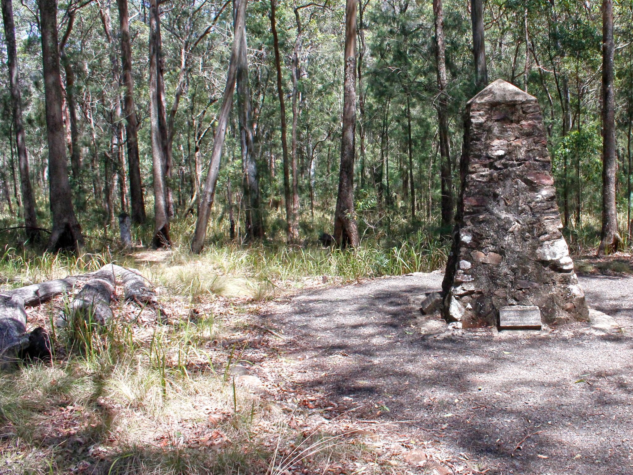
![Soak up some early pioneer history at the cemetery at the end of the track.]() Soak up some early pioneer history at the cemetery at the end of the track.
Photo credit: © Chris Whitelaw
Soak up some early pioneer history at the cemetery at the end of the track.
Photo credit: © Chris Whitelaw
-
![Take in spectacular views of the falls the circuit.]() Take in spectacular views of the falls the circuit.
Photo credit: Maxime Coquard © Queensland Government
Take in spectacular views of the falls the circuit.
Photo credit: Maxime Coquard © Queensland Government
-
![This circuit is a great short walk for the whole family.]() This circuit is a great short walk for the whole family.
Photo credit: Maxime Coquard © Queensland Government
This circuit is a great short walk for the whole family.
Photo credit: Maxime Coquard © Queensland Government
-
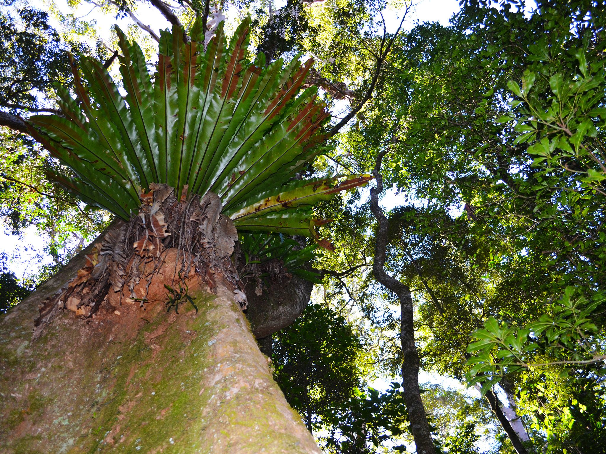
![Marvel at the changing canopy along the track.]() Marvel at the changing canopy along the track.
Photo credit: © Jennifer Bartlett
Marvel at the changing canopy along the track.
Photo credit: © Jennifer Bartlett
-
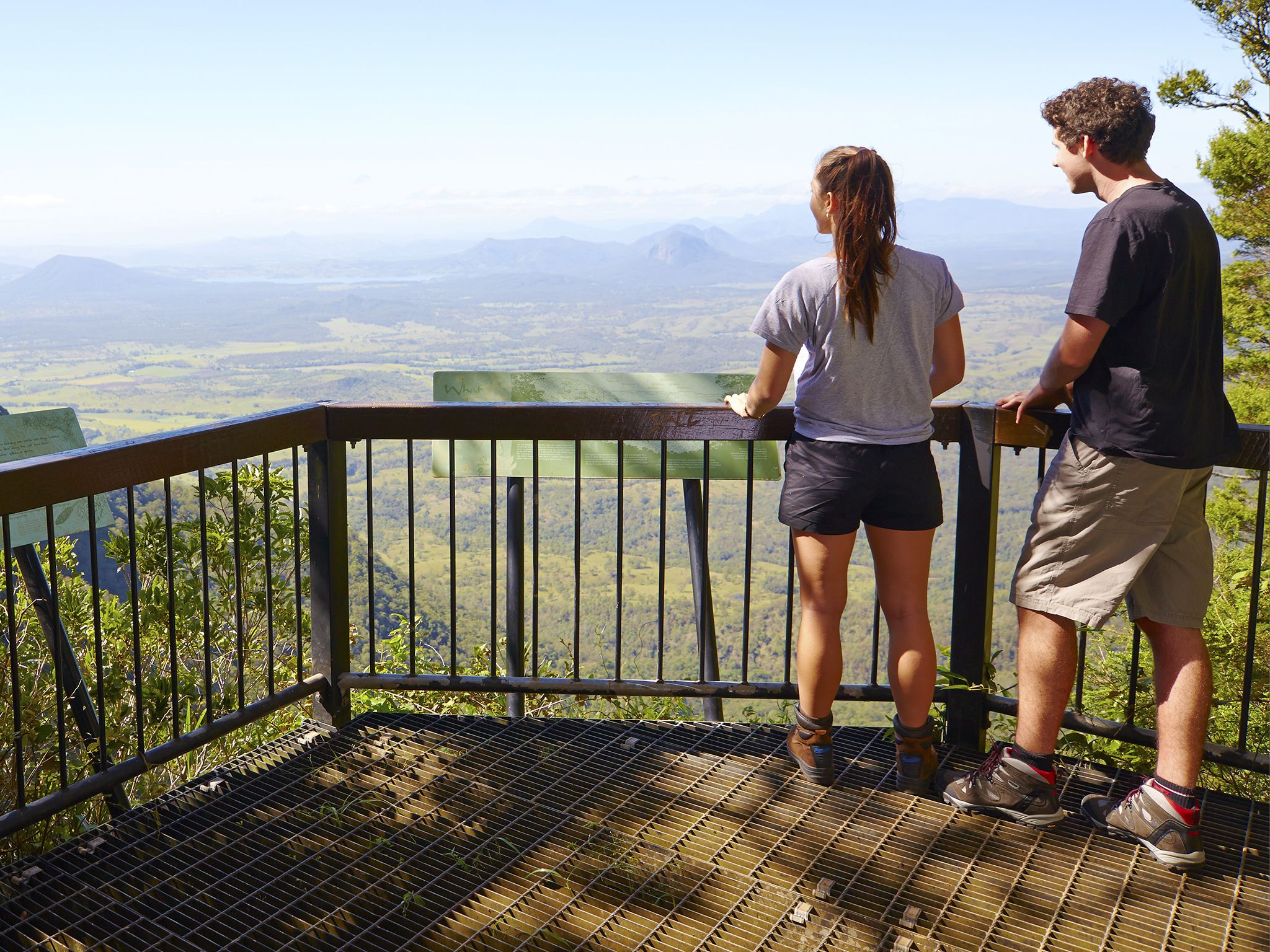
![The lookout has magnificent southern views over the coastal plains below.]() The lookout has magnificent southern views over the coastal plains below.
Photo credit: Maxime Coquard © Queensland Government
The lookout has magnificent southern views over the coastal plains below.
Photo credit: Maxime Coquard © Queensland Government
-
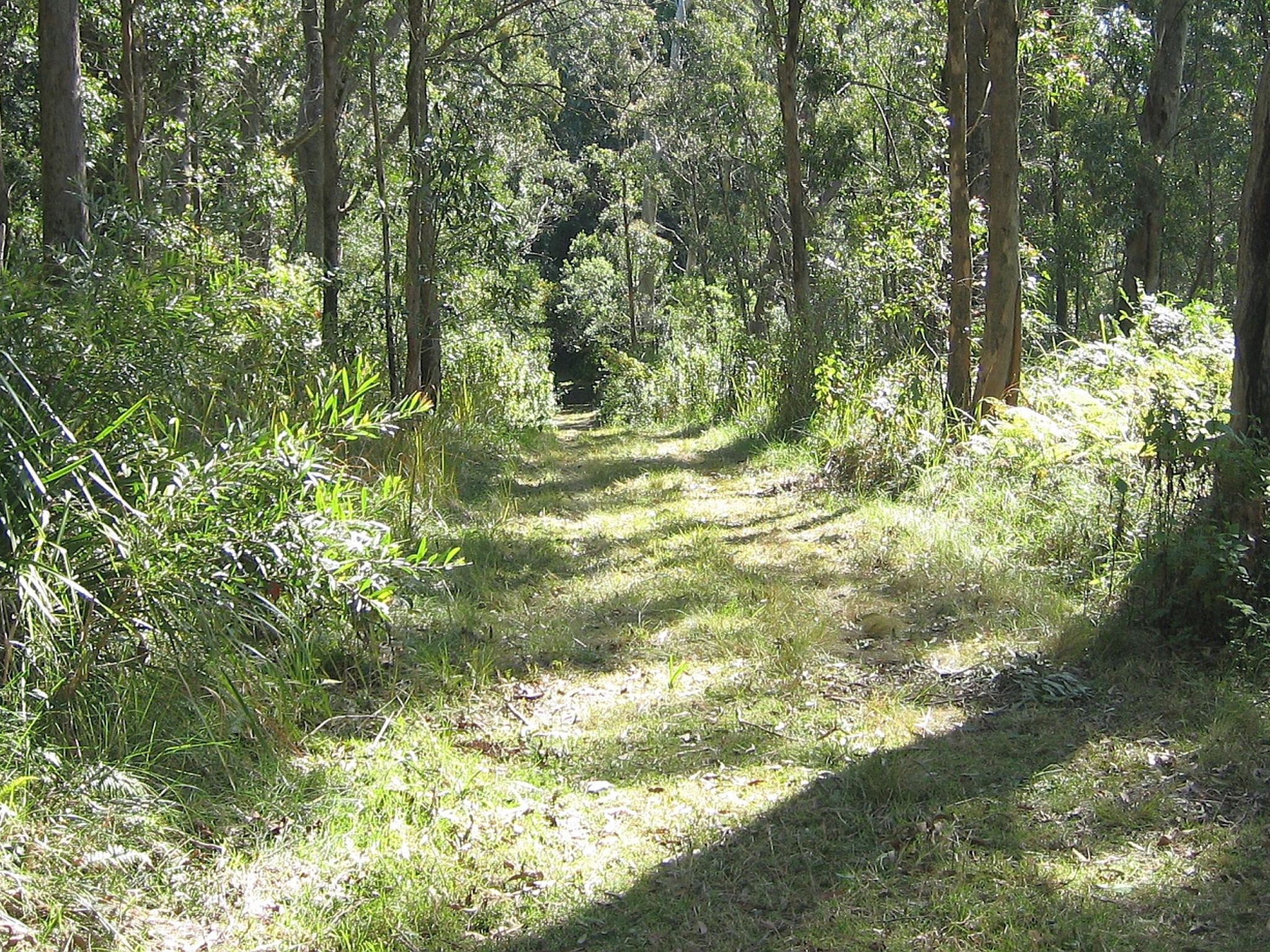
![Follow an old forestry road along the crest of the Mistake Range.]() You'll follow an old forestry road along the crest of the Mistake Range.
Photo credit: Andrew Lowe © Queensland Government
You'll follow an old forestry road along the crest of the Mistake Range.
Photo credit: Andrew Lowe © Queensland Government
-
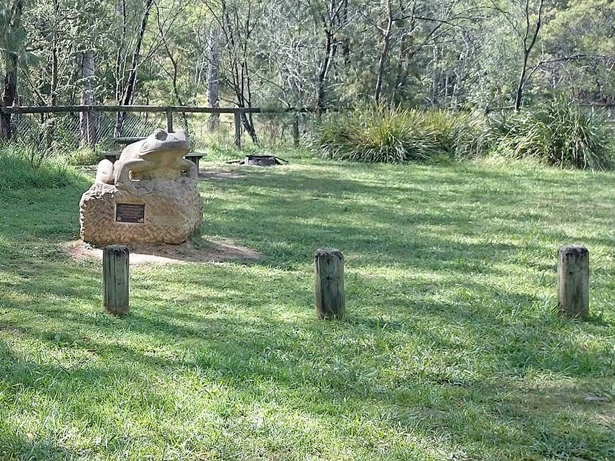
![A sandstone sculpture of the Fleay's barred frog welcomes visitors to the picnic area.]() A sandstone sculpture of the Fleay's barred frog welcomes visitors to the picnic area.
Photo credit: Joel Kotze © Queensland Government
A sandstone sculpture of the Fleay's barred frog welcomes visitors to the picnic area.
Photo credit: Joel Kotze © Queensland Government
-
![After lunch, head off on one of the five walking tracks that leave from this picnic area.]() After lunch, head off on one of the five walking tracks that leave from this picnic area.
Photo credit: Joel Kotze © Queensland Government
After lunch, head off on one of the five walking tracks that leave from this picnic area.
Photo credit: Joel Kotze © Queensland Government
-
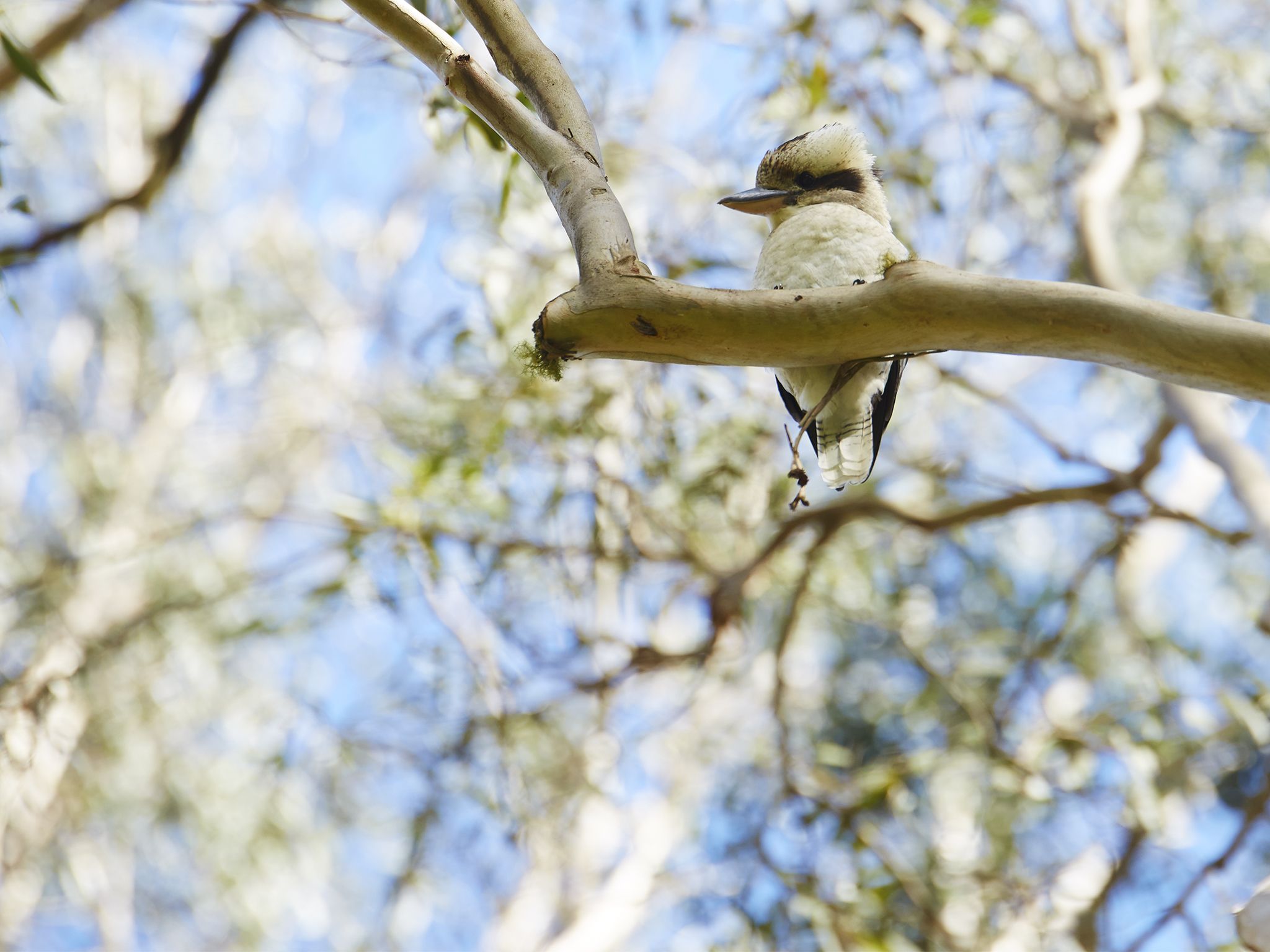
![Picnic among the birds.]() Picnic among the birds.
Photo credit: Maxime Coquard © Queensland Government
Picnic among the birds.
Photo credit: Maxime Coquard © Queensland Government
-
![The Crest is a great starting point to for some of Main Range's most popular walking tracks.]() The Crest is a great starting point to for some of Main Range's most popular walking tracks.
Photo credit: © Jennifer Bartlett
The Crest is a great starting point to for some of Main Range's most popular walking tracks.
Photo credit: © Jennifer Bartlett
-
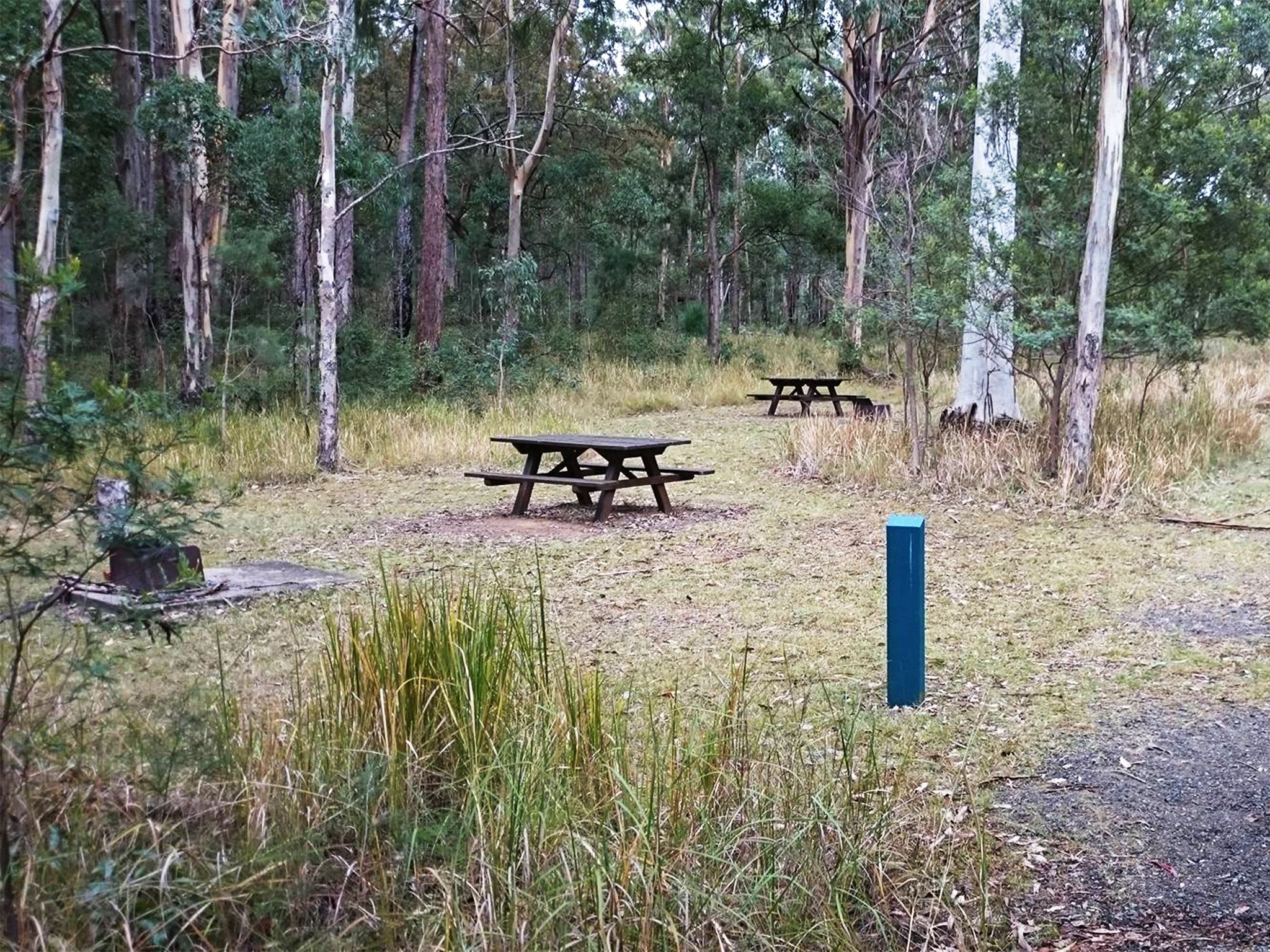
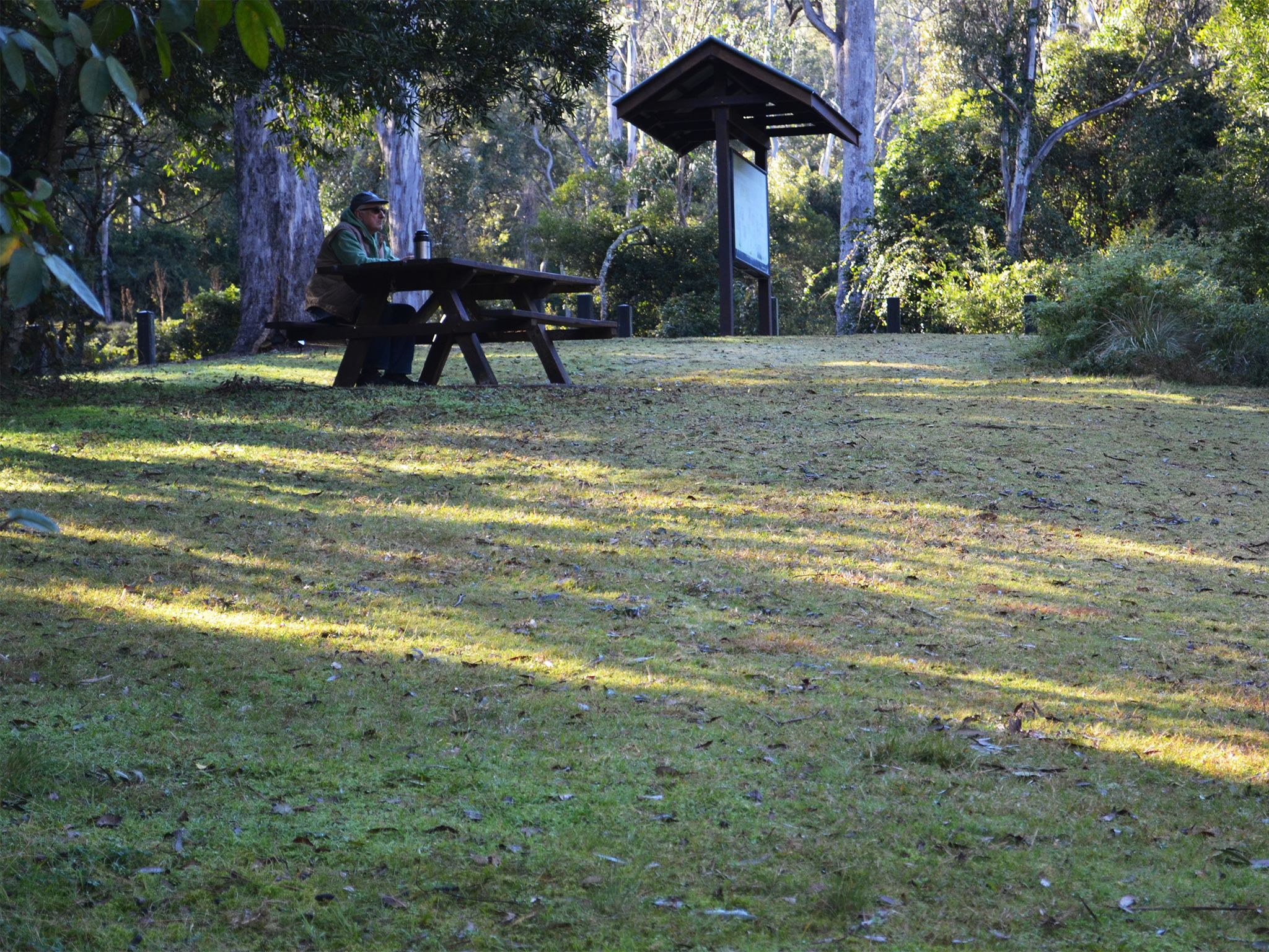
![The picnic area is an open, grassy area set beside the banks of West Gap Creek.]() The picnic area is an open, grassy area set beside the banks of West Gap Creek.
Photo credit: © Jennifer Bartlett
The picnic area is an open, grassy area set beside the banks of West Gap Creek.
Photo credit: © Jennifer Bartlett


- Goomburra section - temporary closure Cascades and Dalrymple circuits 4 April to 30 September 2025
- Main Range National Park - Cunninghams Gap section walking track closures 5 December 2024 to 10 October 2025
- Changes to Scenic Rim Trail end point - Main Range National Park 10 July 2024 to 18 December 2025