Queen Mary Falls circuit
Take a leisurely stroll through changing forests to the top, and then the base, of spectacular Queen Mary Falls.
- Journey type
- Walk
- Distance
- 2km circuit The same start and finish point, but the traveller doesn’t return along the same path
- Time suggested
- Allow 40min walking time.
- Grade
- Grade 3 walking track
Accessible by
- Conventional vehicle
Journey facilities
- Lookout (constructed)
- Walking
-
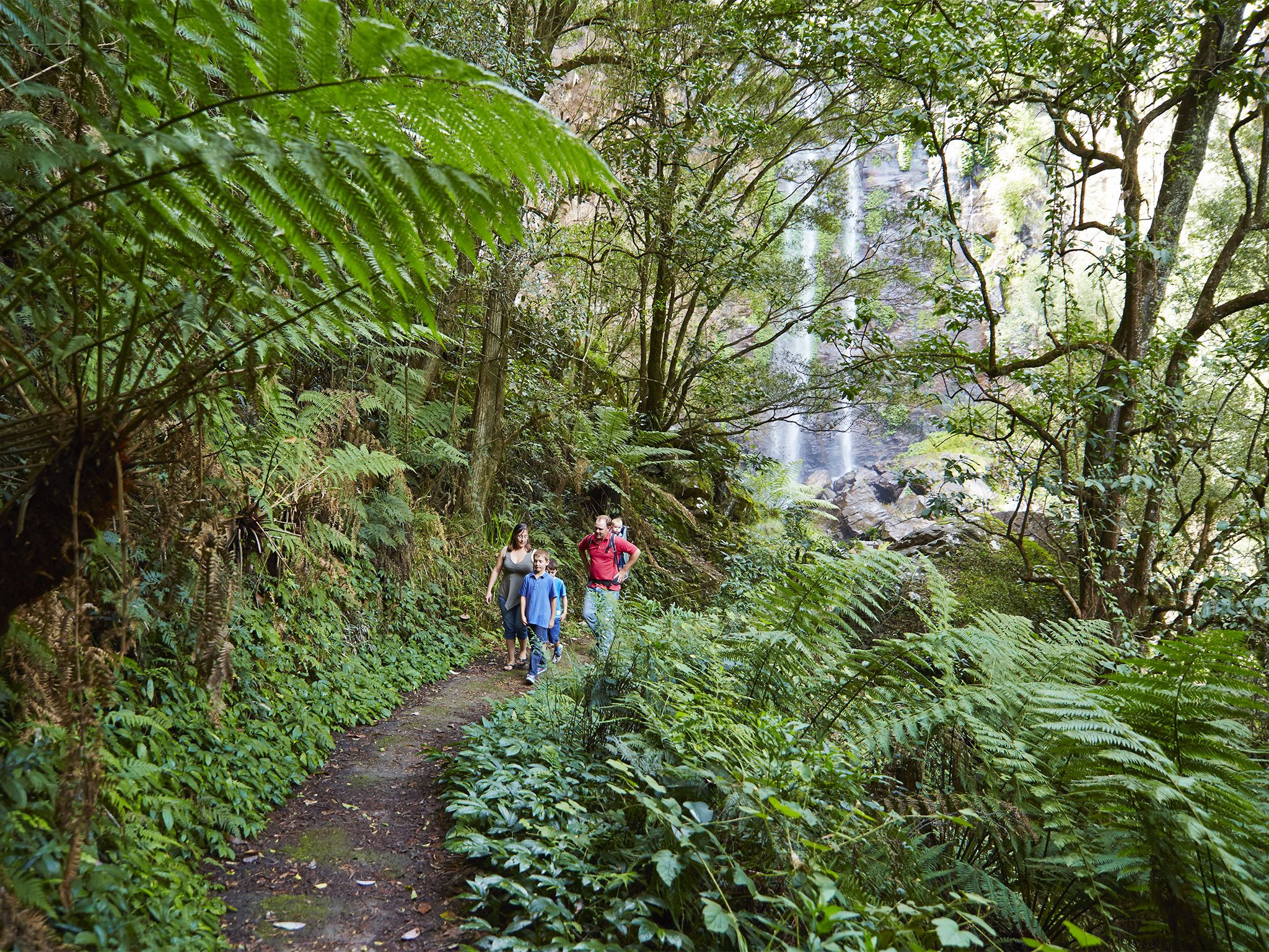
![View the waterfall from above and below.]() View the waterfall from above and below.
Photo credit: Maxime Coquard © Queensland Government
View the waterfall from above and below.
Photo credit: Maxime Coquard © Queensland Government
-
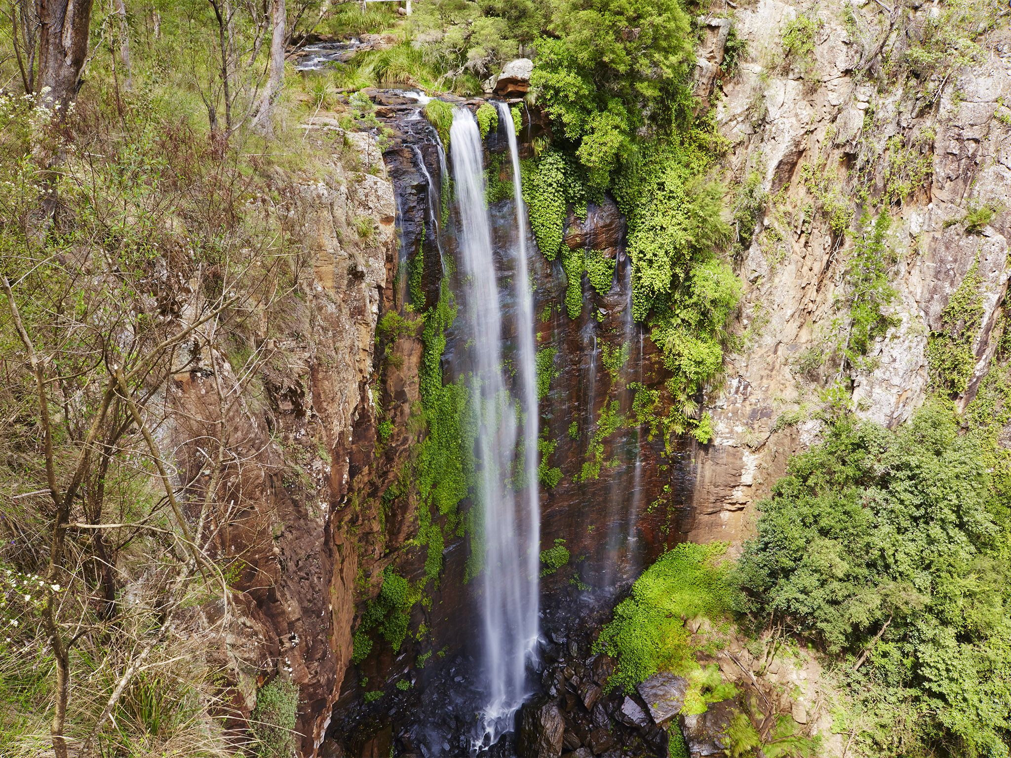
![Take in spectacular views of the falls the circuit.]() Take in spectacular views of the falls the circuit.
Photo credit: Maxime Coquard © Queensland Government
Take in spectacular views of the falls the circuit.
Photo credit: Maxime Coquard © Queensland Government
Queensland National Parks Booking System Update
The new Queensland National Parks Booking Service is live for bookings.
Customer account login
If you are making your first booking since 1 July 2024, a new customer account will be created automatically as part of your next booking. Please note your previous login credentials will no longer be valid.
Customers who have made a booking after 1 July 2024, please use your email address to reset your password to access your account.
From the Queen Mary Falls picnic area, head along a fragrant eucalypt-topped ridgeline to the lush, rainforest gorge.
At the lookout, watch Spring Creek plunge 40m over the falls to the valley floor. Marvel at the rainbows created by the waterfall’s sheer mist, and watch as the creek continues its twisting journey along the valley, to join the Condamine River’s upper reaches.
Continue along the track to the valley floor and cool off in the waterfall’s misty spray—perfect on a hot summer's day.
Our Park Rangers suggest walking the circuit in a clockwise direction is easier on the legs! Or you might prefer going anticlockwise to descend the stairs, then travel through the easier gradient slope in the shade.
This park is part of the Gondwana Rainforests of Australia World Heritage Area, famed for its ongoing geological processes, evolutionary history, and diversity (especially of rare, threatened and endemic species).
Getting there and getting around
The Queen Mary Falls circuit is in the Queen Mary Falls section of Main Range National Park about 120km south-west of Brisbane.
- The circuit starts at the Queen Mary Falls picnic area.
Getting to the Queen Mary Falls section
- Queen Mary Falls is at the south-west end of the park.
- From the east, from Beaudesert, drive 40km west to Boonah, then drive 58km south-west via the Boonah-Rathdowney Road, Carneys Creek Road, and Head Road. If Head Road is closed, travel via Carneys Creek Road, then White Swamp Road.
- The approach from Boonah is very steep and should be travelled with care. It is unsuitable for caravans.
- From the west, drive 8km east of Killarney via Spring Creek Road.
For tourism information for all regions in Queensland, see Queensland.com, and for friendly advice on how to get there, where to stay and what to do, find your closest accredited visitor information centre.
Wheelchair access
There are no wheelchair-accessible facilities.
Before you visit
Opening hours
Queen Mary Falls circuit is open 24 hours a day.
Check park alerts for the latest information on access, closures and conditions.
Visiting safely
For more safety information see Visiting Main Range safely and Walk with care.
- Spicers Gap campground and Governor's Chair Lookout closed due to bushfire 8–15 July 2025
- Goomburra section - temporary closure Cascades and Dalrymple circuits 4 April to 30 July 2025
- Main Range National Park - Cunninghams Gap section walking track closures 5 December 2024 to 10 October 2025
- Changes to Scenic Rim Trail end point - Main Range National Park 10 July 2024 to 18 December 2025