Park is closed
Lake Emma
This intriguing and beautiful lake has unique features that set it apart from the other lakes, lagoons and waterholes in the park.
Accessible by
- 4WD
-
![Lake Emma is a unique, round lake on top of a sand ridge.]() Lake Emma is a unique, round lake on top of a sand ridge.
Photo credit: © Queensland Government
Lake Emma is a unique, round lake on top of a sand ridge.
Photo credit: © Queensland Government
-
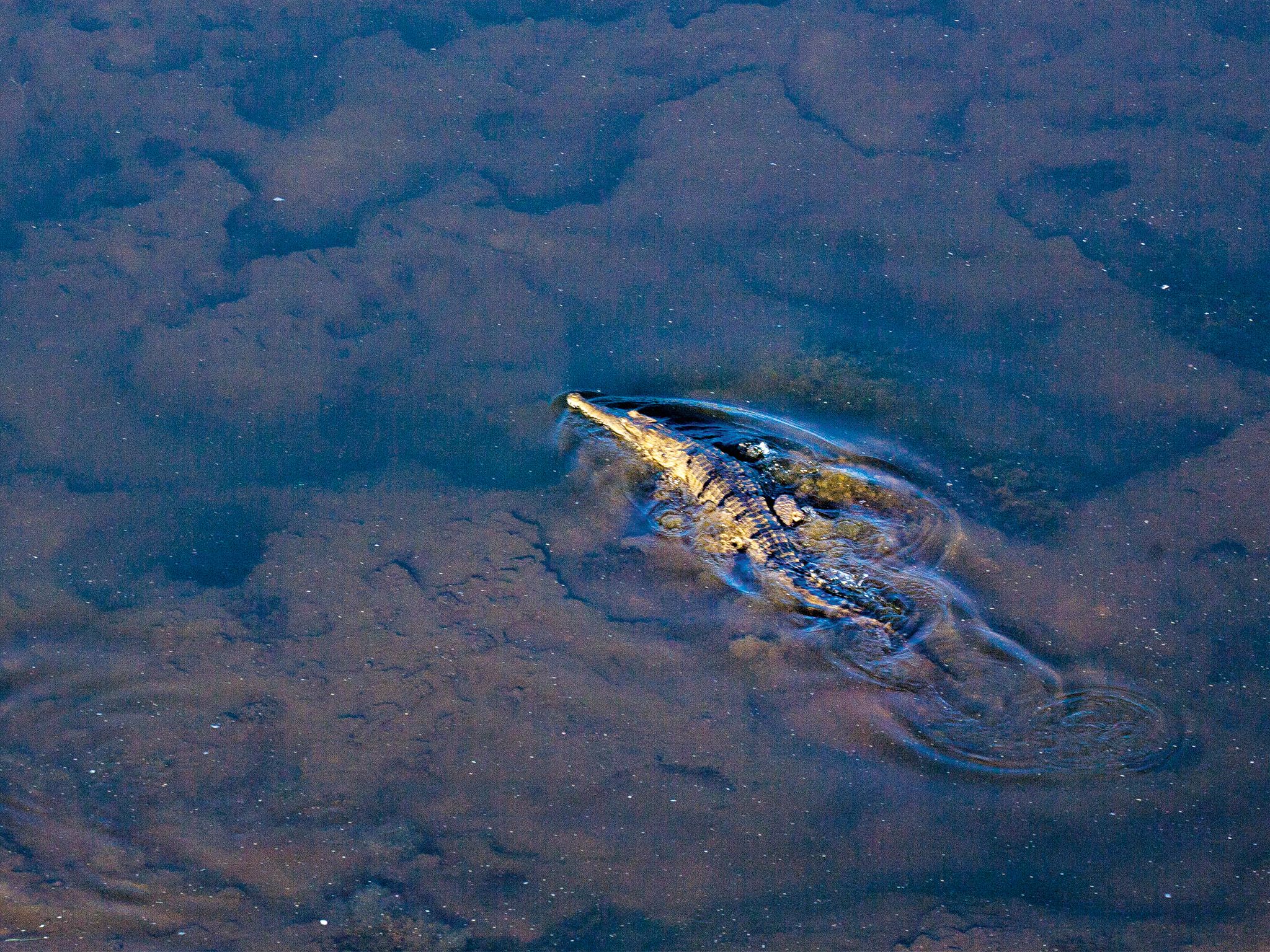
![Lake Emma is the only part of the park where you'll see black swans and freshwater crocodiles.]() Lake Emma is the only part of the park where you'll see black swans and freshwater crocodiles.
Photo credit: Adam Creed © Queensland Government
Lake Emma is the only part of the park where you'll see black swans and freshwater crocodiles.
Photo credit: Adam Creed © Queensland Government

Queensland National Parks Booking System Update
The new Queensland National Parks Booking Service is live for bookings.
Customers without a future booking, your account is created automatically when making your first booking.Customers with a future booking, use your email address to reset your password to access your account.
Sitting proud on the top of a sand ridge, locals believe that Lake Emma is a crater lake—formed after a meteorite crashed to Earth. Close to the south-eastern entrance to the park, on Battlecamp Road, it’s definitely worth stopping for a look.
The shape, location and formation of Lake Emma aren’t all that’s unique. Ringed by lush marshes and sedges, this is one of a few places in the park that you’ll see freshwater crocodiles (freshies) and black swans. Freshies are timid and shy, so tread quietly and you might catch a glimpse of one basking on the bank or lying in the shallows.
Rinyirru (Lakefield) National Park (CYPAL) is jointly managed by the Rinyirru (Lakefield) Aboriginal Corporation and the Queensland Government.
Getting there and getting around
Lake Emma is in the southern part of Rinyirru (Lakefield) National Park (CYPAL), 340km north-west of Cairns, and 140km west of Cooktown, on southern Cape York Peninsula.
- This lake is near the Battle Camp park entrance.
- You need a 4WD to access the park.
- Read 4WD with care for important information on 4WD safety and minimal impact driving.
From Battle Camp Road
- Drive 85km west from Cooktown along Battle Camp Road to the park's eastern boundary.
- Just after you enter the park, turn right at the Lake Emma turn-off.
From the south
- Drive 2km north past Laura on the Peninsula Developmental Road and take the Lakefield turn-off.
- Drive 25km to the park.
- Continue 1km and turn right onto Battle Camp Road.
- Drive 26km east and turn left at the Lake Emma turn-off just before the park's eastern boundary.
For tourism information for all regions in Queensland, see Queensland.com, and for friendly advice on how to get there, where to stay and what to do, find your closest accredited visitor information centre.
Wheelchair access
There are no wheelchair-accessible facilities.
Before you visit
Opening hours
Lake Emma is open 24 hours a day
Check park alerts for the latest information on access, closures and conditions.
Seasonal closures
Rinyirru (Lakefield) National Park (CYPAL) is closed throughout the wet season every year.
- Camping areas south of Lakefield ranger base are closed from 1 December to 31 May.
- Camping areas north of the Lakefield ranger base are closed from 1 December to 30 June.
- These dates vary each year depending on weather and road conditions.
- Refer to the park map for location of the Lakefield ranger base and camping areas.
- Check park alerts for the latest information on access, closures and conditions.
- See the Bureau of Meteorology for weather conditions and forecasts.
- See traffic and travel information for road and travel conditions.
Visiting safely
For more safety information see Visiting Rinyirru (Lakefield) National Park (CYPAL) safely.
- Wet season closure: Rinyirru (Lakefield) National Park (CYPAL) 1 December 2024 to 14 July 2025