Saltwater Crossing camping area
Set up camp under a canopy of delicate freshwater mangrove flowers on either side of beautiful Saltwater Creek.
Accessible by
- 4WD
Camping area facilities
- Campfires allowed (conditions apply)
- Generators allowed (conditions apply)
- Tent camping
- Camper trailer camping
- Tent camping beside car
- Boating
- Fishing
-
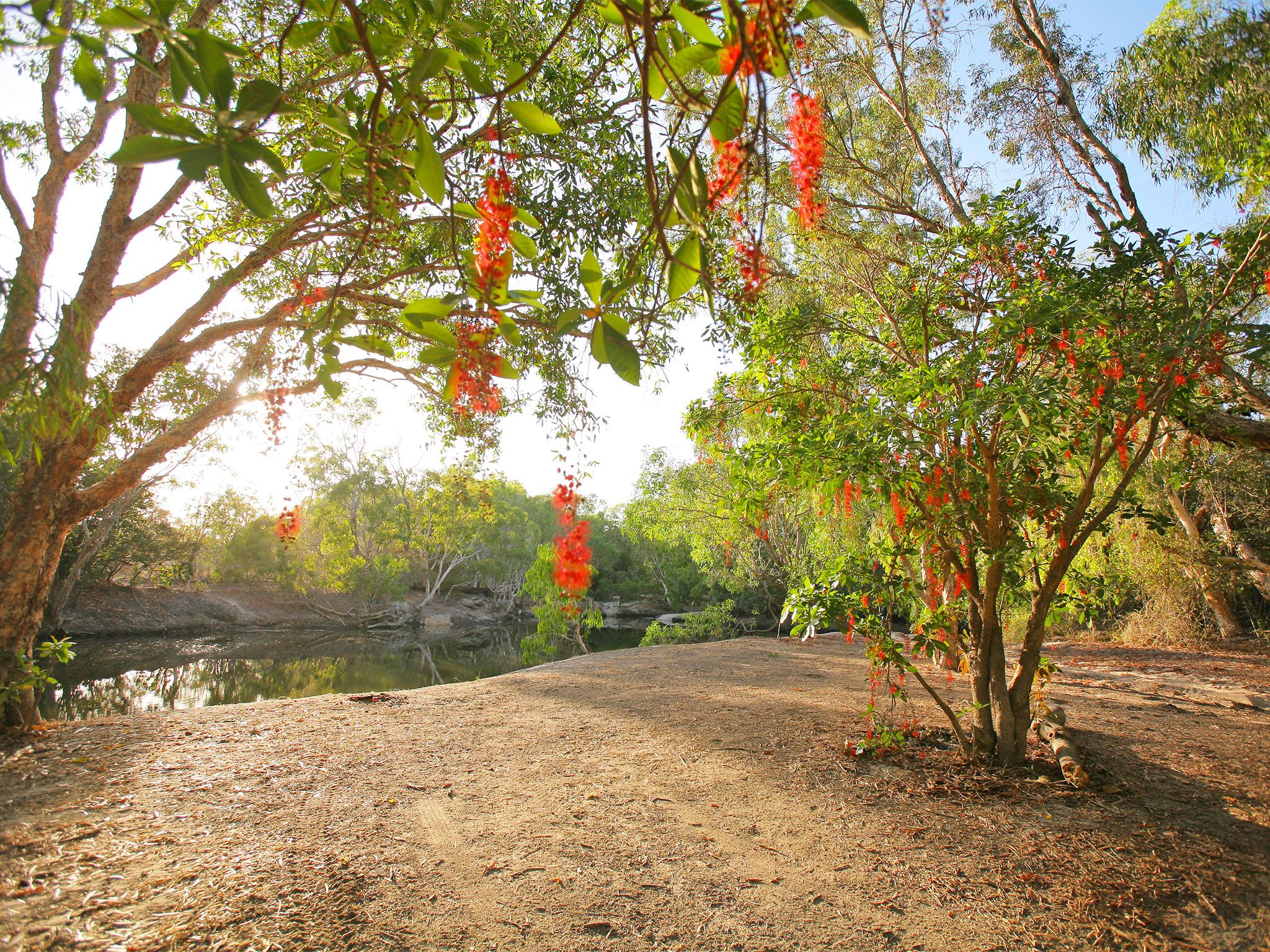
![Spend the night at the beautiful Saltwater Crossing camping area.]() Spend the night at the beautiful Saltwater Crossing camping area.
Photo credit: © John Augusteyn
Spend the night at the beautiful Saltwater Crossing camping area.
Photo credit: © John Augusteyn
-
![Set up camp on either side of Saltwater Creek.]() Set up camp on either side of Saltwater Creek.
Photo credit: © John Augusteyn
Set up camp on either side of Saltwater Creek.
Photo credit: © John Augusteyn
Always check
- Park alerts for the latest information on access, closures and conditions.
- Bureau of Meteorology weather forecasts.
- Current bushfire warnings and incidents and also fire bans and restrictions.
- Your camping permit is booked.
- Any park-specific camping information for
Rinyirru (Lakefield) National Park (CYPAL).
- Visiting Rinyirru (Lakefield) National Park (CYPAL) safely for important safety information.
Visitors need to book their camping permit before they visit. Book online, at an over-the-counter booking office or by phone.
Head out from your Saltwater Creek base camp for spectacular day trips to Low Lake (Rarda-Ndolphin) and Nifold Plain. You'll unearth some of the very best birdwatching, photography and wildlife-spotting that the northern part of the national park (CYPAL) has to offer.
At night sit around the camp fire sharing your photos from the day and, before you head off in the morning, flick a few lures at the snags in Saltwater Creek—you never know your luck.
Rinyirru (Lakefield) National Park (CYPAL) is jointly managed by the Rinyirru (Lakefield) Aboriginal Corporation and the Queensland Government.
Getting there and getting around
Saltwater Crossing camping area is in the northern part of Rinyirru (Lakefield) National Park (CYPAL), 340km north-west of Cairns, and 140km west of Cooktown, on southern Cape York Peninsula.
- This camping area is near the northern entrance to the national park (CYPAL).
- You need a 4WD to access the national park (CYPAL) and camping area.
- Read 4WD with care for important information on 4WD safety and minimal impact driving.
From the north
- Take the Lakefield turn-off at the Musgrave Roadhouse on the Peninsula Developmental Road and drive 38km east on Marina Plains Road to the national park (CYPAL).
- Continue 15km through the national park (CYPAL) along Lakefield Road to Saltwater Crossing.
- Camp sites are on both sides of Lakefield Road at Saltwater Crossing.
From the south
- Drive 2km north past Laura on the Peninsula Developmental Road and take the Lakefield turn-off.
- Drive 25km to the national park (CYPAL).
- Continue 119km along Lakefield Road, past the Lakefield ranger base, to Saltwater Crossing.
- Camp sites are on both sides of Lakefield Road at Saltwater Crossing.
From Cape Melville
- Drive 70km from Wakooka in Cape Melville National Park (CYPAL) to Kalpowar on the eastern boundary of Rinyirru (Lakefield) National Park (CYPAL).
- Continue 1km and turn right onto Lakefield Road.
- Drive 59km north along Lakefield Road to Saltwater Crossing.
- Camp sites are on both sides of Lakefield Road at Saltwater Crossing.
Before you visit
Seasonal closures
Rinyirru (Lakefield) National Park (CYPAL) is closed throughout the wet season every year.
- Camping areas south of Lakefield ranger base are closed from 1 December to 31 May.
- Camping areas north of the Lakefield ranger base are closed from 1 December to 30 June.
- These dates vary each year depending on weather and road conditions.
- Refer to the park map for location of the Lakefield ranger base and camping areas.

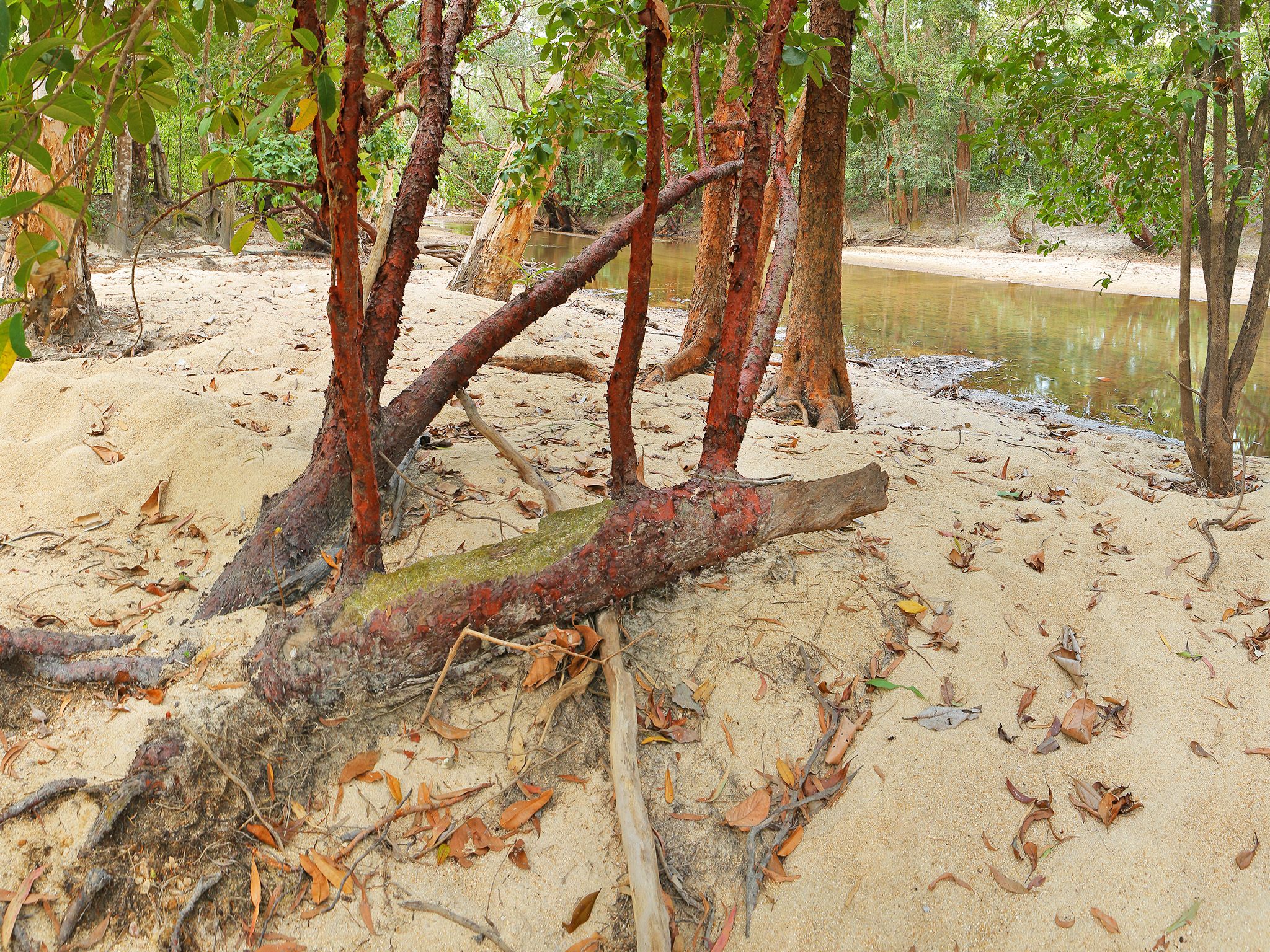
Camp site 1 at Saltwater Crossing camping area.
Photo credit: © Queensland Government
Camping area features
Camp sites are located on both banks of the tidal Saltwater Creek. Nearby Low Lake (Rarda-Ndolphin) and Nifold Plain are ideal for bird watching. Large crocodiles are frequently seen here—Be Crocwise in Croc Country.
Location: northern part of the national park (CYPAL) on Saltwater Creek—by road, the causeway is 53km east of Musgrave Roadhouse and 32km north-west of Hann Crossing. Sites 1 and 2 are on the southern side of Lakefield Road on the eastern bank of the creek; sites 3 and 4 are on the northern side of Lakefield Road on the western bank of the creek.
Map: Rinyirru (Lakefield) National Park (CYPAL) northern camping areas map
Access: the camping area can be reached by four-wheel-drive vehicle only. It is not accessible for caravans, campervans or buses. The road becomes impassable after rain.
Boat launching: nil.
Number of sites: 4 numbered sites.
| Site | Camp size | Other comments |
|---|---|---|
| 1 | Maximum 2 cars and trailers (6 people). | Set back from water. |
| 2 | Maximum 4 cars and trailers (12 people). | Steep river bank. |
| 3 | Maximum 4 cars and trailers (12 people). | Low river bank with shallow water. |
| 4 | Maximum 3 cars and trailers (8 people). | Low river bank with shallow water. |
Camp sites are suitable for: tent camping beside your car and camper trailers.
Camp site surface: sand, dirt and grass (seasonal).
Shade: camp sites 1 and 2 have shade, and sites 3 and 4 have no shade.
Facilities: nil.
Open fires: allowed (except when fire bans apply) but must be contained. Fuel stoves are recommended. Do not collect firewood in the national park (CYPAL).
Generators: only generators operated at less than 65dB(A), when measured 7m from the generator, are permitted, and only between 8am and 7pm.
Essentials to bring: adequate food and drinking water (no fresh water is available), rubbish bags, insect repellent, mosquito nets, fuel stove and adequate fuel and spare parts for your vehicle. Read more about before you visit.
Mobile phone coverage: not available.
Bookings
Advance bookings are essential. Book online or learn about our camping booking options.
Visiting safely
For more safety information see Visiting Rinyirru (Lakefield) National Park (CYPAL) safely and camp with care.
- Viewing platform closed: Red lily lagoon, Rinyirru (Lakefield) National Park (CYPAL) 2 June to 30 November 2025