Check park alerts for the latest on access, closures and conditions, following recent severe weather events in Queensland. Rangers are working hard to safely reopen affected parks.
Visiting Mapleton National Park safely
Queensland National Parks Booking System Update
The new Queensland National Parks Booking Service is live for bookings.
Customer account login
If you are making your first booking since 1 July 2024, a new customer account will be created automatically as part of your next booking. Please note your previous login credentials will no longer be valid.
Customers who have made a booking after 1 July 2024, please use your email address to reset your password to access your account.

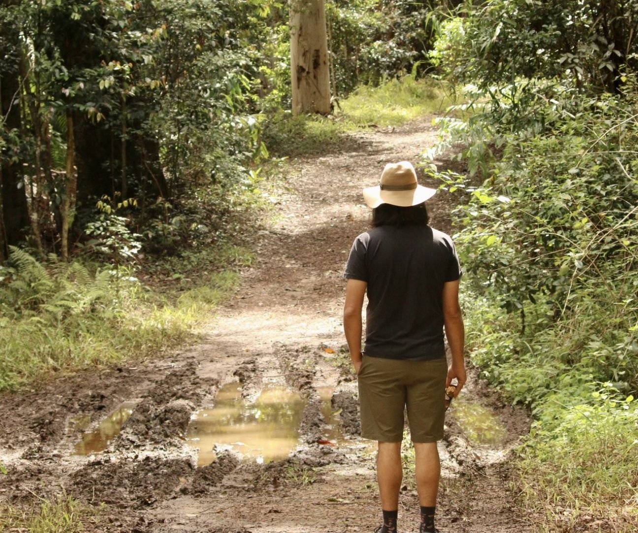
Point Glorious Road, Mapleton National Park. Always drive cautiously on forest roads.
Photo credit: © Ross Naumann, QPWS volunteer
 Open larger image
Access from the Sam Kelly Trailhead to your campsite is a 900m walk.
Photo credit: Katie Roberts© Queensland Government

Flood waters in this area rise and fall quickly and are a hazard to life and property. Plan to visit the park in dry weather.
Photo credit: Queensland Government
Getting there and getting around
From Brisbane, travel 105km north along the Bruce Highway to Nambour, then travel 11km west to Mapleton.
Roads in Mapleton National Park are unsealed and most require four-wheel-drive vehicles for safe access and visiting in dry weather conditions is recommended. Roads may be closed due to weather conditions, road maintenance or high fire danger.
Conventional vehicle accessible areas
Delicia Road is an all-weather road accessible by conventional vehicles and provides access to a Sunshine Coast Hinterland Great Walk entrance point and short walks.
The Mapleton day-use area is accessible by conventional vehicles in dry conditions only, via Delicia Road and a short section of Mapleton Forest Road. This road becomes very slippery in wet conditions.
To reach the Gheerulla camping area trailhead from the north, take the Eumundi–Kenilworth Road turnoff from the Bruce Highway (M1) and travel 24km, turn left into Sam Kelly Road and continue 2km to the trailhead carpark at Sam Kelly Road. Campers are to park their cars at the Sam Kelly carpark and walk 900m to the camping area.
Gheerulla trail-bike track access
There are two access points to the Gheerulla trail bike track both accessible with a conventional vehicle in dry conditions.
- An eastern access point with a trailbike carparking and unloading area is accessible by conventional vehicles in dry conditions only, via Delicia Road and Mapleton Forest Road. Turn off at Mapleton day-use area and travel 1km to the trail bike track car park. This trail head is the best location to access the top 20km one way circuit.
- A western access point to the trailbike track is via Sam Kelly Road, there is no onsite parking or unloading areas provided. Access to the trail bike track is via the Eumundi Kenilworth Road. From the Eumundi Kenilworth Road turn east into Sam Kelly Road and continue 2km to park entry and trailhead.
Four-wheel-drive accessible areas—in dry conditions only
Point Glorious Lookout is accessible by four-wheel-drive vehicle in dry conditions. From Mapleton township travel north on Mapleton Forest Road, Buckby Road and Point Glorious Road. Alternatively, travel west from Yandina via Cooloolabin, Buckby and Point Glorious Roads.
Unsealed forest roads can be steep, rough and winding:
- Slow down. Allow time to react to unexpected situations and changed conditions. You may encounter other drivers, cyclists, walkers, horse riders, cattle and wildlife.
- Be courteous. Pull over to the left to allow vehicles to pass. Do not stop in the middle of the roadway for photography and enjoying the scenery. Find a safe place to pull over or turn around.
- Watch out for corners and steep slopes. Drive carefully around corners, especially after rain. Stay on your side of the road and avoid sudden slowing. Shift down a gear when roads are steep.
- All road rules apply. Obey speed limits. Always wear a seat belt. Never carry passengers outside the vehicle cabin.
- Avoid using forest roads during and immediately after wet weather to reduce damage to road surfaces and for your own safety. Do not attempt to cross flooded creeks.
- Roads may be rough. Forest roads are often rough, with potholes and wash-outs. Driving too fast may be dangerous or cause damage to your vehicle. Drive slowly.
Warning! Heavy rain can flood creek crossings and cause wash outs on forest roads.
For your safety please observe the following:
- Obey all road closures—roads may be closed due to deep water levels at creek crossings or wet and slippery conditions.
- Flood waters in this area rise and fall quickly and are a hazard to life and property.
- Avoid flooded crossings. Submerged obstacles may pose a hazard. Traffic ahead may have created hidden hazards, such as deep holes.
Before you visit, check current conditions:
- Park alerts.
- Weather forecasts at the Bureau of Meteorology.
- Road conditions at the Department of Transport and Main Roads.
Wheelchair accessibility
At Mapleton day-use area, a toilet cubicle is provided for people using wheelchairs—the path access is concrete. A BBQ and picnic table also share the concrete path for wheelchair access.
Nearby, Mapleton Falls National Park has a wheelchair-accessible lookout with views of the waterfall and rainforest valley below.
Staying safe
- Sheer cliffs and slippery rocks can be hazardous. Always supervise children, keep to the walking tracks, stay behind safety fences and follow all warning signs to avoid tragedy.
- Stay on track. Tell a responsible person where you are going and when you should return. Wear sturdy shoes. Carry adequate clothing, water and snack food.
- Supervise children. Natural areas have hazards that children are unfamiliar with, including creeks, cliff edges, stinging plants and wildlife.
- Water hazards—never dive into creeks or rock pools. They contain submerged rocks and logs. Water depth is variable and unpredictable. Rock surfaces can be slippery.
- Carry a first-aid kit—and know how to use it. Use repellent on exposed skin and shoes to discourage mosquitoes, leeches and ticks. Remove ticks immediately.
- Carry fresh water. Drinking water is not provided. Creek water is unsuitable for drinking as it may contain organisms that can cause illness.
- Human food is not for wildlife—it can cause overpopulation, illness and aggressive behaviour.
- Check park alerts for current warnings or closures. Closures can occur during severe wet weather, during high winds and for fire management. For your safety, do not enter the park when closure signs are displayed.
- Do not attempt to cross flooded creeks. If you are caught out on the tracks when creek crossings flood, wait until the water no longer covers the track. Water rises and falls in a short period of time.
In an emergency
In case of accident, other emergency or for reporting a bushfire or acts of arson, please:
- Call Triple Zero (000).
- Advise the location and nature of the emergency.
- Stay on the phone until you are told to hang up.
Mobile phone reception is poor in this area. Consider taking a satellite phone to areas without mobile phone coverage.
For more information about staying safe while visiting national parks, please read the guidelines on safety in parks and forests.
Before you visit
Essentials to bring
- Bring insect repellent to discourage mosquitoes, leeches and ticks.
- Bring your own drinking water—this is not provided. Creek water is unsuitable for drinking as it may contain organisms that can cause illness.
- Wear sturdy shoes, a hat, protective clothing and sunscreen.
- No bins are provided. Bring rubbish bags to remove your rubbish and recyclables from the park.
Opening hours
The park is open 24 hours a day, but for your safety, walk and ride in daylight hours only.
Permits and fees
Camping permits are required and fees apply.
- Find out more about Gheerulla camping area.
- Book your campsite online.
- If you cannot book on line, see camping bookings for other options.
Follow this link for Sunshine Coast Hinterland Great Walk walker's camps.
Climate and weather
Local temperatures can rise above 30°C in summer and drop to freezing point overnight in winter. Nights can be cool at any time of the year.
Always check weather conditions before your visit. Be aware that forest areas are hazardous during strong winds, as tree branches may fall.
During severe wet weather, which occurs mostly in spring and summer, some tracks flood and are closed for public safety. Check park alerts for current warnings or park closures.
For more information see the Bureau of Meteorology website and tourism information links.
Fuel and supplies
Fuel and supplies are available in Mapleton and other nearby towns. For more information see the tourism information links.
- Severe weather damage - Mapleton National Park 14 March to 23 May 2025
- Gheerulla campground - transition to walk-in only facility 30 October 2023 to 31 May 2025