Melaleuca circuit
Delight in the wetlands of cabbage palms, paperbarks and eucalypt forests fringing the delta lakes of the Upper Noosa River.
- Journey type
- Walk
- Distance
- 400m circuit The same start and finish point, but the traveller doesn’t return along the same path
- Time suggested
- Allow 30min walking time.
- Grade
- Grade 3 walking track
Accessible by
- Walk-in
- Boat
- Canoe or kayak
Journey facilities
- Toilets (non-flush)
- Walking
-
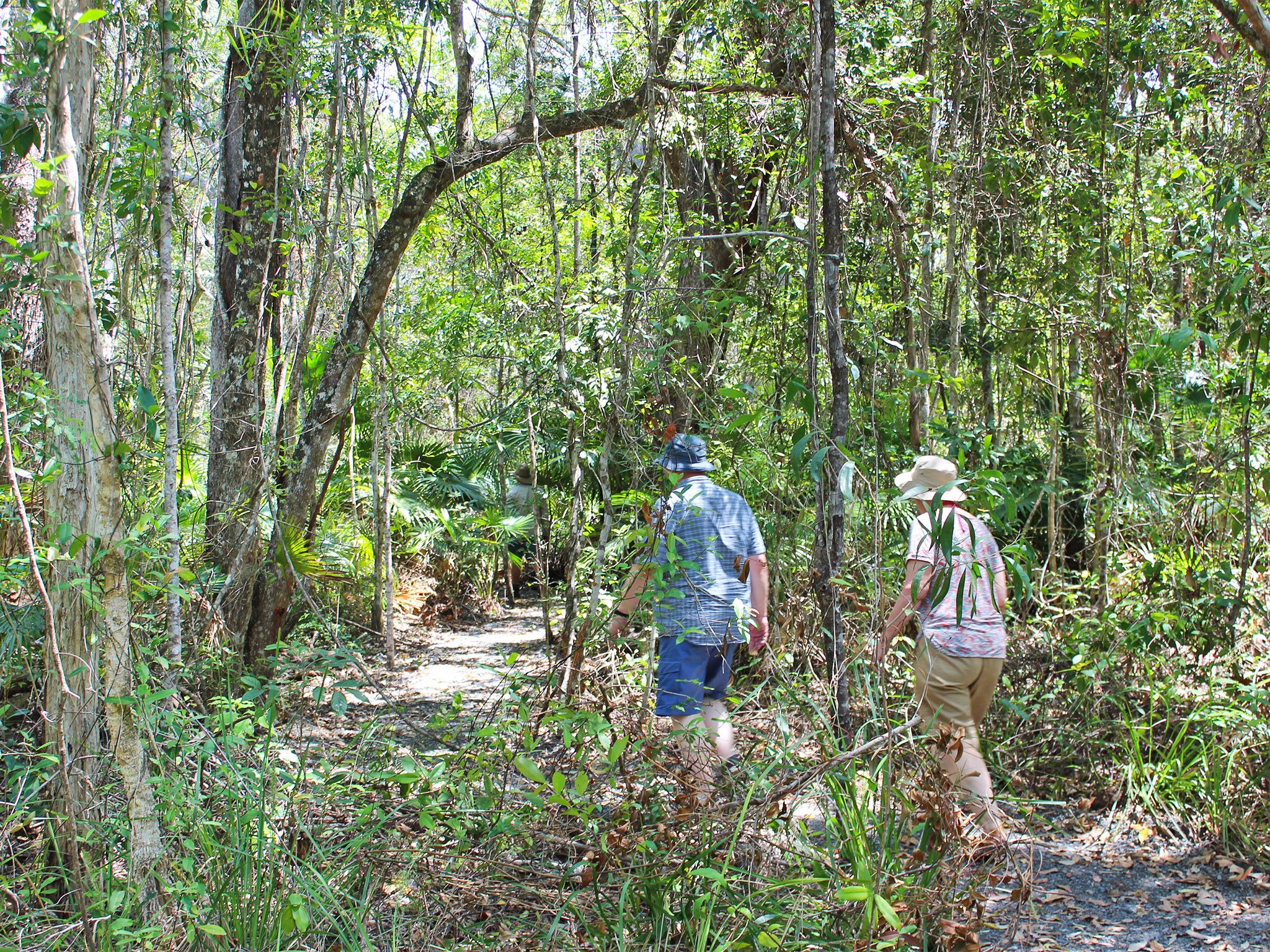
![Listen to the bird calls as you wander along this circuit track.]() Listen to the bird calls as you wander along this circuit track.
Photo credit: Rob Cameron © Queensland Government
Listen to the bird calls as you wander along this circuit track.
Photo credit: Rob Cameron © Queensland Government
-
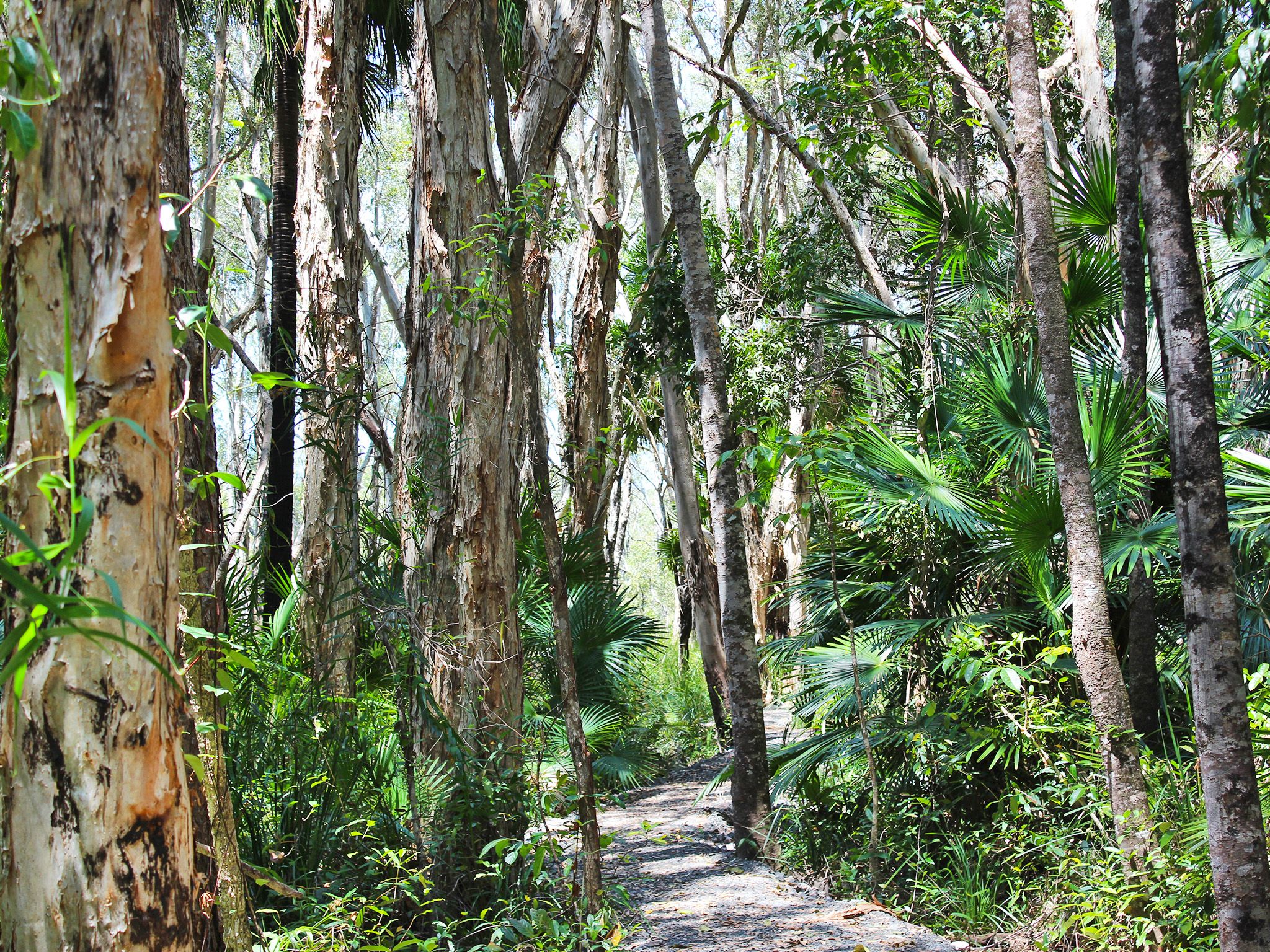
![Discover paperbark trees, cabbage palms, scribbly gums and blue gum forests along the Melaleuca circuit.]() Discover paperbark trees, cabbage palms, scribbly gums and blue gum forests along the Melaleuca circuit.
Photo credit: Rob Cameron © Queensland Government
Discover paperbark trees, cabbage palms, scribbly gums and blue gum forests along the Melaleuca circuit.
Photo credit: Rob Cameron © Queensland Government
From Fig Tree Point day-use area, amble through wetlands into scribbly gum, bloodwood and blue gum forest that fringes the low-lying delta of the Upper Noosa River. Unwind as you enjoy the rich birdsong in this cool retreat. At the junction with the Cooloola Wilderness Trail, turn left to continue through eucalypt forests and back into paperbark wetlands to the day-use area.
Take this short walk as a respite from paddling or motoring as you explore the Upper Noosa River waterway by canoe, kayak or boat; or if you want to explore while staying at the Fig Tree Point camping area.
Refer to the Cooloola and Inskip recreation areas discovery guide for a map and more details.
Getting there and getting around
Melaleuca circuit is in Cooloola Recreation Area, Great Sandy National Park, on the Sunshine Coast between Noosa Heads and Rainbow Beach (155–240km north of Brisbane).
- The walk is in the southern section of Cooloola on the Upper Noosa River waterway.
- It starts from the northern end of the Fig Tree Point day-use area, 2km north of the Kinaba Information Centre.
- You can access the walk by the canoe from Elanda Point, boat from Boreen Point.
- Walkers on the Cooloola Wilderness Trail can also access this walk when camping overnight at the Fig Tree Point camping area.
- Commercial tour boats operate daily from Noosa and Tewantin to Fig Tree Point. Canoes, kayaks and small boats can be hired from private operators at Boreen Point and Elanda Point.
- For tourism information for all regions in Queensland, see Queensland.com, and for friendly advice on how to get there, where to stay and what to do, find your closest accredited visitor information centre.
- Read boat and fish with care for tips on boating and fishing safety and caring for parks.
- Read water safety for important information about staying safe in and near water and caring for parks.
By canoe
- Drive 1.4km on the access road to the Elanda Point car park and canoe launch area.
- Paddle 4.5km (1hr) to the Kinaba Information Centre, then paddle a further 20min north to Fig Tree Point day-use area.
- Stay close to the shore line while paddling northwards. Plan to cross Lake Cootharaba early in the morning when conditions are likely to be calm and travel is easiest.
By boat
- Launch your boat from the Boreen Point boat ramp on Urunga Parade and follow the lake navigational markers out into deeper water and then head on a north-east trajectory towards the visible Cooloola Sand Patch in the distant landscape. When you approach a red navigational marker in the middle of the lake (opposite Elanda Point), turn on a near northerly trajectory to the channel markers, through very shallow shoals, to the Kinaba Information Centre.
- The trip is 7km and boats will take 15min travel time.
- From Kinaba, travel a further 2km north (6 knots maximum speed limit) to Fig Tree Point day-use area. Boats will take 15min travel time.
Via the Wilderness Trail
- From the start of the Cooloola Wilderness Trail at Elanda Point, walk 10.6km (3.5hr) to Fig Tree Point camping area.
- Read walk with care for tips on walking safely and walking lightly.
Getting to Boreen Point and Elanda Point
- From Brisbane drive 135km north on the Bruce Highway or the Sunshine Motorway to Tewantin; or from Gympie drive 58km south and east on the Bruce Highway to Tewantin.
- From Tewantin drive 19km west and north via McKinnon Drive and Louis Bazzo Drive to Boreen Point. Turn left onto Lake Flat Road and drive 2km to the Elanda Point access road.
Wheelchair access
There are no wheelchair-accessible facilities.
Before you visit
Opening hours
Melaleuca circuit is open 24 hours a day.
Check Park alerts for the latest information on access, closures and conditions.
Visiting safely
For more safety information see Visiting Cooloola Recreation Area safely and Walk with care.
- Cooloola Wilderness Trail - No pedestrian access across Kin Kin Creek 14 January 2024 to 14 January 2026
- New waste transfer stations for Great Sandy National Park, Cooloola Recreation Area 14 May to 30 September 2025
- Annual Cooloola Hazard Reduction Burn Program 1 May to 31 August 2025
- Exposed sand cliff and dune landslide danger 28 March 2025 to 28 March 2026
- Speed limit reduction - Teewah Beach camping area 22 November 2024 to 22 November 2025
- Permanent fire prohibition on Teewah Beach 1 April 2021 to 9 October 2025
Conditions report
Cooloola conditions report Updated 1 Aug 2025
Critical information for your safety is included in the conditions report—always check it before you visit.