Conway Range trail, Conway National Park
Delve deep into the ancient forests of the rugged Conway Range. Pass through palm valleys, splash across creeks, travel between majestic rainforest giants and gaze from a lookout over azure tropical water.
- Journey type
- Walk, cycle
- Distance
- 27.1km one-way
- Time suggested
- Allow 3 days walking time with 2 nights camping and allow 4hr riding time (day ride for fit and experienced riders)
- Grade
- Grade 4 walking track Easy mountain-bike trail Intermediate mountain-bike trail Difficult mountain-bike trail
Accessible by
- Conventional vehicle
Journey facilities
- Lookout (natural)
- Picnic tables
- Toilets (non-flush)
- Walking
- Cycling
-
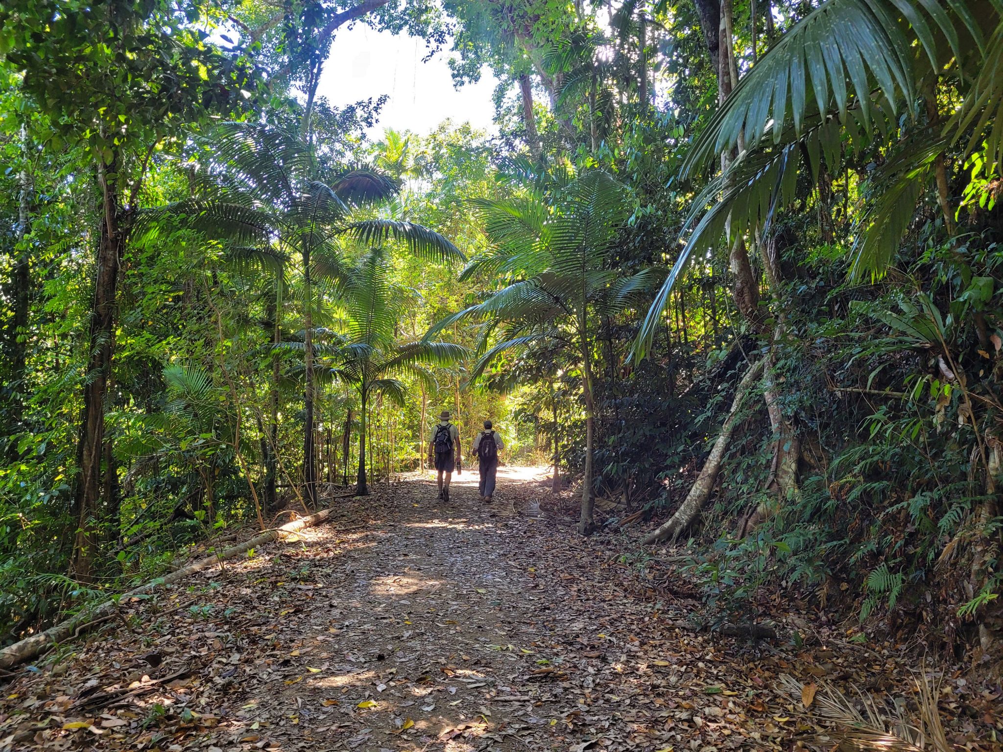
![]() Conway Range trail just before the Wompoo way turnoff
Photo credit: Linda Thompson © Queensland Government
Conway Range trail just before the Wompoo way turnoff
Photo credit: Linda Thompson © Queensland Government
-
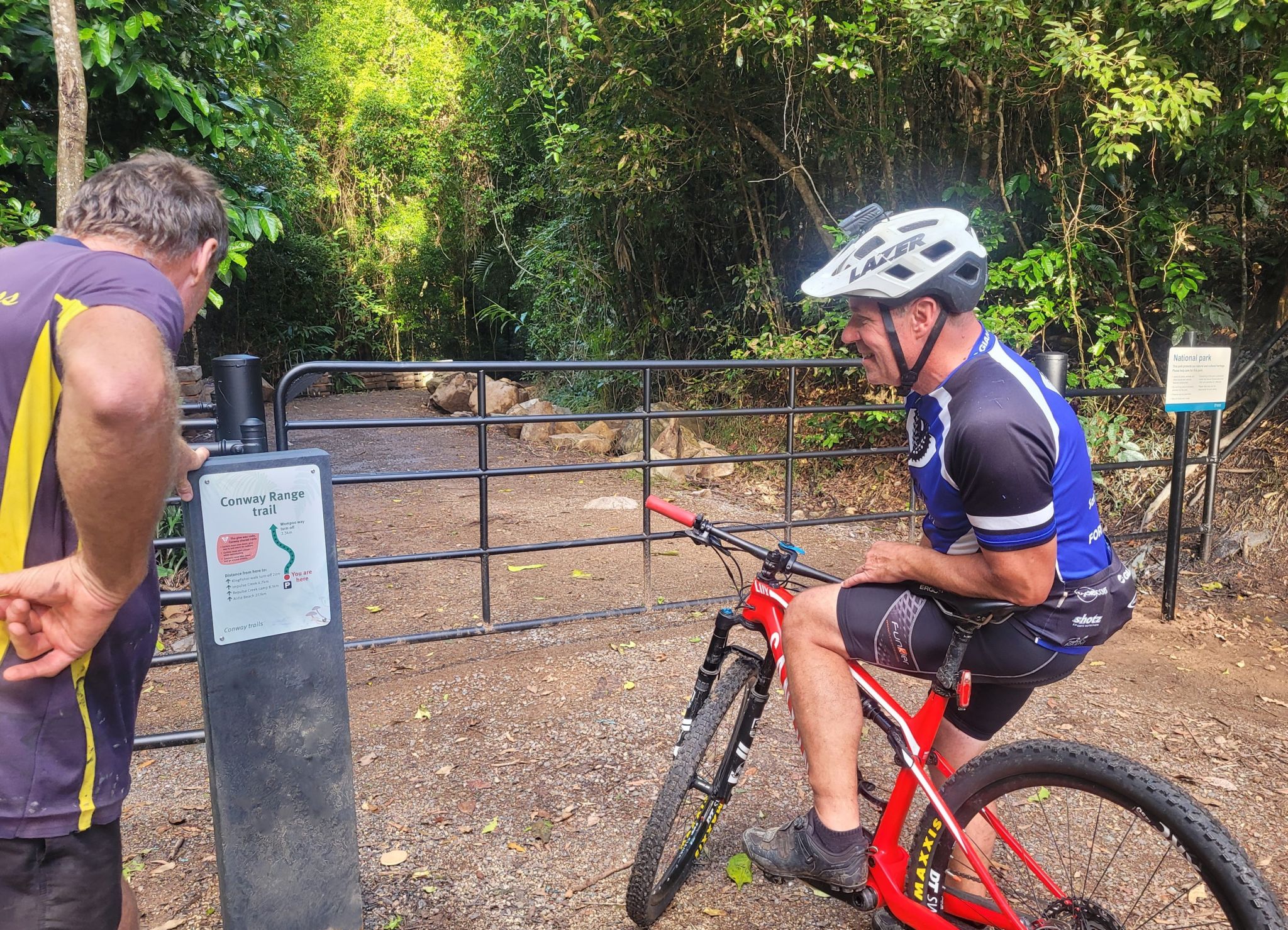
![]() Hike or bike the Conway Range trail
Photo credit: Linda Thompson © Queensland Government
Hike or bike the Conway Range trail
Photo credit: Linda Thompson © Queensland Government
-
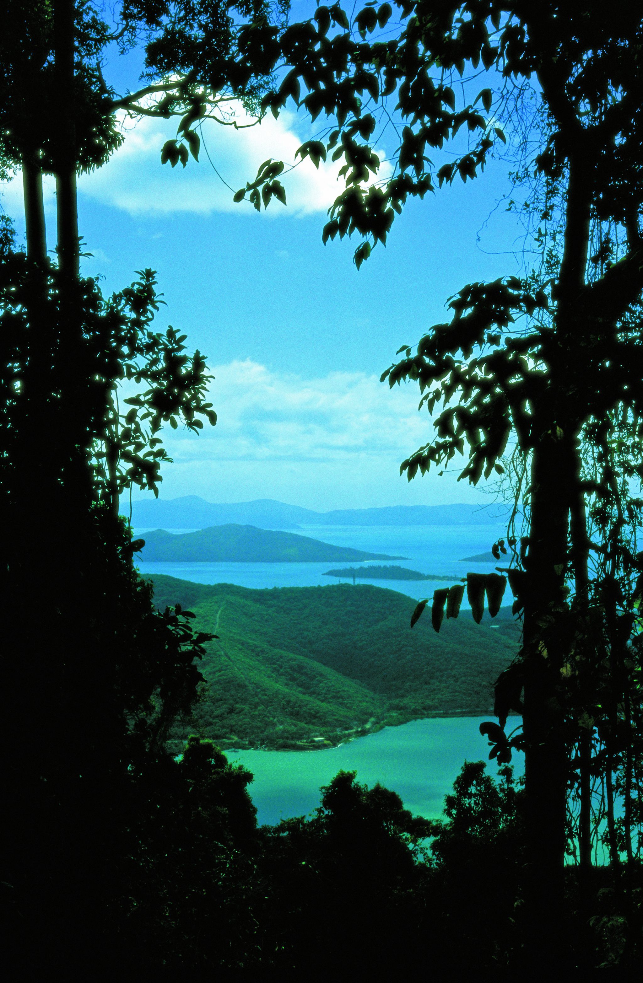
![]() View from Mount Hayward
Photo credit: Adam Creed © Queensland Government
View from Mount Hayward
Photo credit: Adam Creed © Queensland Government
-
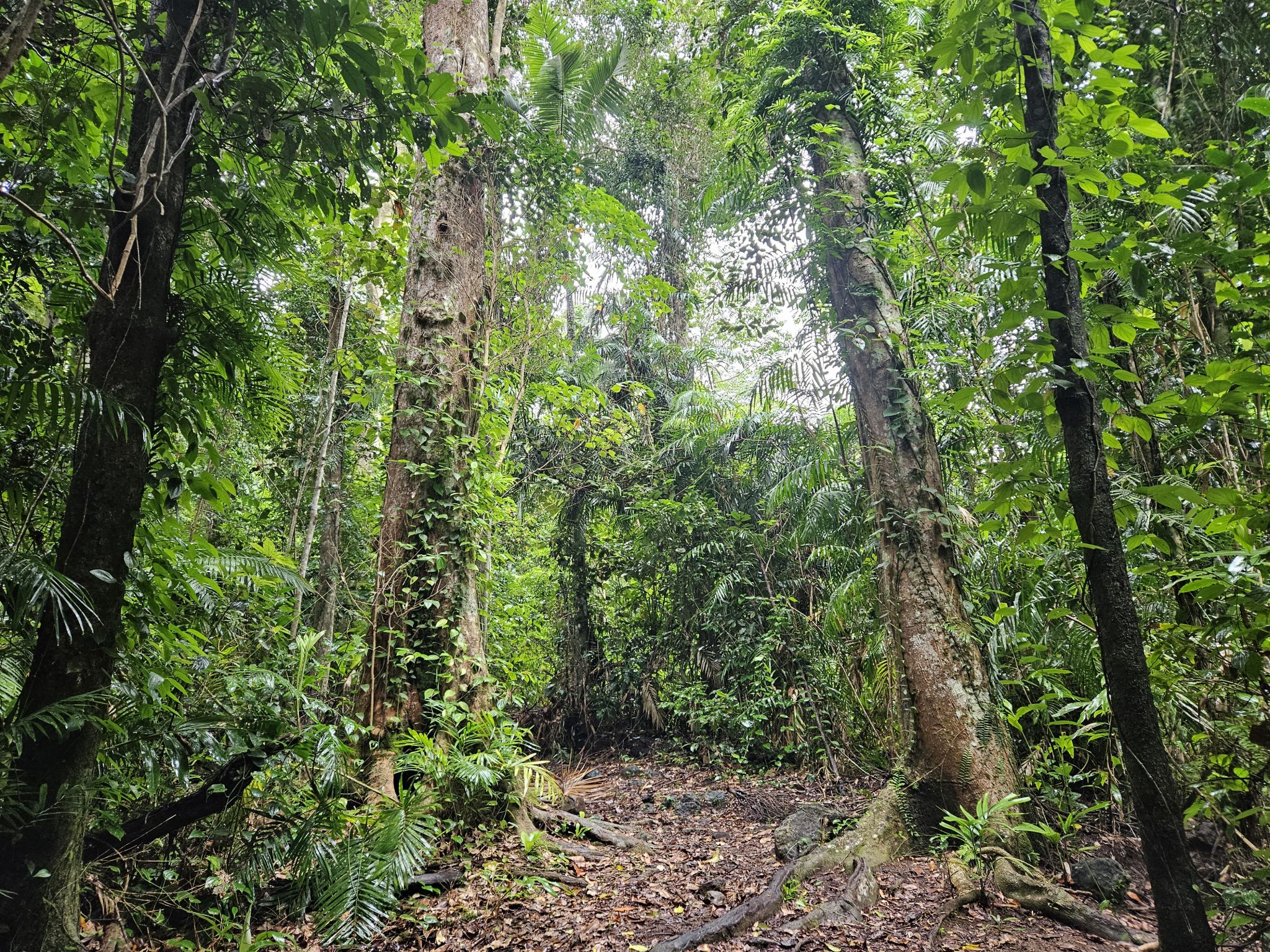
![]() Conway Range trail, between Little Repulse Creek and Mount Hayward
Photo credit: Kylee Gray © Queensland Government
Conway Range trail, between Little Repulse Creek and Mount Hayward
Photo credit: Kylee Gray © Queensland Government
-
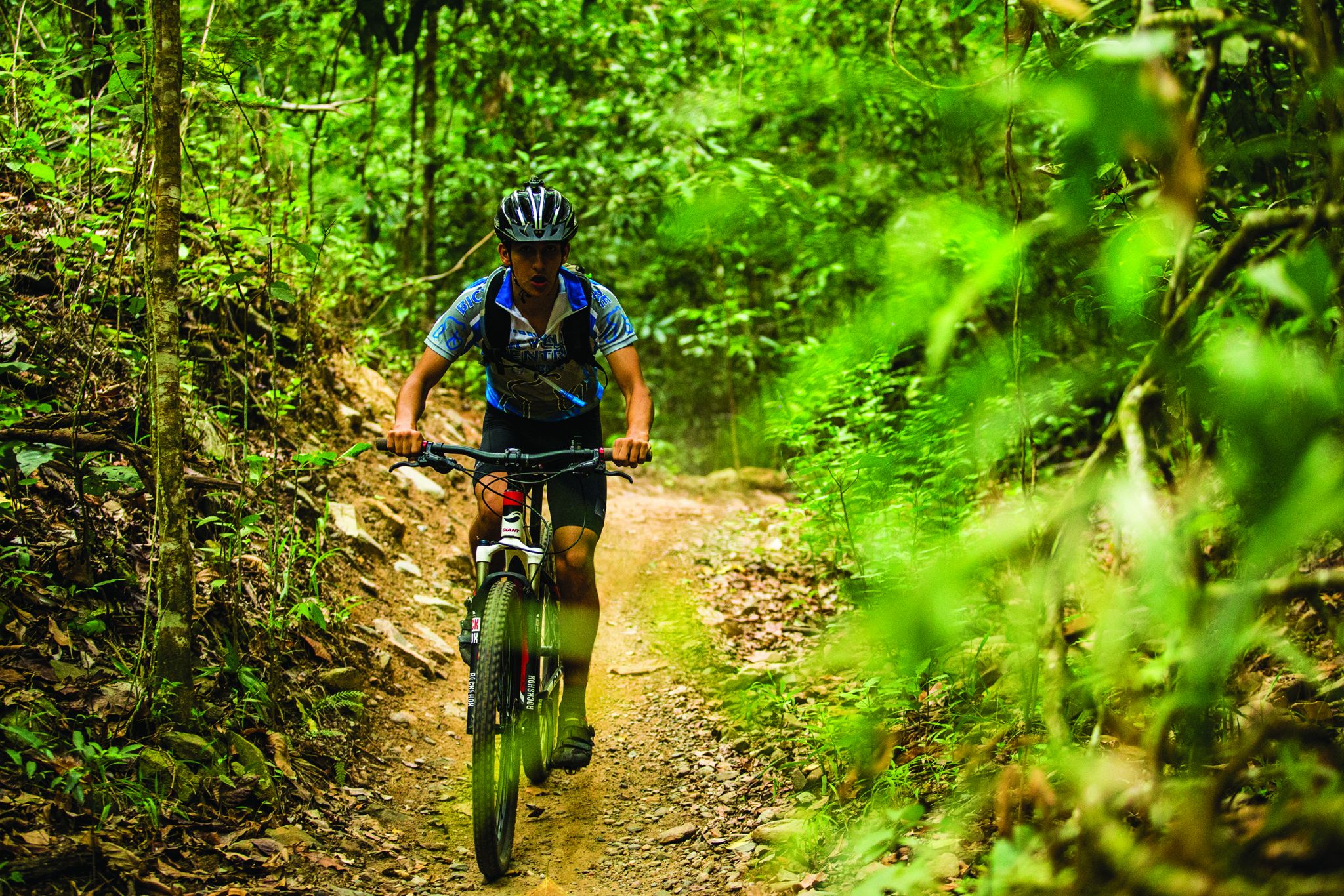
![]() Ride the Conway Range trail
Photo credit: © Tourism Tropical North Queensland
Ride the Conway Range trail
Photo credit: © Tourism Tropical North Queensland
-
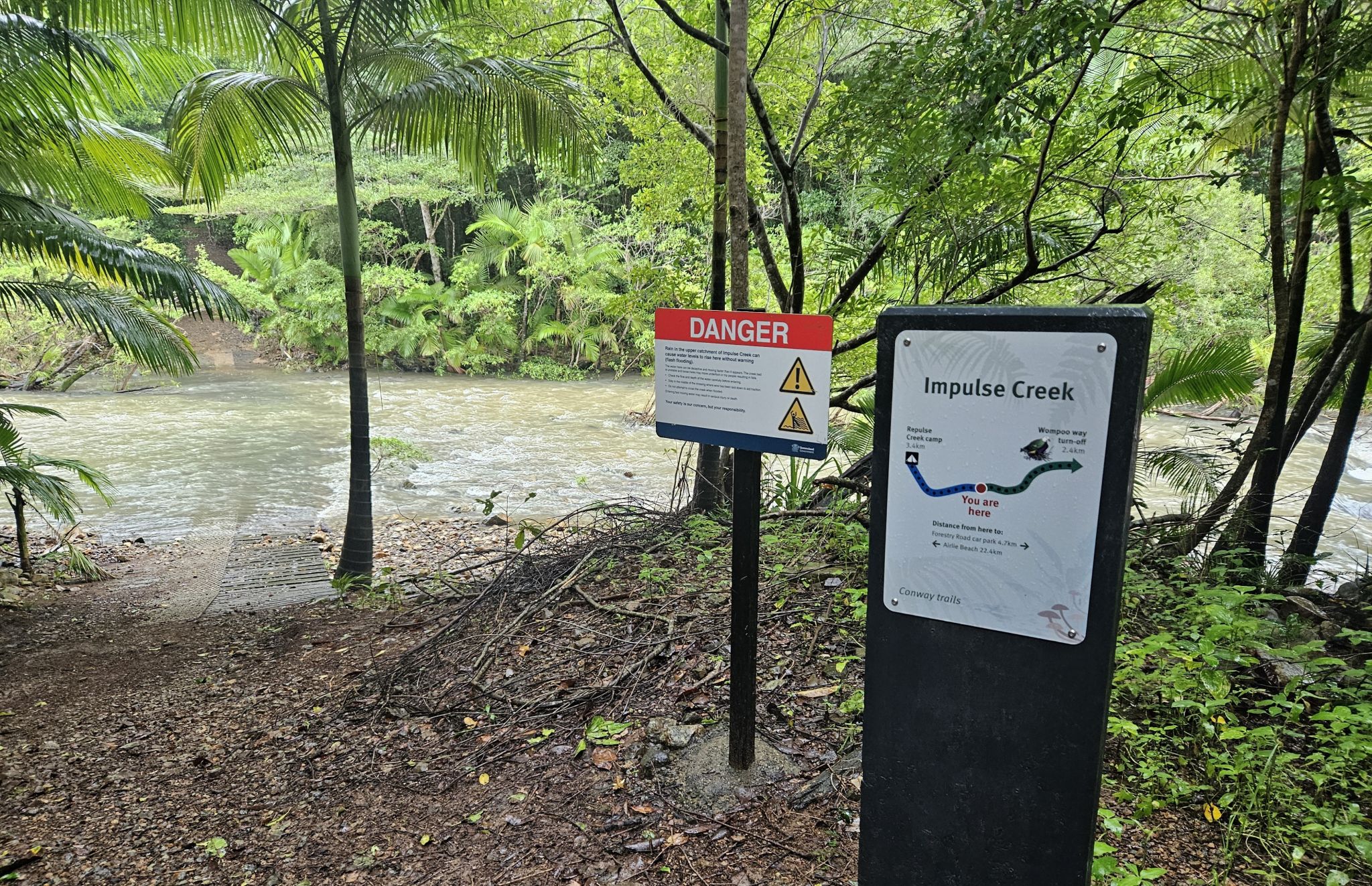
![]() Do not attempt to cross creeks when flooded—Impulse Creek crossing, Conway Range trail
Photo credit: Kylee Gray © Queensland Government
Do not attempt to cross creeks when flooded—Impulse Creek crossing, Conway Range trail
Photo credit: Kylee Gray © Queensland Government
Conway National Park has shared trails where walkers and cyclists share the same trail. Please be careful and courteous and follow the shared trails give way code.
- Cyclists must slow down, give way to and watch for walkers.
- Cyclists must alert others when approaching.
- Everyone must slow down and go around wildlife.
Download the Conway trails map .
Pack up and escape for 3 days of serious walking with 2 nights camping under the stars. Alternatively, if you are a fit and experienced mountain bike rider challenge yourself on a day ride.
Distances described for the Conway Range trail are starting from the Forestry Road trailhead. Allow extra time to explore the Kingfisher walk, Wompoo way and the Honeyeater lookout—all accessed from the trail. Directional totem signs along the Conway Range trail will help guide you to your destination.
Hiking the Conway Range trail
Forestry Road trailhead to Repulse Creek camp 8.1km
- The first 4.7km the Conway Range trail is relatively easy with gentle slopes and a smooth surface. Follow the trail for 2.3km to reach the Wompoo way turn-off (allow extra time to explore Wompoo way). From the Wompoo way turn-off follow the Conway Range trail for 2.4km to Impulse Creek. Please heed all safety signage at Impulse Creek.
- After crossing Impulse Creek, the next 3.4km of the trail to Repulse Creek camping area becomes strenuous with hilly sections and some minor streams to cross. Notice the change in vegetation. Hardy, brown tulip oaks replace the moisture-loving Mackay tulip oaks, and tough, woody vines replace delicate climbers. Set up camp in the rainforest at Repulse Creek camping area.
There is the option to camp at Repulse Creek camping area and return back to the Forestry Road carpark.
Repulse Creek camp to Bloodwood camp 11.6km
- Begin your second day passing through drier forest. You'll cross 2 creeks. The 7.4km section of trial becomes steep and difficult as you ascend a ridge to the summit of Mount Hayward. Enjoy the cool breeze and a rewarding view from the top.
- Continue following the ridge for 4.2km to Bloodwood camping area. Set up your camp and stay the night.
Bloodwood camp to Airlie Beach trailhead 7.4km
- Begin your third day following the steep rocky coastal ridge for 5.1km through low vegetation tangled with vines. The forest survives on rocky soils and endures the seasonal hot sun and occasional tropical cyclones. After the challenging climb the trail descends steeply and dramatically through taller forest to the Honeyeater lookout turn-off (allow extra time to explore the Honeyeater lookout).
- From the Honeyeater lookout turn-off, the trails steep descent continues for 2.3km to the Airlie Beach trailhead. We suggest you slow down and take the time to enjoy this landscape of grasstrees, cycads and gum trees. Remember to arrange transport from the trailhead at Airlie Beach.
Riding the Conway Range trail
From the Forestry Road trailhead, the mountain bike classification of the trail changes from easy to intermediate then difficult for the last 17.2km (download Conway trails map ). Less experienced riders should consider returning to the Forestry Road trailhead after reaching Repulse Creek camp (8.1km one-way) or Little Repulse Creek (9.9km one-way).
From Little Repulse Creek the circuit is classified as difficult. Riding difficulty increases significantly with many long steep sections, narrow and rough trail surfaces and technically difficult, creek crossings. Only fit, experienced and well-prepared riders should attempt to ride the full length of the Conway Range trail.
Access from the Airlie Beach trailhead (Kara Cresent)
Only fit, experienced and well-prepared hikers and riders should attempt the full length of the Conway Range trail from this direction as the trail is difficult with long steep and narrow uphill gradients.
You can hike or ride the Conway Range trail in the opposite direction from the Airlie Beach trailhead (Kara Cresent) to the Forestry Road carpark, 27.1km one-way.
Be well prepared! The first 17.2km of the trail to Little Repulse Creek is challenging and difficult with long steep and narrow uphill gradients with rough, slippery sections. Riders can expect technically difficult creek crossings. From Little Repulse Creek to the Forestry Road carpark (9.9km one-way) the trail becomes easier with gentle slopes and a wide surface. Remember to organise transport from the Forestry Road trailhead.
Essentials to bring
The Conway Range trail is rugged and remote and has limited mobile phone coverage. Help can be hours away. You must be well prepared and responsible for your own safety. Be realistic about your physical condition and ability and consider the trail grades before setting out.
Tell a responsible person where you are going and when you expect to return. Plan to complete your walk or ride well before dark. Know and watch the weather.
You must be fully self-sufficient, your camping equipment should include the following:
- complete first-aid kit—know how to use it
- adequate clothing—be prepared for all weather conditions, especially rain and storms
- sturdy, enclosed footwear
- strong, lightweight tent—shelters are not provided
- lightweight sleeping bag and sleeping mat
- nourishing lightweight food and high-energy snacks—take extra food in case the walk or ride takes. longer than expected
- hat, sunscreen and insect repellent
- small hand trowel and toilet paper
- torch, spare batteries and pocketknife
- good navigation tools and reliable communication equipment—a satellite phone and personal locator beacon is recommended
- lightweight cooking and eating utensils
- container for washing up
- water purification tablets or other method to treat tank water before drinking
- water containers—make sure they’re big enough
- waterproof bags to keep clothing/bedding dry and to store rubbish. Rubbish bins are not provided on the Conway Range trail. All rubbish must be carried out with you
- fuel stove and fuel—fires are prohibited on the Conway Range trail
- lighter and waterproof matches
Getting there and getting around
Forestry Road car park from Airlie Beach
The Conway Range trail is located in Conway National Park approximately 16km southwest of Airlie Beach.
- From Airlie Beach travel southwest along Shute Harbour Road for about 11km and turn left onto Brandy Creek Road.
- Follow this road onto Forestry Road to reach the Forestry Road car park and the Conway Range trail trailhead.
Forestry Road car park from the Bruce Highway
- One kilometre north of Proserpine (or 65km south of Bowen), turn off the highway onto Shute Harbour Road.
- Travel 12km along Shute Harbour Road before turning right onto Brandy Creek Road. Follow this road onto Forestry Road for 5km to reach the Forestry Road car park and the Conway Range trail trailhead.
Kara Cresent trailhead from Airlie Beach
- From Airlie Beach follow Main Street northwest to the roundabout, turn left at the roundabout onto Waterson Way. Travel approximately 700m from the Waterson Way turn off to the trailhead at Kara Cresent.
Wheelchair access
There is no wheelchair access to the Conway Range trail.
Before you visit
Opening hours
The Conway Range trail is open all year round. Access maybe closed at times due to localised flooding, severe weather or park management activities.
Check park alerts for the latest information on access, closures and conditions.
Visiting safely
For more safety information see:
- Temporary closure: Kingfisher walk, Conway National Park 27 February to 30 October 2024
- Conway National Park: Conway Range trail, Conway National Park 20 May to 30 October 2024
- Conway National Park. Feral Animal Management Program 22 April to 15 July 2024
- Extended baiting program for feral pigs and foxes on Conway National Park, Dryander National Park, Dryander State Forest and Dryander Forest Reserve 24 February 2024 to 10 January 2025